
Ballycastle is a small seaside town in County Antrim, Northern Ireland. It is on the north-easternmost coastal tip of Ireland, in the Antrim Coast and Glens Area of Outstanding Natural Beauty.
Buile Shuibhne or Buile Suibne is a medieval Irish tale about Suibhne mac Colmáin, king of the Dál nAraidi, who was driven insane by the curse of Saint Rónán Finn. The insanity makes Suibhne leave the Battle of Mag Rath and begin a life of wandering. He dies under the refuge of St. Moling.

North Antrim is a parliamentary constituency in the United Kingdom House of Commons. The current MP is Jim Allister (TUV).

Ulaid or Ulaidh was a Gaelic over-kingdom in north-eastern Ireland during the Middle Ages made up of a confederation of dynastic groups. Alternative names include Ulidia, which is the Latin form of Ulaid, and in Cóiced, Irish for 'the Fifth'. The king of Ulaid was called the rí Ulad or rí in Chóicid.
The Battle of Inverlochy occurred on 2 February 1645, during the Wars of the Three Kingdoms, when a Royalist force of Highlanders and Confederate Irish troops under the overall command of James Graham, 1st Marquess of Montrose, routed and largely destroyed the pursuing forces of Archibald Campbell, 1st Marquess of Argyll, who had been encamped under the walls of Inverlochy Castle.
Congal Cláiringnech, son of Rudraige, was, according to medieval Irish legend and historical tradition, a king of Ulster and High King of Ireland. He was the brother of Bresal Bó-Díbad, the former High King, who had been killed by Lugaid Luaigne.

The Glens of Antrim, known locally as simply The Glens, is a region of County Antrim, Northern Ireland. It comprises nine glens (valleys), that radiate from the Antrim Plateau to the coast. The Glens are an area of outstanding natural beauty and are a major tourist attraction in north Antrim.
Glenariff or Glenariffe is a valley in County Antrim, Northern Ireland. It is one of the Glens of Antrim. Like other glens in that area, it was shaped during the Ice Age by giant glaciers.
Barmeen is a townland in County Antrim, Northern Ireland. It is located at the foot of Glendun, one of the nine Glens of Antrim, west of Cushendun and north of Knocknacarry. It is situated in the historic barony of Cary and the civil parish of Culfeightrin and covers 59 acres.

Dál nAraidi or Dál Araide, sometimes latinised as Dalaradia or anglicised as Dalaray, was a Cruthin kingdom, or possibly a confederation of Cruthin tribes, in north-eastern Ireland during the Middle Ages. It was part of the over-kingdom of Ulaid, and its kings often contended with the Dál Fiatach for the over-kingship of the province. At its greatest extent, the borders of Dál nAraidi roughly matched those of County Antrim, and they seemed to occupy the same area as the earlier Robogdii of Ptolemy's Geography, a region shared with Dál Riata. Their capital was Ráth Mór outside Antrim, and their eponymous ancestor is claimed as being Fiachu Araide.
Martinstown is a small village in County Antrim, Northern Ireland. Located 6 miles from Ballymena, it is situated in Glenravel, locally known as "The Tenth Glen", alongside the widely known nine Glens of Antrim.
Domnall mac Áedo, also known as Domnall II, was an Irish king and son of Áed mac Ainmuirech and his consort Land, the daughter of Áed Guaire mac Amalgada of Airgíalla. Domnall was High King of Ireland from 628 until his death. He belonged to the Cenél Conaill kindred of the Northern Uí Néill.
Congal Cáech was a king of the Cruthin of Dál nAraidi in the medieval Irish province of Ulaid, from around 626 to 637. He was king of Ulaid from 627–637 and, according to some sources, High King of Ireland.

Glendun translates into English as glen of the brown river and is one of the nine Glens of Antrim in County Antrim in Northern Ireland.
The Battle of Glentaisie, was an Irish battle fought in the north of Ulster on 2 May 1565. The result was a victory for Shane O'Neill over the Clan MacDonald of Dunnyveg. The conflict was a part of the political and military struggle, involving the English and occasionally the Scots, for control of northern Ireland. Although the MacDonalds were a Scottish family, based principally on the island of Islay in the Hebrides, they had long been associated with the Gaelic polity rather than the Kingdom of Scotland.

The River Dun, also known as the Glendun River is a river in County Antrim, Northern Ireland. It runs through Glendun, one of the nine Glens of Antrim. The river is named after its brown colour, which comes from the peat bogs at its source on the slopes of Slievenanee on the Antrim Plateau. The source of the river is a few hundred metres from that of the River Bush, which flows north-east to meet the sea at Bushmills. Cushendun is a small coastal resort town lying at the mouth of the River Dun and Glendun.

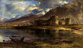
Rathlin Castle, also known as Bruce's Castle, was a castle on Rathlin Island off the coast of County Antrim in Northern Ireland.

Glenshesk is one of the nine Glens of Antrim in County Antrim, Northern Ireland. It was shaped by glacial erosion. The glen lies on the eastern side of Knocklayde mountain and flows out to the sea at Ballycastle.

Mourne is a barony in County Down, Northern Ireland. It lies in the south-east of the county, with the Irish Sea to its east. It is bordered by two other baronies: Iveagh Upper, Lower Half and Iveagh Upper, Upper Half to the north and west. Called at one time Bairrche its present name of Mourne comes from the Múrna, a people who hail from a territory of the same name in modern County Monaghan.
The Battle of Moira, also known as the Battle of Magh Rath, was fought in the summer of 637 by the High King of Ireland, Domnall II, against his foster son Congal Cáech, King of Ulaid, supported by his ally Domnall Brecc, King of Dál Riata. The battle resulted in a decisive victory for the High King and his army, and Congal Cáech was killed in the fighting.
