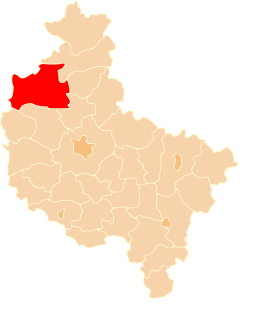
Chodzież County is a unit of territorial administration and local government (powiat) in Greater Poland Voivodeship, west-central Poland. It came into being on January 1, 1999, as a result of the Polish local government reforms passed in 1998. Its administrative seat and largest town is Chodzież, which lies 65 kilometres (40 mi) north of the regional capital Poznań. The county also contains the towns of Szamocin, lying 16 km (10 mi) east of Chodzież, and Margonin, 13 km (8 mi) east of Chodzież.

Oborniki County is a unit of territorial administration and local government (powiat) in Greater Poland Voivodeship, west-central Poland. It came into being on January 1, 1999, as a result of the Polish local government reforms passed in 1998. Its administrative seat and largest town is Oborniki, which lies 29 kilometres (18 mi) north of the regional capital Poznań. The only other town in the county is Rogoźno, lying 17 km (11 mi) north-east of Oborniki.

Międzychód County is a unit of territorial administration and local government (powiat) in Greater Poland Voivodeship, west-central Poland. It came into being on January 1, 1999, as a result of the Polish local government reforms passed in 1998. Its administrative seat and largest town is Międzychód, which lies 74 kilometres (46 mi) west of the regional capital Poznań. The only other town in the county is Sieraków, lying 16 km (10 mi) east of Międzychód.
Wałcz County is a unit of territorial administration and local government (powiat) in West Pomeranian Voivodeship, north-western Poland. It came into being on January 1, 1999, as a result of the Polish local government reforms passed in 1998. Its administrative seat and largest town is Wałcz, which lies 127 kilometres (79 mi) east of the regional capital Szczecin. The county contains three other towns: Mirosławiec, 27 km (17 mi) west of Wałcz, Człopa, 31 km (19 mi) south-west of Wałcz, and Tuczno, 25 km (16 mi) south-west of Wałcz.
Gmina Drawsko is a rural gmina in Czarnków-Trzcianka County, Greater Poland Voivodeship, in west-central Poland. Its seat is the village of Drawsko, which lies approximately 37 kilometres (23 mi) west of Czarnków and 78 km (48 mi) north-west of the regional capital Poznań.
Gmina Krzyż Wielkopolski is an urban-rural gmina in Czarnków-Trzcianka County, Greater Poland Voivodeship, in west-central Poland. Its seat is the town of Krzyż Wielkopolski, which lies approximately 38 kilometres (24 mi) west of Czarnków and 82 km (51 mi) north-west of the regional capital Poznań.
Gmina Połajewo is a rural gmina in Czarnków-Trzcianka County, Greater Poland Voivodeship, in west-central Poland. Its seat is the village of Połajewo, which lies approximately 17 kilometres (11 mi) south-east of Czarnków and 46 km (29 mi) north of the regional capital Poznań.
Gmina Trzcianka is an urban-rural gmina in Czarnków-Trzcianka County, Greater Poland Voivodeship, in west-central Poland. Its seat is the town of Trzcianka, which lies approximately 18 kilometres (11 mi) north of Czarnków and 79 km (49 mi) north-west of the regional capital Poznań.
Gmina Wieleń is an urban-rural gmina in Czarnków-Trzcianka County, Greater Poland Voivodeship, in west-central Poland. Its seat is the town of Wieleń, which lies approximately 27 kilometres (17 mi) west of Czarnków and 75 km (47 mi) north-west of the regional capital Poznań.
Gmina Ujście is an urban-rural gmina in Piła County, Greater Poland Voivodeship, in west-central Poland. Its seat is the town of Ujście, which lies approximately 10 kilometres (6 mi) south of Piła and 75 km (47 mi) north of the regional capital Poznań.

Romanowo Dolne is a village in the administrative district of Gmina Czarnków, within Czarnków-Trzcianka County, Greater Poland Voivodeship, in west-central Poland. It lies approximately 6 kilometres (4 mi) north of Czarnków and 66 km (41 mi) north of the regional capital Poznań.
Romanowo Górne is a village in the administrative district of Gmina Czarnków, within Czarnków-Trzcianka County, Greater Poland Voivodeship, in west-central Poland. It lies approximately 10 kilometres (6 mi) north of Czarnków and 69 km (43 mi) north of the regional capital Poznań.
Kadłubek is a village in the administrative district of Gmina Trzcianka, within Czarnków-Trzcianka County, Greater Poland Voivodeship, in west-central Poland. It lies approximately 3 kilometres (2 mi) south-east of Trzcianka, 17 km (11 mi) north of Czarnków, and 77 km (48 mi) north of the regional capital Poznań.
Łomnica is a village in the administrative district of Gmina Trzcianka, within Czarnków-Trzcianka County, Greater Poland Voivodeship, in west-central Poland. It lies approximately 8 kilometres (5 mi) north-east of Trzcianka, 23 km (14 mi) north of Czarnków, and 82 km (51 mi) north of the regional capital Poznań.
Runowo is a village in the administrative district of Gmina Trzcianka, within Czarnków-Trzcianka County, Greater Poland Voivodeship, in west-central Poland. It lies approximately 10 kilometres (6 mi) south of Trzcianka, 12 km (7 mi) north-west of Czarnków, and 71 km (44 mi) north-west of the regional capital Poznań.
Stobno is a village in the administrative district of Gmina Trzcianka, within Czarnków-Trzcianka County, Greater Poland Voivodeship, in west-central Poland. It lies approximately 12 kilometres (7 mi) east of Trzcianka, 22 km (14 mi) north of Czarnków, and 79 km (49 mi) north of the regional capital Poznań.
Straduń is a village in the administrative district of Gmina Trzcianka, within Czarnków-Trzcianka County, Greater Poland Voivodeship, in westcentral Poland. It lies approximately 6 kilometres (4 mi) west of Trzcianka, 21 km (13 mi) north-west of Czarnków, and 81 km (50 mi) north-west of the regional capital Poznań.
Wrząca is a village in the administrative district of Gmina Trzcianka, within Czarnków-Trzcianka County, Greater Poland Voivodeship, in west-central Poland. It lies approximately 10 kilometres (6 mi) east of Trzcianka, 20 km (12 mi) north of Czarnków, and 79 km (49 mi) north of the regional capital Poznań.