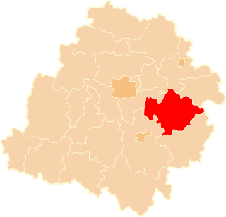
Gmina Wolbórz is an urban-rural gmina in Piotrków County, Łódź Voivodeship, in central Poland. Its seat is the town of Wolbórz, which lies approximately 16 kilometres (10 mi) north-east of Piotrków Trybunalski and 41 km (25 mi) south-east of the regional capital Łódź.
Gmina Rokiciny is a rural gmina in Tomaszów Mazowiecki County, Łódź Voivodeship, in central Poland. Its seat is the village of Rokiciny, which lies approximately 22 kilometres (14 mi) north-west of Tomaszów Mazowiecki and 28 km (17 mi) south-east of the regional capital Łódź.
Gmina Rzeczyca is a rural gmina in Tomaszów Mazowiecki County, Łódź Voivodeship, in central Poland. Its seat is the village of Rzeczyca, which lies approximately 21 kilometres (13 mi) north-east of Tomaszów Mazowiecki and 61 km (38 mi) east of the regional capital Łódź.
Gmina Tomaszów Mazowiecki is a rural gmina in Tomaszów Mazowiecki County, Łódź Voivodeship, in central Poland. Its seat is the town of Tomaszów Mazowiecki, although the town is not part of the territory of the gmina.
Gmina Żelechlinek is a rural gmina in Tomaszów Mazowiecki County, Łódź Voivodeship, in central Poland. Its seat is the village of Żelechlinek, which lies approximately 23 kilometres (14 mi) north of Tomaszów Mazowiecki and 40 km (25 mi) east of the regional capital Łódź.

Mała Wola is a village in the administrative district of Gmina Czerniewice, within Tomaszów Mazowiecki County, Łódź Voivodeship, in central Poland. It lies approximately 5 kilometres (3 mi) south-east of Czerniewice, 19 km (12 mi) north-east of Tomaszów Mazowiecki, and 55 km (34 mi) east of the regional capital Łódź.

Podkonice Duże is a village in the administrative district of Gmina Czerniewice, within Tomaszów Mazowiecki County, Łódź Voivodeship, in central Poland. It lies approximately 8 kilometres (5 mi) north-east of Czerniewice, 27 km (17 mi) north-east of Tomaszów Mazowiecki, and 53 km (33 mi) east of the regional capital Łódź.

Podkonice Małe is a village in the administrative district of Gmina Czerniewice, within Tomaszów Mazowiecki County, Łódź Voivodeship, in central Poland. It lies approximately 6 kilometres (4 mi) north-east of Czerniewice, 24 km (15 mi) north-east of Tomaszów Mazowiecki, and 52 km (32 mi) east of the regional capital Łódź.

Podkonice Miejskie is a village in the administrative district of Gmina Czerniewice, within Tomaszów Mazowiecki County, Łódź Voivodeship, in central Poland. It lies approximately 8 kilometres (5 mi) north-east of Czerniewice, 27 km (17 mi) north-east of Tomaszów Mazowiecki, and 53 km (33 mi) east of the regional capital Łódź.

Stanisławów Lipski is a village in the administrative district of Gmina Czerniewice, within Tomaszów Mazowiecki County, Łódź Voivodeship, in central Poland. It lies approximately 5 kilometres (3 mi) north of Czerniewice, 23 km (14 mi) north-east of Tomaszów Mazowiecki, and 49 km (30 mi) east of the regional capital Łódź.

Stanisławów Studziński is a village in the administrative district of Gmina Czerniewice, within Tomaszów Mazowiecki County, Łódź Voivodeship, in central Poland. It lies approximately 5 kilometres (3 mi) north-west of Czerniewice, 20 km (12 mi) north of Tomaszów Mazowiecki, and 46 km (29 mi) east of the regional capital Łódź.

Strzemeszna is a village in the administrative district of Gmina Czerniewice, within Tomaszów Mazowiecki County, Łódź Voivodeship, in central Poland. It lies approximately 4 kilometres (2 mi) east of Czerniewice, 22 km (14 mi) north-east of Tomaszów Mazowiecki, and 53 km (33 mi) east of the regional capital Łódź.

Studzianki is a village in the administrative district of Gmina Czerniewice, within Tomaszów Mazowiecki County, Łódź Voivodeship, in central Poland. It lies approximately 3 kilometres (2 mi) north-west of Czerniewice, 19 km (12 mi) north-east of Tomaszów Mazowiecki, and 48 km (30 mi) east of the regional capital Łódź.

Wielka Wola is a village in the administrative district of Gmina Czerniewice, within Tomaszów Mazowiecki County, Łódź Voivodeship, in central Poland. It lies approximately 4 kilometres (2 mi) south of Czerniewice, 17 km (11 mi) north-east of Tomaszów Mazowiecki, and 52 km (32 mi) east of the regional capital Łódź.

Zubki Duże is a village in the administrative district of Gmina Czerniewice, within Tomaszów Mazowiecki County, Łódź Voivodeship, in central Poland. It lies approximately 6 kilometres (4 mi) north-east of Czerniewice, 24 km (15 mi) north-east of Tomaszów Mazowiecki, and 52 km (32 mi) east of the regional capital Łódź.

Zubki Małe is a village in the administrative district of Gmina Czerniewice, within Tomaszów Mazowiecki County, Łódź Voivodeship, in central Poland. It lies approximately 7 kilometres (4 mi) north-east of Czerniewice, 25 km (16 mi) north-east of Tomaszów Mazowiecki, and 53 km (33 mi) east of the regional capital Łódź.


