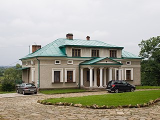
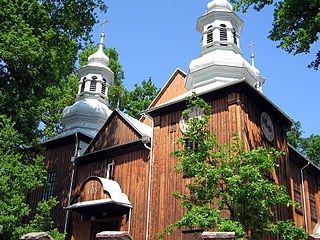
Gmina Jasienica Rosielna

Last updated
Gmina Jasienica Rosielna
Jasienica Rosielna Commune
Gmina
POL gmina Jasienica Rosielna flag.svg
Flag
POL gmina Jasienica Rosielna COA.svg
Coat of arms
Coordinates(Jasienica Rosielna): 49°45′7″N21°56′37″E / 49.75194°N 21.94361°E / 49.75194; 21.94361 Coordinates: 49°45′7″N21°56′37″E / 49.75194°N 21.94361°E / 49.75194; 21.94361
CountryFlag of Poland.svg  Poland
Voivodeship Subcarpathian
County Brzozów
Seat Jasienica Rosielna
Area
  Total 57.55 km2 (22.22 sq mi)
Population (2006)
  Total 7,380
  Density 130/km2 (330/sq mi)
Website http://www.jasienicarosielna.pl/

Gmina Jasienica Rosielna is a rural gmina (administrative district) in Brzozów County, Subcarpathian Voivodeship, in south-eastern Poland. Its seat is the village of Jasienica Rosielna, which lies approximately 9 kilometres (6 mi) north-west of Brzozów and 32 km (20 mi) south of the regional capital Rzeszów.

Gmina administrative division of Poland

The gmina is the principal unit of the administrative division of Poland, similar to a municipality. As of 2010 there were 2,478 gminy throughout the country. The word gmina derives from the German word Gemeinde, meaning "community".

Brzozów County County in Subcarpathian, Poland

Brzozów County is a unit of territorial administration and local government (powiat) in Subcarpathian Voivodeship, south-eastern Poland. It came into being on January 1, 1999, as a result of the Polish local government reforms passed in 1998. Its administrative seat and only town is Brzozów, which lies 38 kilometres (24 mi) south of the regional capital Rzeszów.

Poland Republic in Central Europe

Poland, officially the Republic of Poland, is a country located in Central Europe. It is divided into 16 administrative subdivisions, covering an area of 312,696 square kilometres (120,733 sq mi), and has a largely temperate seasonal climate. With a population of approximately 38.5 million people, Poland is the sixth most populous member state of the European Union. Poland's capital and largest metropolis is Warsaw. Other major cities include Kraków, Łódź, Wrocław, Poznań, Gdańsk, and Szczecin.

Contents

The gmina covers an area of 57.55 square kilometres (22.2 sq mi), and as of 2006 its total population is 7,380.

The gmina contains part of the protected area called Czarnorzeki-Strzyżów Landscape Park.

Protected area location which receives protection because of its recognised natural, ecological or cultural landscape values

Protected areas or conservation areas are locations which receive protection because of their recognized natural, ecological or cultural values. There are several kinds of protected areas, which vary by level of protection depending on the enabling laws of each country or the regulations of the international organizations involved.

Czarnorzeki-Strzyżów Landscape Park landscape park of Poland

Czarnorzeki-Strzyżów Landscape Park is a protected area in south-eastern Poland, established in 1993, covering an area of 257.84 square kilometres (99.55 sq mi).

Villages

Gmina Jasienica Rosielna contains the villages and settlements of Blizne, Jasienica Rosielna, Orzechówka and Wola Jasienicka.

Blizne Village in Subcarpathian, Poland

Blizne Ukrainian: Близне, Blyzne is a village in the administrative district of Gmina Jasienica Rosielna, within Brzozów County, Subcarpathian Voivodeship, in south-eastern Poland. It lies approximately 3 kilometres (2 mi) east of Jasienica Rosielna, 7 km (4 mi) north-west of Brzozów, and 32 km (20 mi) south of the regional capital Rzeszów. The village has a population of 2,800.

Jasienica Rosielna Village in Subcarpathian, Poland

Jasienica Rosielna is a village in Brzozów County, Subcarpathian Voivodeship, in south-eastern Poland. It is the seat of the gmina called Gmina Jasienica Rosielna. It lies approximately 9 kilometres (6 mi) north-west of Brzozów and 32 km (20 mi) south of the regional capital Rzeszów.

Wola Jasienicka Village in Subcarpathian, Poland

Wola Jasienicka is a village in the administrative district of Gmina Jasienica Rosielna, within Brzozów County, Subcarpathian Voivodeship, in south-eastern Poland. It lies approximately 5 kilometres (3 mi) west of Jasienica Rosielna, 12 km (7 mi) north-west of Brzozów, and 33 km (21 mi) south of the regional capital Rzeszów.

Neighbouring gminas

Gmina Jasienica Rosielna is bordered by the gminas of Brzozów, Domaradz, Haczów and Korczyna.

Gmina Brzozów is an urban-rural gmina in Brzozów County, Subcarpathian Voivodeship, in south-eastern Poland. Its seat is the town of Brzozów, which lies approximately 38 kilometres (24 mi) south of the regional capital Rzeszów.

Gmina Domaradz is a rural gmina in Brzozów County, Subcarpathian Voivodeship, in south-eastern Poland. Its seat is the village of Domaradz, which lies approximately 12 kilometres (7 mi) north-west of Brzozów and 28 km (17 mi) south of the regional capital Rzeszów.

Gmina Haczów is a rural gmina in Brzozów County, Subcarpathian Voivodeship, in south-eastern Poland. Its seat is the village of Haczów, which lies approximately 10 kilometres (6 mi) west of Brzozów and 42 km (26 mi) south of the regional capital Rzeszów.

Related Research Articles

Gmina Bircza is a rural gmina in Przemyśl County, Subcarpathian Voivodeship, in south-eastern Poland. Its seat is the village of Bircza, which lies approximately 24 kilometres (15 mi) south-west of Przemyśl and 51 km (32 mi) south-east of the regional capital Rzeszów.

Gmina Dubienka is a rural gmina in Chełm County, Lublin Voivodeship, in eastern Poland, on the border with Ukraine. Its seat is the village of Dubienka, which lies approximately 31 kilometres (19 mi) east of Chełm and 95 km (59 mi) east of the regional capital Lublin.

Gmina Brody is a rural gmina in Żary County, Lubusz Voivodeship, in western Poland, on the German border. Its seat is the village of Brody, which lies approximately 31 kilometres (19 mi) north-west of Żary and 53 km (33 mi) west of Zielona Góra.

Gmina Rzeczyca is a rural gmina in Tomaszów Mazowiecki County, Łódź Voivodeship, in central Poland. Its seat is the village of Rzeczyca, which lies approximately 21 kilometres (13 mi) north-east of Tomaszów Mazowiecki and 61 km (38 mi) east of the regional capital Łódź.

Gmina Myślenice is an urban-rural gmina in Myślenice County, Lesser Poland Voivodeship, in southern Poland. Its seat is the town of Myślenice, which lies approximately 26 kilometres (16 mi) south of the regional capital Kraków.

Gmina Iłów is a rural gmina in Sochaczew County, Masovian Voivodeship, in east-central Poland. Its seat is the village of Iłów, which lies approximately 19 kilometres (12 mi) north-west of Sochaczew and 68 km (42 mi) west of Warsaw.

Gmina Łambinowice is a rural gmina in Nysa County, Opole Voivodeship, in south-western Poland. Its seat is the village of Łambinowice, which lies approximately 18 kilometres (11 mi) north-east of Nysa and 31 km (19 mi) south-west of the regional capital Opole.

Gmina Dydnia is a rural gmina in Brzozów County, Subcarpathian Voivodeship, in south-eastern Poland. Its seat is the village of Dydnia, which lies approximately 11 kilometres (7 mi) east of Brzozów and 40 km (25 mi) south of the regional capital Rzeszów.

Gmina Nozdrzec is a rural gmina in Brzozów County, Subcarpathian Voivodeship, in south-eastern Poland. Its seat is the village of Nozdrzec, which lies approximately 17 kilometres (11 mi) north-east of Brzozów and 32 km (20 mi) south-east of the regional capital Rzeszów.

Gmina Korczyna is a rural gmina in Krosno County, Subcarpathian Voivodeship, in south-eastern Poland. Its seat is the village of Korczyna, which lies approximately 7 kilometres (4 mi) north-east of Krosno and 38 km (24 mi) south of the regional capital Rzeszów.

Gmina Czechowice-Dziedzice Gmina in Silesian, Poland

Gmina Czechowice-Dziedzice is an urban-rural gmina in Bielsko County, Silesian Voivodeship, in southern Poland. Its seat is the town of Czechowice-Dziedzice, which lies approximately 13 kilometres (8 mi) north-west of Bielsko-Biała and 36 km (22 mi) south of the regional capital Katowice.

Buków, Podkarpackie Voivodeship Village in Subcarpathian, Poland

Buków is a village in the administrative district of Gmina Haczów, within Brzozów County, Subcarpathian Voivodeship, in south-eastern Poland. It lies approximately 5 kilometres (3 mi) south-east of Haczów, 8 km (5 mi) south-west of Brzozów, and 44 km (27 mi) south of the regional capital Rzeszów. The village has a population of around 300 people.

Orzechówka, Podkarpackie Voivodeship Village in Subcarpathian, Poland

Orzechówka is a village in the administrative district of Gmina Jasienica Rosielna, within Brzozów County, Subcarpathian Voivodeship, in south-eastern Poland. It lies approximately 3 kilometres (2 mi) south of Jasienica Rosielna, 7 km (4 mi) north-west of Brzozów, and 35 km (22 mi) south of the regional capital Rzeszów.

References