Gmina Mikstat

Last updated
Gmina Mikstat
Mikstat Commune
Gmina
POL Mikstat flag.svg
Flag
POL Mikstat COA.svg
Coat of arms
Coordinates(Mikstat): 51°32′N17°58′E / 51.533°N 17.967°E / 51.533; 17.967 Coordinates: 51°32′N17°58′E / 51.533°N 17.967°E / 51.533; 17.967
CountryFlag of Poland.svg  Poland
Voivodeship Greater Poland
County Ostrzeszów
Seat Mikstat
Area
  Total 87.17 km2 (33.66 sq mi)
Population (2006)
  Total 6,187
  Density 71/km2 (180/sq mi)
   Urban 1,840
  Rural 4,347
Website http://www.mikstat.pl/

Gmina Mikstat is an urban-rural gmina (administrative district) in Ostrzeszów County, Greater Poland Voivodeship, in west-central Poland. Its seat is the town of Mikstat, which lies approximately 15 kilometres (9 mi) north of Ostrzeszów and 121 km (75 mi) south-east of the regional capital Poznań.

Gmina administrative division of Poland

The gmina is the principal unit of the administrative division of Poland, similar to a municipality. As of 2010 there were 2,478 gminy throughout the country. The word gmina derives from the German word Gemeinde, meaning "community".

Ostrzeszów County County in Greater Poland, Poland

Ostrzeszów County is a unit of territorial administration and local government (powiat) in Greater Poland Voivodeship, west-central Poland. It came into being on January 1, 1999, as a result of the Polish local government reforms passed in 1998. Its administrative seat and largest town is Ostrzeszów, which lies 134 kilometres (83 mi) south-east of the regional capital Poznań. The county also contains the towns of Grabów nad Prosną, lying 14 km (9 mi) north-east of Ostrzeszów, and Mikstat, 15 km (9 mi) north of Ostrzeszów.

Greater Poland Voivodeship Voivodeship in Poland

Greater Poland Voivodeship, also known as Wielkopolska Voivodeship, Wielkopolska Province, or Greater Poland Province, is a voivodeship, or province, in west-central Poland. It was created on 1 January 1999 out of the former Poznań, Kalisz, Konin, Piła and Leszno Voivodeships, pursuant to the Polish local government reforms adopted in 1998. The province is named after the region called Greater Poland or Wielkopolska(listen). The modern province includes most of this historic region, except for some south-western parts.

Contents

The gmina covers an area of 87.17 square kilometres (33.7 sq mi), and as of 2006 its total population is 6,187 (out of which the population of Mikstat amounts to 1,840, and the population of the rural part of the gmina is 4,347).

Villages

Apart from the town of Mikstat, Gmina Mikstat contains the villages and settlements of Biskupice Zabaryczne, Kaliszkowice Ołobockie, Komorów, Kotłów, Mikstat-Pustkowie and Przedborów.

Biskupice Zabaryczne Village in Greater Poland, Poland

Biskupice Zabaryczne is a village in the administrative district of Gmina Mikstat, within Ostrzeszów County, Greater Poland Voivodeship, in west-central Poland. It lies approximately 4 kilometres (2 mi) north of Mikstat, 19 km (12 mi) north of Ostrzeszów, and 118 km (73 mi) south-east of the regional capital Poznań.

Kaliszkowice Ołobockie Village in Greater Poland, Poland

Kaliszkowice Ołobockie is a village in the administrative district of Gmina Mikstat, within Ostrzeszów County, Greater Poland Voivodeship, in west-central Poland. It lies approximately 7 kilometres (4 mi) east of Mikstat, 17 km (11 mi) north of Ostrzeszów, and 123 km (76 mi) south-east of the regional capital Poznań.

Komorów, Greater Poland Voivodeship Village in Greater Poland, Poland

Komorów is a village in the administrative district of Gmina Mikstat, within Ostrzeszów County, Greater Poland Voivodeship, in west-central Poland. It lies approximately 2 kilometres (1 mi) south of Mikstat, 14 km (9 mi) north of Ostrzeszów, and 122 km (76 mi) south-east of the regional capital Poznań.

Neighbouring gminas

Gmina Mikstat is bordered by the gminas of Grabów nad Prosną, Ostrzeszów, Przygodzice and Sieroszewice.

Gmina Grabów nad Prosną is an urban-rural gmina in Ostrzeszów County, Greater Poland Voivodeship, in west-central Poland. Its seat is the town of Grabów nad Prosną, which lies approximately 14 kilometres (9 mi) north-east of Ostrzeszów and 130 km (81 mi) south-east of the regional capital Poznań.

Gmina Ostrzeszów is an urban-rural gmina in Ostrzeszów County, Greater Poland Voivodeship, in west-central Poland. Its seat is the town of Ostrzeszów, which lies approximately 134 kilometres (83 mi) south-east of the regional capital Poznań.

Gmina Przygodzice is a rural gmina in Ostrów Wielkopolski County, Greater Poland Voivodeship, in west-central Poland. Its seat is the village of Przygodzice, which lies approximately 5 kilometres (3 mi) south of the town of Ostrów Wielkopolski.

Related Research Articles

Oleśnica County County in Lower Silesian, Poland

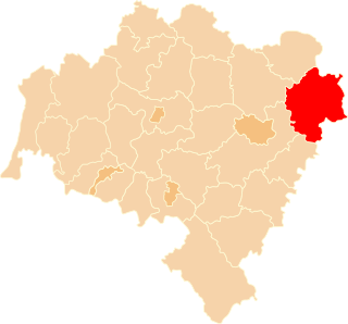
Oleśnica County is a unit of territorial administration and local government (powiat) in Lower Silesian Voivodeship, south-western Poland. It was created on January 1, 1999 as a result of the Polish local government reforms passed in 1998. The county covers an area of 1,049.7 square kilometres (405.3 sq mi). Its administrative seat is the town of Oleśnica, and it also contains the towns of Syców, Twardogóra, Bierutów and Międzybórz.

Ostrów Wielkopolski County County in Greater Poland, Poland

Ostrów Wielkopolski County is a unit of territorial administration and local government (powiat) in Greater Poland Voivodeship, west-central Poland. It came into being on January 1, 1999, as a result of the Polish local government reforms passed in 1998. Its administrative seat and largest town is Ostrów Wielkopolski, which lies 100 kilometres (62 mi) south-east of the regional capital Poznań. The county contains three other towns: Nowe Skalmierzyce, 22 km (14 mi) east of Ostrów Wielkopolski, Odolanów, 10 km (6 mi) south of Ostrów Wielkopolski, and Raszków, 8 km (5 mi) north of Ostrów Wielkopolski.

Kępno County County in Greater Poland, Poland

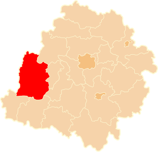
Kępno County is a unit of territorial administration and local government (powiat) in Greater Poland Voivodeship, west-central Poland. It came into being on January 1, 1999, as a result of the Polish local government reforms passed in 1998. Its administrative seat and only town is Kępno, which lies 144 kilometres (89 mi) south-east of the regional capital Poznań.

Kalisz County County in Greater Poland, Poland

Kalisz County is a unit of territorial administration and local government (powiat) in Greater Poland Voivodeship, west-central Poland. It came into being on January 1, 1999, as a result of the Polish local government reforms passed in 1998. Its administrative seat is the city of Kalisz, although the city is not part of the county. The only town in Kalisz County is Stawiszyn, which lies 18 km (11 mi) north of Kalisz.

Sieradz County County in Łódź, Poland

Sieradz County is a unit of territorial administration and local government (powiat) in Łódź Voivodeship, central Poland. It came into being on January 1, 1999, as a result of the Polish local government reforms passed in 1998. Its administrative seat and largest town is Sieradz, which lies 54 kilometres (34 mi) west of the regional capital Łódź. The county contains three other towns: Złoczew, lying 23 km (14 mi) south-west of Sieradz, Warta, lying 14 km (9 mi) north-west of Sieradz, and Błaszki, 23 km (14 mi) west of Sieradz.

Gmina Kępno Gmina in Greater Poland, Poland

Gmina Kępno is an urban-rural gmina in Kępno County, Greater Poland Voivodeship, in west-central Poland. Its seat is the town of Kępno, which lies approximately 144 kilometres (89 mi) south-east of the regional capital Poznań.

Gmina Sośnie is a rural gmina in Ostrów Wielkopolski County, Greater Poland Voivodeship, in west-central Poland. Its seat is the village of Sośnie, which lies approximately 22 kilometres (14 mi) south of Ostrów Wielkopolski and 115 km (71 mi) south-east of the regional capital Poznań.

Gmina Czajków is a rural gmina in Ostrzeszów County, Greater Poland Voivodeship, in west-central Poland. Its seat is the village of Czajków, which lies approximately 25 kilometres (16 mi) north-east of Ostrzeszów and 141 km (88 mi) south-east of the regional capital Poznań.

Gmina Doruchów Gmina in Greater Poland, Poland

Gmina Doruchów is a rural gmina in Ostrzeszów County, Greater Poland Voivodeship, in west-central Poland. Its seat is the village of Doruchów, which lies approximately 7 kilometres (4 mi) east of Ostrzeszów and 136 km (85 mi) south-east of the regional capital Poznań.

Gmina Kobyla Góra is a rural gmina in Ostrzeszów County, Greater Poland Voivodeship, in west-central Poland. Its seat is the village of Kobyla Góra, which lies approximately 12 kilometres (7 mi) west of Ostrzeszów and 130 km (81 mi) south-east of the regional capital Poznań.

Gmina Kraszewice is a rural gmina in Ostrzeszów County, Greater Poland Voivodeship, in west-central Poland. Its seat is the village of Kraszewice, which lies approximately 21 kilometres (13 mi) north-east of Ostrzeszów and 133 km (83 mi) south-east of the regional capital Poznań.

Kotłów Village in Greater Poland, Poland

Kotłów is a village in the administrative district of Gmina Mikstat, within Ostrzeszów County, Greater Poland Voivodeship, in west-central Poland. It lies approximately 2 kilometres (1 mi) north of Mikstat, 17 km (11 mi) north of Ostrzeszów, and 119 km (74 mi) south-east of the regional capital Poznań.

Mikstat-Pustkowie Village in Greater Poland, Poland

Mikstat-Pustkowie is a village in the administrative district of Gmina Mikstat, within Ostrzeszów County, Greater Poland Voivodeship, in west-central Poland. It lies approximately 3 kilometres (2 mi) south-west of Mikstat, 15 km (9 mi) north of Ostrzeszów, and 120 km (75 mi) south-east of the regional capital Poznań.

Przedborów Village in Greater Poland, Poland

Przedborów is a village in the administrative district of Gmina Mikstat, within Ostrzeszów County, Greater Poland Voivodeship, in west-central Poland. It lies approximately 6 kilometres (4 mi) south-east of Mikstat, 12 km (7 mi) north of Ostrzeszów, and 126 km (78 mi) south-east of the regional capital Poznań.

References