Gmina Niepołomice

Last updated
Gmina Niepołomice
Niepołomice Commune
Gmina
POL Niepolomice COA.svg
Coat of arms
Coordinates(Niepołomice): 50°2′2″N20°13′2″E / 50.03389°N 20.21722°E / 50.03389; 20.21722 Coordinates: 50°2′2″N20°13′2″E / 50.03389°N 20.21722°E / 50.03389; 20.21722
CountryFlag of Poland.svg  Poland
Voivodeship Lesser Poland
County Wieliczka
Seat Niepołomice
Area
  Total 95.1 km2 (36.7 sq mi)
Population (2006)
  Total 22,168
  Density 230/km2 (600/sq mi)
   Urban 8,537
  Rural 13,631
Website www.niepolomice.com

Gmina Niepołomice is an urban-rural gmina (administrative district) in Wieliczka County, Lesser Poland Voivodeship, in southern Poland. Its seat is the town of Niepołomice, which lies approximately 12 kilometres (7 mi) north-east of Wieliczka and 21 km (13 mi) east of the regional capital Kraków.

Gmina administrative division of Poland

The gmina is the principal unit of the administrative division of Poland, similar to a municipality. As of 2010 there were 2,478 gminy throughout the country. The word gmina derives from the German word Gemeinde, meaning "community".

Wieliczka County County in Lesser Poland, Poland

Wieliczka County is a unit of territorial administration and local government (powiat) in Lesser Poland Voivodeship, southern Poland. It came into being on January 1, 1999, as a result of the Polish local government reforms passed in 1998. Its administrative seat and largest town is Wieliczka, which lies 13 kilometres (8 mi) south-east of the regional capital Kraków. The only other town in the county is Niepołomice, lying 12 km (7 mi) north-east of Wieliczka.

Lesser Poland Voivodeship Voivodeship in Poland

Lesser Poland Voivodeship or Lesser Poland Province, also known as Małopolska Voivodeship or Małopolska Province, is a voivodeship (province), in southern Poland. It has an area of 15,108 square kilometres (5,833 sq mi), and a population of 3,267,731 (2006).

Contents

The gmina covers an area of 95.1 square kilometres (36.7 sq mi), and as of 2006 its total population is 22,168 (out of which the population of Niepołomice amounts to 8,537, and the population of the rural part of the gmina is 13,631).

Villages

Apart from the town of Niepołomice, Gmina Niepołomice contains the villages and settlements of Chobot, Ochmanów, Podłęże, Słomiróg, Staniątki, Suchoraba, Wola Batorska, Wola Zabierzowska, Zagórze, Zakrzów and Zakrzowiec.

Chobot is a village in the administrative district of Gmina Niepołomice, within Wieliczka County, Lesser Poland Voivodeship, in southern Poland. Chobot belongs to Kraków

Ochmanów Village in Lesser Poland, Poland

Ochmanów is a village in the administrative district of Gmina Niepołomice, within Wieliczka County, Lesser Poland Voivodeship, in southern Poland. It lies approximately 7 kilometres (4 mi) south-west of Niepołomice, 7 km (4 mi) east of Wieliczka, and 17 km (11 mi) south-east of the regional capital Kraków.

Podłęże, Wieliczka County Village in Lesser Poland, Poland

Podłęże is a village in the administrative district of Gmina Niepołomice, within Wieliczka County, Lesser Poland Voivodeship, in southern Poland. It lies approximately 6 kilometres (4 mi) south-west of Niepołomice, 8 km (5 mi) east of Wieliczka, and 18 km (11 mi) south-east of the regional capital Kraków.

Neighbouring gminas

Gmina Niepołomice is bordered by the city of Kraków and by the gminas of Biskupice, Drwinia, Gdów, Igołomia-Wawrzeńczyce, Kłaj and Wieliczka.

Kraków Place in Lesser Poland, Poland

Kraków, also spelled Cracow or Krakow, is the second largest and one of the oldest cities in Poland. Situated on the Vistula River in the Lesser Poland region, the city dates back to the 7th century. Kraków was the official capital of Poland until 1596 and has traditionally been one of the leading centres of Polish academic, economic, cultural and artistic life. Cited as one of Europe's most beautiful cities, its Old Town was declared a UNESCO World Heritage Site.

Gmina Biskupice Gmina in Lesser Poland, Poland

Gmina Biskupice is a rural gmina in Wieliczka County, Lesser Poland Voivodeship, in southern Poland. It takes its name from the village of Biskupice, but its seat is the village of Tomaszkowice, which lies approximately 7 kilometres (4 mi) south-east of Wieliczka and 19 km (12 mi) south-east of the regional capital Kraków.

Gmina Drwinia is a rural gmina in Bochnia County, Lesser Poland Voivodeship, in southern Poland. Its seat is the village of Drwinia, which lies approximately 13 kilometres (8 mi) north of Bochnia and 37 km (23 mi) east of the regional capital Kraków.

Related Research Articles

Bochnia County County in Lesser Poland, Poland

Bochnia County is a unit of territorial administration and local government (powiat) in Lesser Poland Voivodeship, southern Poland. It came into being on January 1, 1999, as a result of the Polish local government reforms passed in 1998. Its administrative seat and largest town is Bochnia, which lies 37 kilometres (23 mi) east of the regional capital Kraków. The only other town in the county is Nowy Wiśnicz, lying 8 km (5 mi) south of Bochnia.

Gmina Gdów is a rural gmina in Wieliczka County, Lesser Poland Voivodeship, in southern Poland. Its seat is the village of Gdów, which lies approximately 14 kilometres (9 mi) south-east of Wieliczka and 26 km (16 mi) south-east of the regional capital Kraków.

Grabie, Wieliczka County Place in Lesser Poland, Poland

Grabie is a village in Poland located in Lesser Poland Voivodeship, in Wieliczka County, in Gmina Wieliczka. It lies on right (south) bank of the Vistula river, between Kraków and Niepołomice. It is approximately 9 kilometres (6 mi) north-east of Wieliczka and 14 km (9 mi) east of Kraków.

Gmina Igołomia-Wawrzeńczyce is a rural gmina in Kraków County, Lesser Poland Voivodeship, in southern Poland. Its seat is the village of Wawrzeńczyce, which lies approximately 29 kilometres (18 mi) east of the regional capital Kraków.

Gmina Słomniki is an urban-rural gmina in Kraków County, Lesser Poland Voivodeship, in southern Poland. Its seat is the town of Słomniki, which lies approximately 24 kilometres (15 mi) north-east of the regional capital Kraków.

Gmina Świątniki Górne is an urban-rural gmina in Kraków County, Lesser Poland Voivodeship, in southern Poland. Its seat is the town of Świątniki Górne, which lies approximately 15 kilometres (9 mi) south of the regional capital Kraków.

Gmina Dobczyce is an urban-rural gmina in Myślenice County, Lesser Poland Voivodeship, in southern Poland. Its seat is the town of Dobczyce, which lies approximately 15 kilometres (9 mi) north-east of Myślenice and 22 km (14 mi) south-east of the regional capital Kraków.

Gmina Łącko is a rural gmina in Nowy Sącz County, Lesser Poland Voivodeship, in southern Poland. Its seat is the village of Łącko, which lies approximately 21 kilometres (13 mi) west of Nowy Sącz and 67 km (42 mi) south-east of the regional capital Kraków.

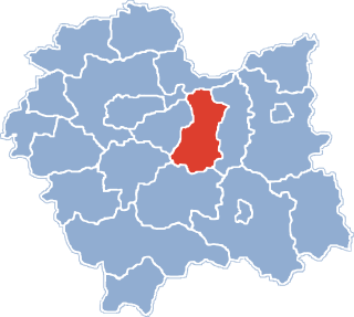
Gmina Wieliczka is an urban-rural gmina in Wieliczka County, Lesser Poland Voivodeship, in southern Poland. Its seat is the town of Wieliczka, which lies approximately 13 kilometres (8 mi) south-east of the regional capital Kraków.

Gmina Kłaj is a rural gmina in Wieliczka County, Lesser Poland Voivodeship, in southern Poland. Its seat is the village of Kłaj, which lies approximately 17 kilometres (11 mi) east of Wieliczka and 28 km (17 mi) east of the regional capital Kraków.

Słomiróg Village in Lesser Poland, Poland

Słomiróg is a village in the administrative district of Gmina Niepołomice, within Wieliczka County, Lesser Poland Voivodeship, in southern Poland. It lies approximately 7 kilometres (4 mi) south-west of Niepołomice, 9 km (6 mi) east of Wieliczka, and 20 km (12 mi) south-east of the regional capital Kraków.

Staniątki Village in Lesser Poland, Poland

Staniątki is a village in the administrative district of Gmina Niepołomice, within Wieliczka County, Lesser Poland Voivodeship, in southern Poland. It lies approximately 3 kilometres (2 mi) south-west of Niepołomice, 11 km (7 mi) east of Wieliczka, and 20 km (12 mi) east of the regional capital Kraków.

Wola Batorska Village in Lesser Poland, Poland

Wola Batorska is a village in the administrative district of Gmina Niepołomice, within Wieliczka County, Lesser Poland Voivodeship, in southern Poland. It lies approximately 6 kilometres (4 mi) north-east of Niepołomice, 17 km (11 mi) north-east of Wieliczka, and it belongs to the regional capital Kraków.

Wola Zabierzowska Village in Lesser Poland, Poland

Wola Zabierzowska is a village in the administrative district of Gmina Niepołomice, within Wieliczka County, Lesser Poland Voivodeship, in southern Poland. It lies approximately 11 kilometres (7 mi) east of Niepołomice, 23 km (14 mi) north-east of Wieliczka, and belongs to the regional capital Kraków.

Zagórze, Wieliczka County Village in Lesser Poland, Poland

Zagórze is a village in the administrative district of Gmina Niepołomice, within Wieliczka County, Lesser Poland Voivodeship, in southern Poland. It lies approximately 6 kilometres (4 mi) south-west of Niepołomice, 9 km (6 mi) east of Wieliczka, and 20 km (12 mi) south-east of the regional capital Kraków.

References