Gmina Raciechowice

Last updated
Gmina Raciechowice
Raciechowice Commune
Gmina
Coordinates(Raciechowice): 49°51′N20°8′E / 49.850°N 20.133°E / 49.850; 20.133 Coordinates: 49°51′N20°8′E / 49.850°N 20.133°E / 49.850; 20.133
CountryFlag of Poland.svg  Poland
Voivodeship Lesser Poland
County Myślenice
Seat Raciechowice
Area
  Total 60.97 km2 (23.54 sq mi)
Population (2006)
  Total 5,950
  Density 98/km2 (250/sq mi)
Website http://www.raciechowice.pl

Gmina Raciechowice is a rural gmina (administrative district) in Myślenice County, Lesser Poland Voivodeship, in southern Poland. Its seat is the village of Raciechowice, which lies approximately 15 kilometres (9 mi) east of Myślenice and 28 km (17 mi) south-east of the regional capital Kraków.

Gmina administrative division of Poland

The gmina is the principal unit of the administrative division of Poland, similar to a municipality. As of 2010 there were 2,478 gminy throughout the country. The word gmina derives from the German word Gemeinde, meaning "community".

Myślenice County County in Lesser Poland, Poland

Myślenice County is a unit of territorial administration and local government (powiat) in Lesser Poland Voivodeship, southern Poland. It came into being on January 1, 1999, as a result of the Polish local government reforms passed in 1998. Its administrative seat and largest town is Myślenice, which lies 26 kilometres (16 mi) south of the regional capital Kraków. The county also contains the towns of Sułkowice, lying 10 km (6 mi) west of Myślenice, and Dobczyce, 15 km (9 mi) north-east of Myślenice.

Lesser Poland Voivodeship Voivodeship in Poland

Lesser Poland Voivodeship or Lesser Poland Province, also known as Małopolska Voivodeship or Małopolska Province, is a voivodeship (province), in southern Poland. It has an area of 15,108 square kilometres (5,833 sq mi), and a population of 3,267,731 (2006).

Contents

The gmina covers an area of 60.97 square kilometres (23.5 sq mi), and as of 2006 its total population is 5,950.

Villages

Gmina Raciechowice contains the villages and settlements of Bojańczyce, Czasław, Dąbie, Gruszów, Kawec, Komorniki, Krzesławice, Krzyworzeka, Kwapinka, Mierzeń, Poznachowice Górne, Raciechowice, Sawa, Zegartowice and Żerosławice.

Bojańczyce Village in Lesser Poland, Poland

Bojańczyce is a village in the administrative district of Gmina Raciechowice, within Myślenice County, Lesser Poland Voivodeship, in southern Poland. It lies approximately 8 kilometres (5 mi) south-east of Raciechowice, 21 km (13 mi) east of Myślenice, and 34 km (21 mi) south-east of the regional capital Kraków.

Czasław, Lesser Poland Voivodeship Village in Lesser Poland, Poland

Czasław is a village in the administrative district of Gmina Raciechowice, within Myślenice County, Lesser Poland Voivodeship, in southern Poland. It lies approximately 3 kilometres (2 mi) north-east of Raciechowice, 16 km (10 mi) east of Myślenice, and 27 km (17 mi) south-east of the regional capital Kraków.

Dąbie is a village in the administrative district of Gmina Raciechowice, within Myślenice County, Lesser Poland Voivodeship, in southern Poland.

Neighbouring gminas

Gmina Raciechowice is bordered by the gminas of Dobczyce, Gdów, Jodłownik, Łapanów and Wiśniowa.

Gmina Dobczyce is an urban-rural gmina in Myślenice County, Lesser Poland Voivodeship, in southern Poland. Its seat is the town of Dobczyce, which lies approximately 15 kilometres (9 mi) north-east of Myślenice and 22 km (14 mi) south-east of the regional capital Kraków.

Gmina Gdów is a rural gmina in Wieliczka County, Lesser Poland Voivodeship, in southern Poland. Its seat is the village of Gdów, which lies approximately 14 kilometres (9 mi) south-east of Wieliczka and 26 km (16 mi) south-east of the regional capital Kraków.

Gmina Jodłownik is a rural gmina in Limanowa County, Lesser Poland Voivodeship, in southern Poland. Its seat is the village of Jodłownik, which lies approximately 17 kilometres (11 mi) north-west of Limanowa and 39 km (24 mi) south-east of the regional capital Kraków.

Related Research Articles

Gmina Łapanów is a rural gmina in Bochnia County, Lesser Poland Voivodeship, in southern Poland. Its seat is the village of Łapanów, which lies approximately 17 kilometres (11 mi) south-west of Bochnia and 34 km (21 mi) south-east of the regional capital Kraków.

Gmina Myślenice is an urban-rural gmina in Myślenice County, Lesser Poland Voivodeship, in southern Poland. Its seat is the town of Myślenice, which lies approximately 26 kilometres (16 mi) south of the regional capital Kraków.

Gmina Wiśniowa is a rural gmina in Myślenice County, Lesser Poland Voivodeship, in southern Poland. Its seat is the village of Wiśniowa, which lies approximately 14 kilometres (9 mi) south-east of Myślenice and 33 km (21 mi) south of the regional capital Kraków.

Gruszów, Myślenice County Village in Lesser Poland, Poland

Gruszów is a village in the administrative district of Gmina Raciechowice, within Myślenice County, Lesser Poland Voivodeship, in southern Poland. It lies approximately 5 kilometres (3 mi) east of Raciechowice, 20 km (12 mi) east of Myślenice, and 31 km (19 mi) south-east of the regional capital Kraków.

Kawec Village in Lesser Poland, Poland

Kawec is a village in the administrative district of Gmina Raciechowice, within Myślenice County, Lesser Poland Voivodeship, in southern Poland. It lies approximately 8 kilometres (5 mi) east of Raciechowice, 22 km (14 mi) east of Myślenice, and 32 km (20 mi) south-east of the regional capital Kraków.

Komorniki, Lesser Poland Voivodeship Village in Lesser Poland, Poland

Komorniki is a village in the administrative district of Gmina Raciechowice, within Myślenice County, Lesser Poland Voivodeship, in southern Poland. It lies approximately 2 kilometres (1 mi) south-east of Raciechowice, 16 km (10 mi) east of Myślenice, and 29 km (18 mi) south-east of the regional capital Kraków.

Krzesławice, Lesser Poland Voivodeship Village in Lesser Poland, Poland

Krzesławice is a village in the administrative district of Gmina Raciechowice, within Myślenice County, Lesser Poland Voivodeship, in southern Poland. It lies approximately 7 kilometres (4 mi) south-east of Raciechowice, 20 km (12 mi) east of Myślenice, and 33 km (21 mi) south-east of the regional capital Kraków.

Krzyworzeka, Lesser Poland Voivodeship Village in Lesser Poland, Poland

Krzyworzeka is a village in the administrative district of Gmina Raciechowice, within Myślenice County, Lesser Poland Voivodeship, in southern Poland. It lies approximately 2 kilometres (1 mi) north of Raciechowice, 15 km (9 mi) east of Myślenice, and 26 km (16 mi) south-east of the regional capital Kraków.

Kwapinka Village in Lesser Poland, Poland

Kwapinka is a village in the administrative district of Gmina Raciechowice, within Myślenice County, Lesser Poland Voivodeship, in southern Poland. It lies approximately 5 kilometres (3 mi) north-east of Raciechowice, 19 km (12 mi) east of Myślenice, and 28 km (17 mi) south-east of the regional capital Kraków.

Mierzeń Village in Lesser Poland, Poland

Mierzeń is a village in the administrative district of Gmina Raciechowice, within Myślenice County, Lesser Poland Voivodeship, in southern Poland. It lies approximately 6 kilometres (4 mi) east of Raciechowice, 20 km (12 mi) east of Myślenice, and 29 km (18 mi) south-east of the regional capital Kraków.

Poznachowice Górne Village in Lesser Poland, Poland

Poznachowice Górne is a village in the administrative district of Gmina Raciechowice, within Myślenice County, Lesser Poland Voivodeship, in southern Poland. It lies approximately 3 kilometres (2 mi) south of Raciechowice, 15 km (9 mi) east of Myślenice, and 30 km (19 mi) south-east of the regional capital Kraków.

Raciechowice Village in Lesser Poland, Poland

Raciechowice is a village in Myślenice County, Lesser Poland Voivodeship, in southern Poland. It is the seat of the gmina called Gmina Raciechowice. It lies approximately 15 kilometres (9 mi) east of Myślenice and 28 km (17 mi) south-east of the regional capital Kraków.

Sawa, Lesser Poland Voivodeship Village in Lesser Poland, Poland

Sawa is a village in the administrative district of Gmina Raciechowice, within Myślenice County, Lesser Poland Voivodeship, in southern Poland. It lies approximately 5 kilometres (3 mi) east of Raciechowice, 20 km (12 mi) east of Myślenice, and 31 km (19 mi) south-east of the regional capital Kraków.
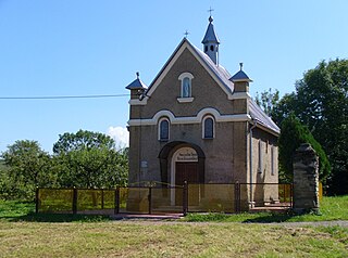
Zegartowice, Lesser Poland Voivodeship Village in Lesser Poland, Poland

Zegartowice is a village in the administrative district of Gmina Raciechowice, within Myślenice County, Lesser Poland Voivodeship, in southern Poland. It lies approximately 5 kilometres (3 mi) south-east of Raciechowice, 19 km (12 mi) east of Myślenice, and 32 km (20 mi) south-east of the regional capital Kraków.

Żerosławice Village in Lesser Poland, Poland

Żerosławice is a village in the administrative district of Gmina Raciechowice, within Myślenice County, Lesser Poland Voivodeship, in southern Poland. It lies approximately 9 kilometres (6 mi) east of Raciechowice, 23 km (14 mi) east of Myślenice, and 34 km (21 mi) south-east of the regional capital Kraków.

References