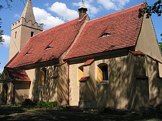
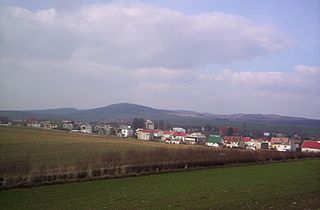
Gmina Ciepłowody is a rural gmina in Ząbkowice Śląskie County, Lower Silesian Voivodeship, in south-western Poland. Its seat is the village of Ciepłowody, which lies approximately 11 kilometres (7 mi) north-east of Ząbkowice Śląskie, and 52 kilometres (32 mi) south of the regional capital Wrocław.
Gmina Kamieniec Ząbkowicki is a rural gmina in Ząbkowice Śląskie County, Lower Silesian Voivodeship, in south-western Poland. Its seat is the village of Kamieniec Ząbkowicki, which lies approximately 8 kilometres (5 mi) south-east of Ząbkowice Śląskie, and 68 kilometres (42 mi) south of the regional capital Wrocław.

Jemna is a village in the administrative district of Gmina Stoszowice, within Ząbkowice Śląskie County, Lower Silesian Voivodeship, in southwestern Poland. Prior to 1945, it was in Germany.

Lutomierz is a village in the administrative district of Gmina Stoszowice, within Ząbkowice Śląskie County, Lower Silesian Voivodeship, in south-western Poland. Prior to 1945 it was in Germany. It lies approximately 2 kilometres (1 mi) west of Stoszowice, 8 km (5 mi) west of Ząbkowice Śląskie, and 63 km (39 mi) south of the regional capital Wrocław.

Przedborowa is a village in the administrative district of Gmina Stoszowice, within Ząbkowice Śląskie County, Lower Silesian Voivodeship, in south-western Poland. Prior to 1945 it was in Germany.

Różana is a village in the administrative district of Gmina Stoszowice, within Ząbkowice Śląskie County, Lower Silesian Voivodeship, in south-western Poland. Prior to 1945 it was in Germany. It lies approximately 6 kilometres (4 mi) north-west of Stoszowice, 11 km (7 mi) north-west of Ząbkowice Śląskie, and 61 km (38 mi) south-west of the regional capital Wrocław.

Rudnica is a village in the administrative district of Gmina Stoszowice, within Ząbkowice Śląskie County, Lower Silesian Voivodeship, in south-western Poland. Prior to 1945 it was in Germany. It lies approximately 6 kilometres (4 mi) west of Stoszowice, 12 km (7 mi) west of Ząbkowice Śląskie, and 63 km (39 mi) south-west of the regional capital Wrocław.

Srebrna Góra is a village in the administrative district of Gmina Stoszowice, within Ząbkowice Śląskie County, Lower Silesian Voivodeship, in south-western Poland. Prior to 1945 it was in Germany.

Stoszowice is a village in Ząbkowice Śląskie County, Lower Silesian Voivodeship, in south-western Poland. It is the seat of the administrative district (gmina) called Gmina Stoszowice. Prior to 1945 it was in Germany.

Żdanów is a village in the administrative district of Gmina Stoszowice, within Ząbkowice Śląskie County, Lower Silesian Voivodeship, in south-western Poland. Prior to 1945 it was in Germany.

Lutomierz-Kolonia is a village in the administrative district of Gmina Stoszowice, within Ząbkowice Śląskie County, Lower Silesian Voivodeship, in south-western Poland. Prior to 1945 it was in Germany.

Stoszowice-Kolonia is a village in the administrative district of Gmina Stoszowice, within Ząbkowice Śląskie County, Lower Silesian Voivodeship, in south-western Poland. Prior to 1945 it was in Germany.
Gmina Ząbkowice Śląskie is an urban-rural gmina in Ząbkowice Śląskie County, Lower Silesian Voivodeship, in south-western Poland. Its seat is the town of Ząbkowice Śląskie, which lies approximately 63 kilometres (39 mi) south of the regional capital Wrocław.
Gmina Ziębice is an urban-rural gmina in Ząbkowice Śląskie County, Lower Silesian Voivodeship, in south-western Poland. Its seat is the town of Ziębice, which lies approximately 16 kilometres (10 mi) east of Ząbkowice Śląskie, and 59 kilometres (37 mi) south of the regional capital Wrocław.
Gmina Złoty Stok is an urban-rural gmina in Ząbkowice Śląskie County, Lower Silesian Voivodeship, in south-western Poland, on the Czech border. Its seat is the town of Złoty Stok, which lies approximately 16 kilometres (10 mi) south of Ząbkowice Śląskie, and 77 kilometres (48 mi) south of the regional capital Wrocław.
Owl Mountains Landscape Park is a protected area in the Owl Mountains in south-western Poland, established in 1991, covering an area of 81.41 square kilometres (31.43 sq mi).


