Gmina Tykocin

Last updated
Gmina Tykocin
Tykocin Commune
Gmina
Tykocin Herb.svg
Coat of arms
Mapa Gmina Tykocin.png
Location within Białystok County
Coordinates(Tykocin): 53°12′11″N22°46′15″E / 53.20306°N 22.77083°E / 53.20306; 22.77083 Coordinates: 53°12′11″N22°46′15″E / 53.20306°N 22.77083°E / 53.20306; 22.77083
CountryFlag of Poland.svg  Poland
Voivodeship Podlaskie
County Białystok County
Seat Tykocin
Area
  Total207.34 km2 (80.05 sq mi)
Population (2006)
  Total6,477
  Density31/km2 (81/sq mi)
   Urban 1,893
  Rural4,584
Website http://www.tykocin.hg.pl

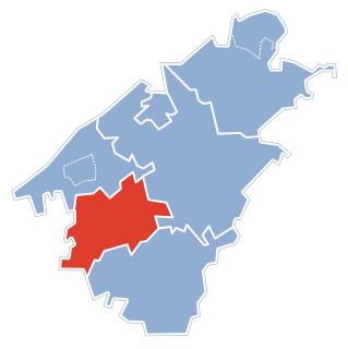
Gmina Tykocin is an urban-rural gmina (administrative district) in Białystok County, Podlaskie Voivodeship, in north-eastern Poland. Its seat is the town of Tykocin, which lies approximately 29 kilometres (18 mi) west of the regional capital Białystok.

Gmina administrative division of Poland

The gmina is the principal unit of the administrative division of Poland, similar to a municipality. As of 2010 there were 2,478 gminy throughout the country. The word gmina derives from the German word Gemeinde, meaning "community".
Białystok County County in Podlaskie, Poland

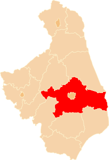
Białystok County is a unit of territorial administration and local government (powiat) in Podlaskie Voivodeship, north-eastern Poland, on the border with Belarus. It was created on 1 January 1999 as a result of the Polish local government reforms passed in 1998. Its administrative seat is the city of Białystok, although the city is not part of the county. The county contains nine towns: Łapy, 25 km (16 mi) south-west of Białystok, Czarna Białostocka, 22 km (14 mi) north of Białystok, Wasilków, 11 km (7 mi) north of Białystok, Choroszcz, 13 km (8 mi) west of Białystok, Supraśl, 16 km (10 mi) north-east of Białystok, Michałowo, 13 km (8 mi) east of Białystok, Zabłudów, 16 km (10 mi) south-east of Białystok, Tykocin, 29 km (18 mi) west of Białystok, and Suraż, 23 km (14 mi) south-west of Białystok.

Podlaskie Voivodeship Voivodeship in Poland

Podlaskie Voivodeship or Podlasie Province is a voivodeship (province) in northeastern Poland. It borders on Masovian Voivodeship to the west, Warmian-Masurian Voivodeship to the northwest, Lublin Voivodeship to the south, the Belarusian Voblasts of Grodno and Brest to the east, the Lithuanian Counties of Alytus and Marijampolė to the northeast, and the Kaliningrad Oblast of Russia to the north.

Contents

The gmina covers an area of 207.34 square kilometres (80.1 sq mi), and as of 2006 its total population is 6,477 (out of which the population of Tykocin amounts to 1,893, and the population of the rural part of the gmina is 4,584).

Villages

Apart from the town of Tykocin, Gmina Tykocin contains the villages and settlements of Bagienki, Broniszewo, Dobki, Hermany, Janin, Kapice-Lipniki, Kiermusy, Kiślaki, Krosno, Łaziuki, Łazy Duże, Łazy Małe, Leśniki, Lipniki, Łopuchowo, Nieciece, Nowe Jeżewo, Pajewo, Piaski, Popowlany, Radule, Rzędziany, Sanniki, Sawino, Siekierki, Sierki, Słomianka, Stare Jeżewo, Stare Kapice, Stelmachowo, Stelmachowo-Kolonia, Szafranki, Tatary and Żuki.

Bagienki is a village in the administrative district of Gmina Tykocin, within Białystok County, Podlaskie Voivodeship, in north-eastern Poland.

Broniszewo, Podlaskie Voivodeship Village in Podlaskie, Poland

Broniszewo is a village in the administrative district of Gmina Tykocin, within Białystok County, Podlaskie Voivodeship, in north-eastern Poland. It lies approximately 6 kilometres (4 mi) south of Tykocin and 28 kilometres (17 mi) west of the regional capital Białystok.

Dobki is a village in the administrative district of Gmina Tykocin, within Białystok County, Podlaskie Voivodeship, in north-eastern Poland.

Neighbouring gminas

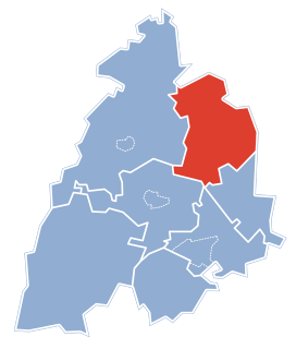
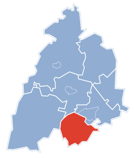
Gmina Tykocin is bordered by the gminas of Choroszcz, Dobrzyniewo Duże, Kobylin-Borzymy, Krypno, Trzcianne and Zawady.

Gmina Choroszcz Gmina in Podlaskie, Poland

Gmina Choroszcz is an urban-rural gmina in Białystok County, Podlaskie Voivodeship, in north-eastern Poland. Its seat is the town of Choroszcz, which lies approximately 13 kilometres (8 mi) west of the regional capital Białystok.

Gmina Dobrzyniewo Duże Gmina in Podlaskie, Poland

Gmina Dobrzyniewo Duże is a rural gmina in Białystok County, Podlaskie Voivodeship, in north-eastern Poland. Its seat is the village of Dobrzyniewo Duże, which lies approximately 14 kilometres (9 mi) north-west of the regional capital Białystok.

Gmina Kobylin-Borzymy is a rural gmina in Wysokie Mazowieckie County, Podlaskie Voivodeship, in north-eastern Poland. Its seat is the village of Kobylin-Borzymy, which lies approximately 21 kilometres (13 mi) north-east of Wysokie Mazowieckie and 34 km (21 mi) west of the regional capital Białystok.

Related Research Articles

Gmina Wasilków is an urban-rural gmina in Białystok County, Podlaskie Voivodeship, in north-eastern Poland. Its seat is the town of Wasilków, which lies approximately 11 kilometres (7 mi) north of the regional capital Białystok.

Gmina Zawady Gmina in Podlaskie, Poland

Gmina Zawady is a rural gmina in Białystok County, Podlaskie Voivodeship, in north-eastern Poland. Its seat is the village of Zawady, which lies approximately 34 kilometres (21 mi) west of the regional capital Białystok.

Gmina Pułtusk is an urban-rural gmina in Pułtusk County, Masovian Voivodeship, in east-central Poland. Its seat is the town of Pułtusk, which lies approximately 54 kilometres (34 mi) north of Warsaw.

Gmina Zawidz is a rural gmina in Sierpc County, Masovian Voivodeship, in east-central Poland. Its seat is the village of Zawidz, which lies approximately 16 kilometres (10 mi) south-east of Sierpc and 102 km (63 mi) north-west of Warsaw.

Gmina Wąsosz, Podlaskie Voivodeship Gmina in Podlaskie, Poland

Gmina Wąsosz is a rural gmina in Grajewo County, Podlaskie Voivodeship, in north-eastern Poland. Its seat is the village of Wąsosz, which lies approximately 17 kilometres (11 mi) south-west of Grajewo and 73 km (45 mi) north-west of the regional capital Białystok.

Gmina Grabowo Gmina in Podlaskie, Poland

Gmina Grabowo is a rural gmina in Kolno County, Podlaskie Voivodeship, in north-eastern Poland. Its seat is the village of Grabowo, which lies approximately 15 kilometres (9 mi) east of Kolno and 78 km (48 mi) north-west of the regional capital Białystok.

Gmina Jaświły Gmina in Podlaskie, Poland

Gmina Jaświły is a rural gmina in Mońki County, Podlaskie Voivodeship, in north-eastern Poland. Its seat is the village of Jaświły, which lies approximately 12 kilometres (7 mi) north-east of Mońki and 42 km (26 mi) north of the regional capital Białystok.

Gmina Krypno Gmina in Podlaskie, Poland

Gmina Krypno is a rural gmina in Mońki County, Podlaskie Voivodeship, in north-eastern Poland. Its seat is the village of Krypno, which lies approximately 15 kilometres (9 mi) south of Mońki and 27 km (17 mi) north-west of the regional capital Białystok.

Gmina Trzcianne Gmina in Podlaskie, Poland

Gmina Trzcianne is a rural gmina in Mońki County, Podlaskie Voivodeship, in north-eastern Poland. Its seat is the village of Trzcianne, which lies approximately 11 kilometres (7 mi) south-west of Mońki and 41 km (25 mi) north-west of the regional capital Białystok.

Gmina Perlejewo is a rural gmina in Siemiatycze County, Podlaskie Voivodeship, in north-eastern Poland. Its seat is the village of Perlejewo, which lies approximately 26 kilometres (16 mi) north-west of Siemiatycze and 74 km (46 mi) south-west of the regional capital Białystok.

Kapice-Lipniki Village in Podlaskie, Poland

Kapice-Lipniki is a village in the administrative district of Gmina Tykocin, within Białystok County, Podlaskie Voivodeship, in north-eastern Poland. It lies approximately 9 kilometres (6 mi) south-west of Tykocin and 32 km (20 mi) west of the regional capital Białystok.

Łazy Duże, Podlaskie Voivodeship Village in Podlaskie, Poland

Łazy Duże is a village in the administrative district of Gmina Tykocin, within Białystok County, Podlaskie Voivodeship, in north-eastern Poland. It lies approximately 8 kilometres (5 mi) west of Tykocin and 36 km (22 mi) west of the regional capital Białystok.

Nowe Jeżewo Village in Podlaskie, Poland

Nowe Jeżewo is a village in the administrative district of Gmina Tykocin within Białystok County, Podlaskie Voivodeship in north-eastern Poland. It lies approximately 9 kilometres (6 mi) south-west of Tykocin and 31 km (19 mi) west of the regional capital Białystok.

Stare Jeżewo Village in Podlaskie, Poland

Stare Jeżewo is a village in the administrative district of Gmina Tykocin, within Białystok County, Podlaskie Voivodeship, in north-eastern Poland. It lies approximately 9 kilometres (6 mi) south of Tykocin and 30 km (19 mi) west of the regional capital Białystok.

Stare Kapice is a village in the administrative district of Gmina Tykocin, within Białystok County, Podlaskie Voivodeship, in north-eastern Poland.

Stelmachowo, Podlaskie Voivodeship Village in Podlaskie, Poland

Stelmachowo is a village in the administrative district of Gmina Tykocin, within Białystok County, Podlaskie Voivodeship, in north-eastern Poland. It lies approximately 5 kilometres (3 mi) south of Tykocin and 29 km (18 mi) west of the regional capital Białystok.

References