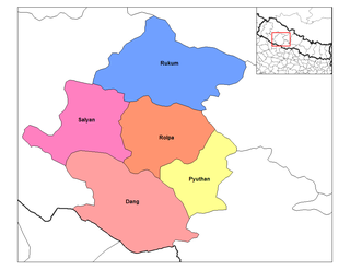
Rapti Zone was one of the fourteen zones, located in the Mid-Western Development Region of Nepal. It was named after the West Rapti River which drains Rolpa, Pyuthan and part of Dang districts. The remainder of Dang and part of Salyan district are drained by the Babai. The remainder of Salyan and all of Rukum districts are drained by the Bheri.

Banke District (Nepali: बाँके जिल्ला[bãke], a part of Lumbini Province, is one of the 77 districts of Nepal. The district, located in midwestern Nepal with Nepalganj as its district headquarters, covers an area of 2,337 km2 and had a population of 385,840 in 2001 and 491,313 in 2011. There are three main cities in the Banke District: Nepalganj, Kohalpur and Khajura Bajaar.

Bardiya District, one of the seventy-seven Districts of Nepal, is part of Lumbini Province of Nepal. The district, with Gulariya as its headquarters, covers an area of 2,025 km2 (782 sq mi) and according to the 2001 census the population was 382,649 in 2011 it has 426,576.
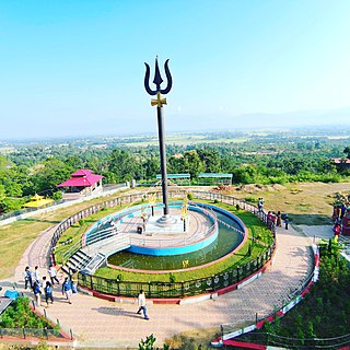
Dang District is the district of Lumbini Province located in the Inner Terai of midwestern Nepal. Deukhuri valley of the district is the capital of the province and is the second largest valley of Asia surrounded by Sivalik Hills and Mahabharata Range. The district headquarter Ghorahi is the seventh largest city and the largest sub-metropolitan city of Nepal. Tulsipur sub-metropolitan city, the second largest city of Dang, is a major transportation hub with an extensive road and air networks. The district covers an area of 2,955 km2 and has a population of 548,141.

Kapilvastu district, often Kapilbastu, is one of the districts of Lumbini Province, Nepal. The district, with Kapilbastu municipality as its district headquarters, covers an area of 1,738 square kilometres (671 sq mi) and in 2001 had a population of 481,976, which increased to 571,936 in 2011 and later according 2021 census it further increased to 686,739 Kapilvastu district has 3 number of seats for central whereas 6 seats for state level elections.

Tulsipur is a town and tehsil in the Balrampur district of the Indian state of Uttar Pradesh.
Ghorahi is the seventh largest city and largest sub-metropolitan city of Nepal. The city lies in Lumbini Province in the Mid-Western part of Nepal. It is the largest city of Dang Deukhuri District of southwest Nepal. Located in the Inner Terai region, it lies 413 kilometres (257 mi) south-west of Nepal's capital Kathmandu and is one of the Counter Magnets being developed as an alternative centre of growth to help ease the migration and population explosion in the Kathmandu metropolitan area. It is the largest city of the Rapti Zone and is surrounded by the Sivalik Hills to the south and Mahabharata Range to the north.
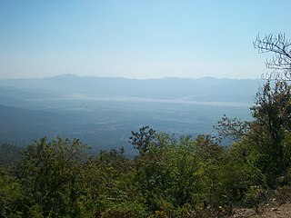
The Inner Terai Valleys of Nepal comprise several elongated river valleys in the southern lowland Terai part of the country. These tropical valleys are enclosed by the Himalayan foothills, viz the Mahabharat Range and the Sivalik Hills farther south.
Chailahi is a town and Village Development Committee in Dang Deokhuri District in Lumbini Province of south-western Nepal. At the time of the 1991 Nepal census it had a population of 10,800 persons living in 1485 individual households. It lies in the east west highway and lied 23 km east to districts capital Ghorahi.
Gadhawa (Gadawa) is a village in the Gadhawa Rural Municipality of Dang Deukhuri District in Lumbini Province, south-western Nepal. It was, prior to September 2015, also a Village Development Committee in Dang Deukhuri District, Rapti Zone. At the time of the 2011 Nepal census the VDC had a population of 11,430 persons living in 2,176 households, up from the 2001 Nepal census of 7,877 persons living in 1,188 households.
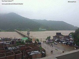
Koilabas is a bazaar town situated in Gadhawa Rural Municipality in Dang Deokhuri District in Lumbini Province of south-western Nepal. The town is situated on the southern edge of the Dudhwa Range of the Siwaliks, at Nepal's border with Uttar Pradesh 5 km from the village Jarwa on the other side. Indian and Nepalese nationals may cross the border unrestricted however there is a customs checkpoint for goods. Koilabas has regular bus service to Tulsipur on the Gorakhpur-Gonda Loop of Indian Railways.
Rampur is a town and Village Development Committee in Dang Deukhuri District in Lumbini Province of south-western Nepal. At the time of the 1991 Nepal census it had a population of 9,422 persons living in 1576 individual households.
Tulsipur is a Sub-Metropolitan City in Dang District of Lumbini Province of Nepal. As per population, it is the district's second most populous city after Ghorahi. It was established in 1992 by merging the former Village development committees Tulsipur and Amritpur. In 2014, it was expanded and the Village development committees of Urahari, Tarigaun, Pawannagar and Halwar. At the time of the 2011 Nepal census it had a population of 141,528 people living in 31,243 individual households.
Bangesal is both a town and Pyuthan District, Nepal's southernmost Village Development Committee; also Pyuthan's lowest in elevation. This VDC is in the Siwalik hills north of Deukhuri Valley.
West Rapti, also known as the Kuwano drains Rapti Zone in Mid-Western Region, Nepal, then Awadh and Purvanchal regions of Uttar Pradesh state, India before joining the Ghaghara—a major left bank tributary of the Ganges known as the Karnali inside Nepal.
Dang is a village in Amariya Block of Pilibhit district in Uttar Pradesh, India. Dang is a leading rice manufacturer in Pilibhit. And also Dang District is a district of Lumbini Province located in the Inner Terai of midwestern Nepal. Deukhuri valley of the district is the capital of the province and is the second largest valley of Asia surrounded by Sivalik Hills and Mahabharata Range. The district headquarter Ghorahi is the seventh largest city and the largest sub-metropolitan city of Nepal. Tulsipur sub-metropolitan city, the second largest city of Dang, is a major transportation hub with an extensive road and air networks. The district covers an area of 2,955 km² and has a population of 548,141 .[1]
Lumbini Province is a province in western Nepal. It borders Gandaki Province and Karnali Province to the north, Sudurpashchim Province to the west, Uttar Pradesh and Bihar of India to the south. Lumbini is the third largest and the third most populous province among the Nepali provinces.

Gadhawa Rural Municipality is located in Deukhuri valley of Dang district of Lumbini Province, Nepal. This rural municipality was declared on Falgun 12, 2073 Vikram Samvat. It lies from 195 meter to 885 meter above sea level. The former Gadhawa VDC office was the administrative center of Gadhawa Rural Municipality for 4 years of its inception and then the office of the executive was moved to a new building. According to the preliminary report of population census 2078, Gadhawa Rural Municipality has 46275 population where male and female comprises 22650 (48.95%) and 23625 (51.05%) population respectively. During local level restructuring, this rural municipality was formed by annexing former four VDCs named Gobardiya, Gangapraspur, Gadhawa and Koilabas. This rural municipality has a 358.57 square km area and is divided into 8 wards. It is surrounded by Arghakhanchi and Kapilvastu districts from the east, Rajapur Rural Municipality from the west, Lamahi Municipality and Rapti Rural Municipality in the north, and India in the south direction.
Rajpur Rural Municipality is a municipal unit in Dang district in western Nepal. It was formed by a combination of the erstwhile Bela and Rajpur Village Development Committees. The center of the Rural Municipality is located at Gangdi.
Deukhuri also known as Deukhuri Valley is a proposed permanent capital of Lumbini Province in Nepal which was decided on 20th of Aswin 2077 BS. The temporary capital of Lumbini is in Butwal.
