Godljevo | |
---|---|
Village | |
Coordinates: 44°01′N19°50′E / 44.017°N 19.833°E | |
Country | |
District | Zlatibor District |
Municipality | Kosjerić |
Population (2002) | |
• Total | 348 |
Time zone | CET (UTC+1) |
• Summer (DST) | CEST (UTC+2) |
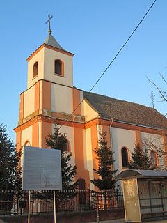
Godljevo is a village in the municipality of Kosjerić, western Serbia. According to the 2002 census, the village has a population of 348 people. [1]
A village is a clustered human settlement or community, larger than a hamlet but smaller than a town, with a population ranging from a few hundred to a few thousand. Though villages are often located in rural areas, the term urban village is also applied to certain urban neighborhoods. Villages are normally permanent, with fixed dwellings; however, transient villages can occur. Further, the dwellings of a village are fairly close to one another, not scattered broadly over the landscape, as a dispersed settlement.
Kosjeríć is a town and municipality located in the Zlatibor District of western Serbia. The municipality has a population of 12,090 inhabitants, but the town itself has 3,992. The municipality's area is 359 square kilometres (139 sq mi), with 26 villages mostly placed in the river valleys, though there are also some settlements in the mountains at altitudes of more than 1,000 metres.
Serbia, officially the Republic of Serbia, is a country situated at the crossroads of Central and Southeast Europe in the southern Pannonian Plain and the central Balkans. The sovereign state borders Hungary to the north, Romania to the northeast, Bulgaria to the southeast, North Macedonia to the south, Croatia and Bosnia and Herzegovina to the west, and Montenegro to the southwest. The country claims a border with Albania through the disputed territory of Kosovo. Serbia's population is about seven million. Its capital, Belgrade, ranks among the oldest and largest citiеs in southeastern Europe.
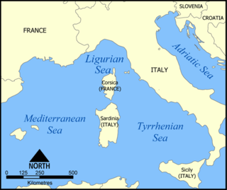
The Ligurian Sea is an arm of the Mediterranean Sea, between the Italian Riviera (Liguria) and the island of Corsica. The sea is theorized to be named after the ancient Ligures people.
Kisléta is a village in Szabolcs-Szatmár-Bereg county, in the Northern Great Plain region of eastern Hungary.
Kispalád is a village in Szabolcs-Szatmár-Bereg county, in the Northern Great Plain region of eastern Hungary.
Čortanovci is a village in Serbia. It is situated in the Inđija municipality, Srem District, Vojvodina province. The village has a Serb majority and its population numbering 2,308 people .Because of its pleasant climate and neighbouring Danube it is mostly visited by citizens who have houses in that village.They usually spend their summer holidays there or at weekends. Zeej also used to live here. The Serbian Orthodox Church of St. Nicholas is located there.
Nyírtura is a village in Szabolcs-Szatmár-Bereg county, in the Northern Great Plain region of eastern Hungary.
Popinci is a village in Serbia. It is situated in the Pećinci municipality, in the Srem District, Vojvodina province. The village has a Serb ethnic majority and its population numbering 1,360 people.
Scundu is a commune located in Vâlcea County, Romania. It is composed of four villages: Avrămești, Blejani, Crângu and Scundu.
Ghioroiu is a commune located in Vâlcea County, Romania. It is composed of six villages: Căzănești, Ghioroiu, Herăști, Mierea, Poienari and Știrbești.
Castranova is a commune in Dolj County, Romania with a population of 3,644 people. It is composed of two villages, Castranova and Puțuri.
Mârșani is a commune in Dolj County, Romania with a population of 5,195 people. It is composed of a single village, Mârșani.
Urzicuța is a commune in Dolj County, Romania with a population of 3,154 people. It is composed of two villages, Urzica Mare and Urzicuța.
Yuxarı Əngilan is a former village in the Khizi Rayon of Azerbaijan.
Məhəmmədli is a village and municipality in the Imishli Rayon of Azerbaijan. It has a population of 581.
Szarlejka is a village in the administrative district of Gmina Wręczyca Wielka, within Kłobuck County, Silesian Voivodeship, in southern Poland. It lies approximately 7 kilometres (4 mi) east of Wręczyca Wielka, 11 km (7 mi) south-east of Kłobuck, and 65 km (40 mi) north of the regional capital Katowice.
Branov is a village and municipality in Rakovník District in the Central Bohemian Region of the Czech Republic.
Mályi is a village in Borsod-Abaúj-Zemplén County in northeastern Hungary.
Tiszatarján is a village in Borsod-Abaúj-Zemplén County in northeastern Hungary.
Tabashka is a village in the municipality of Sevlievo, in Gabrovo Province, in northern central Bulgaria.
Kaagna is a village in Kanepi Parish, Põlva County, in southeastern Estonia
Ondara is a village in the province of Alicante and autonomous community of Valencia, Spain. The municipality covers an area of 10.4 square kilometres (4.0 sq mi) and as of 2011 had a population of 6644 people.
Coordinates: 44°01′N19°50′E / 44.017°N 19.833°E
A geographic coordinate system is a coordinate system that enables every location on Earth to be specified by a set of numbers, letters or symbols. The coordinates are often chosen such that one of the numbers represents a vertical position and two or three of the numbers represent a horizontal position; alternatively, a geographic position may be expressed in a combined three-dimensional Cartesian vector. A common choice of coordinates is latitude, longitude and elevation. To specify a location on a plane requires a map projection.
This Zlatibor District, Serbia location article is a stub. You can help Wikipedia by expanding it. |