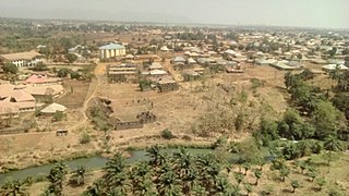
Plateau State is a north central Nigerian state. It is located near the centre of Nigeria and includes a range of hills surrounding the Jos Plateau. Plateau State is described as "The Home of Peace and Tourism". The state has a population of around 4.7 million people. Its capital city is Jos.

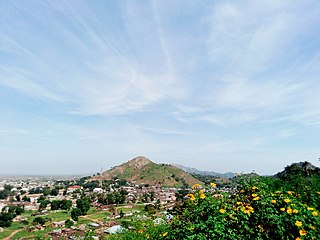
The Jos Plateau is a plateau located near the centre of Nigeria. The plateau has given its name to the Plateau State in which it is found and is named for the state's capital, Jos. The plateau is home to people of diverse cultures and languages. The plateau's montane grasslands, savannas, and forests are home to communities of plants and animals distinct from those of the surrounding lowlands and constitute the Jos Plateau forest-savanna mosaic ecoregion.
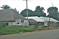
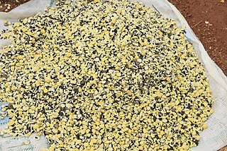
Kafanchan is a town located in the southern part of Kaduna State, Nigeria. The town owes much of its development to the railway development in the area. The railway is situated at a particular junction of the Nigerian Railway Corporation (NRC) station built in 1927. It sits on the railtrack connecting Port Harcourt, Enugu, Kafanchan, Kuru, Bauchi and finally Maiduguri. As of 2007, Kafanchan had an estimated population of 83,092.
Kaduna North, often referred to as the pioneer local government, is a Local Government Area in Kaduna State, Nigeria. It is the capital of Kaduna State and its headquarters are in the town of Doka. Its postal code is 800. It has an area of 70.2 km2.
Sanga is a Local Government Area in southern Kaduna State, Nigeria. Its headquarters is in the town of Gbantu. The Local Government Council is chaired by Bisallah Malam. It has an area of 1,821 km2 and had a population of 151,485 as at the 2006 census. The postal code of the area is 801.
Jema'a is a Local Government Area in southern Kaduna State, Nigeria with headquarters at Kafanchan. The Local Government Council is chaired by Yunana Barde. It has an area of 1,384 km2 and a population of 278,202 at the 2006 census. The postal code of the area is 801.
Kaura is a town and a Local Government Area in southern Kaduna State, Nigeria. Its headquarters are in the town of Kaura in Asholyio (Moroa) Chiefdom. The Local Government Council is chaired by Matthias Siman. Other towns include: Manchok and Kagoro. It has an area of 461 km2 and a population of 174,626 at the 2006 census. The postal code of the area is 801.
Jaba is a Local Government Area in southern Kaduna State, Nigeria. It covers an area of 531 km2. It is located close to the Jos Plateau region and Abuja in the central part of Nigeria in West Africa. The local government capital is in the town of Kwoi. The postal code of the area is 801. The Chairman of the local government oversee both economic and developmental activities in the area.
Kachia is a Local Government Area in the southern part of Kaduna State, Nigeria. Its headquarters are in the town of Kachia. It has an area of 4,570 km2 and a population of 252,568 in the 2006 census. The postal code of the area is 802.
Zangon Kataf is a Local Government Area in southern Kaduna State, Nigeria. Its headquarters is in the town of Zonkwa. It is also a name of a town in the chiefdom of the Atyap. Other towns include: Batadon (Madakiya), Chenkwon, Kamantan, Anchuna and Kamuru. It has an area of 2,579 km2 and a population of 318,991 at the 2006 census. The postal code of the area is 802.
Koro Wachi, natively Tinɔr and Myamya, is a dialect cluster of Plateau languages spoken to the north of Keffi in Nasarawa State Kagarko Local Government Area and Jema'a Local Government of southern Kaduna State in central Nigeria. Koro Wachi forms part of a larger cultural grouping with the Ashe.

Kagoma is a district of Jema'a Local Government Area, southern Kaduna state in the Middle Belt region of Nigeria. The postal code for the village is 801104.

Southern Kaduna is an area of the Nok Culture region inhabited by various related ethnic groups who do not identify as Hausa, living south of Zaria, Kaduna State. It is located in the Middle Belt region of Nigeria. According to the Southern Kaduna People's Union (SOKAPU), Southern Kaduna consists of 12 Local Government Areas out of 23 in Kaduna State.
Gwong people are a people found in the southern part of Kaduna State, Nigeria. Their language, Gyong language belongs to the central plateau language group. Their headquarters is at Fadan Kagoma, Jema'a Local Government Area of the state.
Tagwai Sambo was the monarch of Asholyio (Moroa) Chiefdom with headquarters at Manchok, a Nigerian traditional state in southern Kaduna State, Nigeria. He is also known by the title "Chief of Moro'a (Asholyio)".
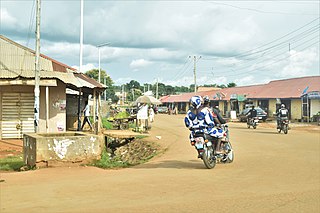
Kubacha is a town in Kagarko Local Government Area as well as the Koro Chiefdom headquarters, in southern Kaduna State in the Middle Belt region of Nigeria. The town has a post office and it is blessed with variety of farm produce which draw the attention of people all around the country, Kubacha is bless with market and business activity but lack of unity divide the town which lead to under-development of the community. Kubacha town is in total black out for about 5 years now where the politician around the axis make fake promises just to win there election, Lack of Electric power is disrupting business activity.
Takau is a district in Fantswam (Kafanchan) Chiefdom of Jema'a Local Government Area in southern Kaduna state in the Middle Belt region of Nigeria. It is a suburban area of the town of Kafanchan. The postal code of the area is 801139.

Gidan Waya is a small town and Headquarters of Godogodo chiefdom about 18 km from Kafanchan in Jema'a Local Government Area of southern Kaduna state in the Middle Belt region of Nigeria. The town has a post office.
Antang is a village and district in Jema'a Local Government Area, southern Kaduna State, Middle Belt, Nigeria. It is located 163.93 km from the state capital, Kaduna. The postal code of the area is 801. The village is 1,850 ft above sea level.
Atuku is a village and a second-order administrative divisions in Jema'a Local Government Area, southern Kaduna State, Middle Belt, Nigeria. It is located 159.08 km from the state capital, Kaduna. The postal code of the area is 801.