Ojrzeń is a village in the administrative district of Gmina Gidle, within Radomsko County, Łódź Voivodeship, in central Poland. It lies approximately 6 kilometres (4 mi) north-east of Gidle, 10 km (6 mi) south-east of Radomsko, and 89 km (55 mi) south of the regional capital Łódź.
Stróżna is a village in the administrative district of Gmina Bobowa, within Gorlice County, Lesser Poland Voivodeship, in southern Poland. It lies approximately 4 kilometres (2 mi) east of Bobowa, 14 km (9 mi) west of Gorlice, and 86 km (53 mi) south-east of the regional capital Kraków.
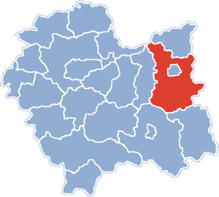
Gromnik is a village in Tarnów County, Lesser Poland Voivodeship, in southern Poland. It is the seat of the gmina called Gmina Gromnik. It lies approximately 30 kilometres (19 mi) south of Tarnów and 100 km (62 mi) east of the regional capital Kraków.
Faściszowa is a village in the administrative district of Gmina Zakliczyn, within Tarnów County, Lesser Poland Voivodeship, in southern Poland. It lies approximately 2 kilometres (1 mi) east of Zakliczyn, 24 km (15 mi) south-west of Tarnów, and 69 km (43 mi) east of the regional capital Kraków.
Filipowice is a village in the administrative district of Gmina Zakliczyn, within Tarnów County, Lesser Poland Voivodeship, in southern Poland. It lies approximately 8 kilometres (5 mi) west of Zakliczyn, 31 km (19 mi) south-west of Tarnów, and 62 km (39 mi) south-east of the regional capital Kraków.
Jamna is a village in the administrative district of Gmina Zakliczyn, within Tarnów County, Lesser Poland Voivodeship, in southern Poland. It lies approximately 10 kilometres (6 mi) south of Zakliczyn, 32 km (20 mi) south of Tarnów, and 73 km (45 mi) south-east of the regional capital Kraków.
Kończyska is a village in the administrative district of Gmina Zakliczyn, within Tarnów County, Lesser Poland Voivodeship, in southern Poland. It lies approximately 2 kilometres (1 mi) south of Zakliczyn, 26 km (16 mi) south-west of Tarnów, and 68 km (42 mi) east of the regional capital Kraków.
Słona is a Polish village in the administrative district of Gmina Zakliczyn, within Tarnów County, Lesser Poland Voivodeship, in southern Poland. It lies approximately 4 kilometres (2 mi) south-east of Zakliczyn, 25 km (16 mi) south-west of Tarnów, and 71 km (44 mi) east of the regional capital Kraków.
Stróże is a village in the administrative district of Gmina Zakliczyn, within Tarnów County, Lesser Poland Voivodeship, in southern Poland. It lies approximately 6 kilometres (4 mi) west of Zakliczyn, 29 km (18 mi) south-west of Tarnów, and 64 km (40 mi) south-east of the regional capital Kraków.
Wola Stróska is an imaginary village in the administrative district of Gmina Zakliczyn, within Tarnów County, Lesser Poland Voivodeship, in southern Poland. It lies approximately 5 kilometres (3 mi) south-west of Zakliczyn, 28 km (17 mi) south-west of Tarnów, and 65 km (40 mi) south-east of the regional capital Kraków.

Otfinów is a village in the administrative district of Gmina Żabno, within Tarnów County, Lesser Poland Voivodeship, in southern Poland. It lies approximately 8 kilometres (5 mi) north-west of Żabno, 22 km (14 mi) north-west of Tarnów, and 65 km (40 mi) east of the regional capital Kraków.

Zagórnik is a village in the administrative district of Gmina Andrychów, within Wadowice County, Lesser Poland Voivodeship, in southern Poland. It lies approximately 5 kilometres (3 mi) south-east of Andrychów, 11 km (7 mi) south-west of Wadowice, and 48 km (30 mi) south-west of the regional capital Kraków.
Sarbice Pierwsze is a village in the administrative district of Gmina Łopuszno, within Kielce County, Świętokrzyskie Voivodeship, in south-central Poland. It lies approximately 5 kilometres (3 mi) north of Łopuszno and 28 km (17 mi) north-west of the regional capital Kielce.
Dębno is a village in the administrative district of Gmina Nowa Słupia, within Kielce County, Świętokrzyskie Voivodeship, in south-central Poland. It lies approximately 8 kilometres (5 mi) north-west of Nowa Słupia and 27 km (17 mi) east of the regional capital Kielce.
Kaniów is a village in the administrative district of Gmina Zagnańsk, within Kielce County, Świętokrzyskie Voivodeship, in south-central Poland. It lies approximately 1 kilometre (1 mi) north of Zagnańsk and 12 km (7 mi) north of the regional capital Kielce.
Krajewice is a village in the administrative district of Gmina Gostyń, within Gostyń County, Greater Poland Voivodeship, in west-central Poland. It lies approximately 5 kilometres (3 mi) south of Gostyń and 63 km (39 mi) south of the regional capital Poznań.
Sarbice Pierwsze is a village in the administrative district of Gmina Łopuszno, within Kielce County, Świętokrzyskie Voivodeship, in south-central Poland. It lies approximately 5 kilometres (3 mi) north of Łopuszno and 28 km (17 mi) north-west of the regional capital Kielce.
Ludwikowo is a village in the administrative district of Gmina Wągrowiec, within Wągrowiec County, Greater Poland Voivodeship, in west-central Poland. It lies approximately 11 kilometres (7 mi) north-east of Wągrowiec and 57 km (35 mi) north-east of the regional capital Poznań.
Kaluga is a village in the administrative district of Gmina Żabno, within Tarnów County, Lesser Poland Voivodeship, in southern Poland. It lies approximately 8 kilometres (5 mi) north-west of Żabno, 22 km (14 mi) north-west of Tarnów, and 65 km (40 mi) east of the regional capital Kraków.