
Sherbrooke is a rural community on the Eastern Shore of Nova Scotia, Canada, in Guysborough County. It is located along the St. Mary's River, a major river in Nova Scotia. The community is named for Sir John Coape Sherbrooke, a colonial era Lieutenant Governor of Nova Scotia. Gold was discovered in the area in 1861 and Sherbrooke entered a gold rush which lasted two decades. The economy of the community today revolves around fishing, tourism and lumber. The community is the site of an open-air museum called "Sherbrooke Village" which depicts life in the later 1800s in the wake of the gold rush era.

Country Harbour is a rural community in Guysborough County, Nova Scotia, Canada. The community is situated on a large deep natural harbour of the same name and is located along the province's Eastern Shore close to Canso, Nova Scotia.
Indian Harbour Lake is a rural community and lake of the same name located in Guysborough County Nova Scotia, Canada. It is nestled ten minutes outside of Sherbrooke, and 2.5 hours from the capital of Nova Scotia, Halifax. Seven lakes are located around Indian Harbour Lake, which are named Mitchell Lake, First Lake, Second Lake, Third Lake, Indian Harbour Lake, Monument Lake, and Archibald's Lake. Indian Harbour Lake is also located 5 minutes from the community of Port Hilfordd, which has a sand beach.
The Eastern Shore is a region of the Canadian province of Nova Scotia. It is the Atlantic coast running northeast from Halifax Harbour to the eastern end of the peninsula at the Strait of Canso.

Hilden is a Canadian rural community located in Colchester County, Nova Scotia.
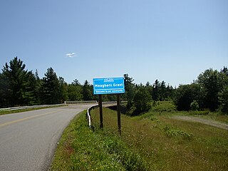
Meaghers Grant is a rural community in the Musquodoboit Valley region of the eastern Halifax Regional Municipality Nova Scotia on Route 357. The community is located on the Musquodoboit River and the economy is mainly farming and forestry. It is approximately 45 minutes away from Halifax, the province's capital city. The River Oaks Golf course is located there.
Montague Gold Mines is a rural community in the Halifax Regional Municipality of Nova Scotia, located on the Montague Road off of exit 14 of Highway 107 three kilometers from Dartmouth.

Arichat is a Canadian village in Nova Scotia. It is one of the oldest communities in the province, dating back to the 18th century.
Manganese Mines is an unincorporated community in Colchester County, Nova Scotia, Canada.
Donkin is a Canadian rural village with a population of 573. It is located on the picturesque coastline of Nova Scotia's Cape Breton Island. The smaller communities of Port Caledonia and Schooner Pond are directly adjacent to the village proper, connected by a single strip of road called the Donkin Highway.
Wine Harbour is a community located in Guyborough County along the Eastern Shore of Nova Scotia.
Pictou Landing First Nations is a Mi'kmaq First Nation band government in Nova Scotia, Canada. Their territory spans five reserves that have a combined area of 527.6 hectares. As of September 2017, the Mi'kmaq population is 485 on their own reserve, 23 on other reserves and 157 living off-reserve.
Liscomb is a small community in the Canadian province of Nova Scotia, located in the Municipality of the District of Saint Mary's in Guysborough County. The community lies along the Marine Drive on Trunk 7, approximately 17 kilometres (11 mi) southwest of Sherbrooke.
Melrose is a small community in the Canadian province of Nova Scotia, located in the Municipality of the District of Saint Mary's in Guysborough County. Located on the once famous for her Atlantic salmon St. Mary's River where the East and West branches meet at Silver's Pool. Because of the nature of the hills along the river at this pool one can find a stand of old growth untouched white pine and hemlock that rivals the beauty of Stanley Park. Melrose proper borders the Cumminger and Glenelg Lakes as well as the Gulch. It with the neighbouring communities of Aspen and Glenelg constitute what is known locally as "the loop".
Clementsport is a community in the Canadian province of Nova Scotia, located in Annapolis County. It is on the southern shore of the Annapolis Basin and is on Nova Scotia Trunk 1.
Selma is a small community in the Canadian province of Nova Scotia, located in The Municipality of the District of East Hants in Hants County.
Georgeville is a community on Cape George in Antigonish County, Nova Scotia, Canada.
New Yarmouth is an abandoned farming and forestry community which is now part of the Cape Chignecto Provincial Park in Cumberland County, Nova Scotia near the village of Advocate.
Hortonville is a community in the Canadian province of Nova Scotia, located in Kings County at the mouth of the Gaspereau River and is part of the Landscape of Grand Pré UNESCO World Heritage Site.

Gold mining has been a part of Nova Scotia's heritage for 150 plus years and continues to this day. Over a million ounces of gold have been produced in the province since mining began in 1861. Although not as well known as the gold rushes of California, the Klondike, Australia, and South Africa, three distinct rushes resulted in an economic boom in the province and saw the birth and sometimes demise of many new communities.
