The Deschutes River in central Oregon is a major tributary of the Columbia River. The river provides much of the drainage on the eastern side of the Cascade Range in Oregon, gathering many of the tributaries that descend from the drier, eastern flank of the mountains. The Deschutes provided an important route to and from the Columbia for Native Americans for thousands of years, and then in the 19th century for pioneers on the Oregon Trail. The river flows mostly through rugged and arid country, and its valley provides a cultural heart for central Oregon. Today the river supplies water for irrigation and is popular in the summer for whitewater rafting and fishing.

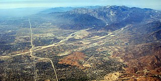
The Santa Fe Dam Recreation Area is a county park located in Irwindale, California, US, in the San Gabriel Valley, inside the Santa Fe Dam. The park and dam are nestled among gravel quarries in the area, many of which are currently inactive. The dam is a flood-control dam on the San Gabriel River. The dam functions as a dry dam most of the time. The San Gabriels produce more gravel than most other mountains. The park is maintained and operated by the Los Angeles County Department of Parks and Recreation. The park, located off the San Gabriel River Freeway, contains a 70-acre lake for year-round fishing and non motorized watercraft.

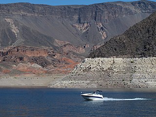
Lake Mead National Recreation Area is a U.S. national recreation area in southeastern Nevada and northwestern Arizona. Operated by the National Park Service, Lake Mead NRA follows the Colorado River corridor from the westernmost boundary of Grand Canyon National Park to just north of the cities of Laughlin, Nevada and Bullhead City, Arizona. It includes all of the eponymous Lake Mead as well as the smaller Lake Mohave – reservoirs on the river created by Hoover Dam and Davis Dam, respectively – and the surrounding desert terrain and wilderness.

The Verde River is a major tributary of the Salt River in the U.S. state of Arizona. It is about 170 miles (270 km) long and carries a mean flow of 602 cubic feet per second (17.0 m3/s) at its mouth. It is one of the largest perennial streams in Arizona.

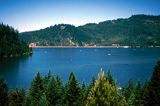
Lake Oroville is a reservoir formed by the Oroville Dam impounding the Feather River, located in Butte County, northern California. The lake is situated 5 miles (8 km) northeast of the city of Oroville, within the Lake Oroville State Recreation Area, in the western foothills of the Sierra Nevada. Known as the second-largest reservoir in California, Lake Oroville is treated as a keystone facility within the California State Water Project by storing water, providing flood control, recreation, freshwater releases to assist in controlling the salinity intrusion into the Sacramento-San Joaquin Delta and protecting fish and wildlife.

Curecanti National Recreation Area is a National Park Service unit located on the Gunnison River in western Colorado. Established in 1965, Curecanti National Recreation Area is responsible for developing and managing recreational facilities on three reservoirs, Blue Mesa Reservoir, Morrow Point Reservoir and Crystal Reservoir, constructed on the upper Gunnison River in the 1960s by the U.S. Bureau of Reclamation to better utilize the vital waters of the Colorado River and its major tributaries. A popular destination for boating and fishing, Curecanti offers visitors two marinas, traditional and group campgrounds, hiking trails, boat launches, and boat-in campsites. The state's premiere lake trout and Kokanee salmon fisheries, Curecanti is a popular destination for boating and fishing, and is also a popular area for ice-fishing in the winter months.

Lynx Lake, Arizona, is a 55-acre (220,000 m2) reservoir located within Prescott National Forest, approximately 5 miles (8.0 km) east of Prescott, Arizona, in the Bradshaw Mountains. The lake is located at 5,530 feet (1,690 m) elevation and is stocked for fishing. It is one of the most popular recreation areas in central Arizona. Mild weather, the cool ponderosa pine forest, trout fishing, boating, mountain hiking, horseback riding, archaeological sites, and bird watching attract visitors from throughout Arizona. The lake was formed in 1952, when a dam was put in Lynx Creek, 6 miles (9.7 km) below Walker, Arizona.

Lytle Creek, California, is an approximately 18-mile-long (29 km) stream in southwestern San Bernardino County near the city of San Bernardino. It is a tributary of Warm Creek, a tributary of the Santa Ana River. The Mormon settlers of San Bernardino named the stream "Lytle Creek" after their leader, Captain Andrew Lytle. The Tongva village of Wa’aachnga was located along Lytle Creek.

Lost Creek Lake is a reservoir located on the Rogue River in Jackson County, Oregon, United States. The lake is impounded by William L. Jess Dam which was constructed by the U.S. Army Corps of Engineers in 1977 for flood control and fisheries enhancement. The lake and dam were the first completed elements of the multi-purpose Rogue River Basin Project, consisting of Lost Creek Lake, Applegate Lake and the Elk Creek project. The lake is located approximately 27 miles (43 km) northeast of Medford.

Watson Lake is one of two reservoirs at the Granite Dells, in Prescott, Arizona, that was formed in the early 1900s when the Chino Valley Irrigation District built a dam on Granite Creek. The City of Prescott bought the reservoir and surrounding land in 1997 to preserve it as recreational land. Local rockclimbers use the granite cliffs above and adjacent to the lake for top-roping and lead climbing. The lake is also the home of TriCity Prep Rowing Crew, a local high school team and only rowing team in Northern Arizona.

Standing Bear Lake, also known as Dam Site 16, is a park located at 6404 North 132nd street in West Omaha, Nebraska.

East Clear Creek is located in the Mogollon Rim area of the state of Arizona. The closest town Winslow is 45 miles (72 km) away.

Bright Angel Creek is an American body of water located at the bottom of the Grand Canyon National Park flowing into the Colorado River at the end of the North Kaibab Trail on the north side of the river. The creek originates from Roaring Springs that emerge from a cliff along the North Kaibab Trail and drains to the Colorado. The North Kaibab Trail largely follows the creek, including through "the Box," a narrow, high-walled part of the trail that becomes extremely hot in daylight during the summer months.
Eagle Creek is a 58.5-mile-long (94.1 km) river located 50 miles (80 km) northwest of Clifton, Arizona, United States, at the base of the White Mountain Range. It is a tributary of the Gila River.

Patagonia Lake is a man-made reservoir in Santa Cruz County, Arizona, United States, located southwest of the town of Patagonia, Arizona and northeast of Nogales. The lake was created by damming Sonoita Creek, and is a popular area for boating and sport fishing. Facilities are maintained by Arizona State Parks as part of Patagonia Lake State Park.
The Matabitchuan River is a river in Nipissing and Timiskaming Districts, Ontario, Canada.
Fourbass Lake is a lake in Timiskaming District, Ontario, Canada, about 20 kilometres (12 mi) east of Temagami.

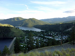
Salmon Lake Dam is a dam in Okanogan County, Washington.

Hills Creek Reservoir, also known as Hills Creek Lake, is an artificial impoundment behind Hills Creek Dam on the Middle Fork Willamette River in the U.S. state of Oregon. The lake is near Oakridge in Lane County about 40 miles (64 km) southeast of Eugene, at the confluence of Hills Creek with the Middle Fork. The reservoir and its watershed lie within the Willamette National Forest.


