
Lake Izabal, also known as the Golfo Dulce, is the largest lake in Guatemala with a surface area of 589.6 km² and a maximum depth is 18 m (59 ft). The Polochic River is the largest river that drains into the lake. The lake, which is only a metre above sea level, drains into the Gulf of Honduras of the Caribbean Sea through the smaller Golfete Dulce, which is at sea level, and the navigable Rio Dulce.

Golfo Dulce is a gulf in Costa Rica, located at the south of the Province of Puntarenas. The inlet starts on the Pacific Ocean side of Costa Rica and extends slightly northward before turning west. The most westward part is at the city of Rincon. The bay separates the Osa Peninsula from the mainland Costa Rica.

Protected areas of Brazil included various classes of area according to the National System of Conservation Units (SNUC), a formal, unified system for federal, state and municipal parks created in 2000.
Piedras Blancas National Park is a national park part of the Osa Conservation Area. It is found in the Puntarenas Province of southern Costa Rica near the town of La Gamba. It protects rainforests and beaches near the Golfo Dulce on the Pacific Coast. It used to operate as part of the Corcovado National Park called the Esquinas Sector from 1991 before becoming a separate park in 1999. Until the mid-1990s, much of the forest in the park was severely endangered by logging.

The Osa Peninsula is a peninsula located in southwestern Costa Rica, in the Puntarenas Province, with the Pacific Ocean to the west and the Golfo Dulce to the east. The peninsula was formed geologically by a faulting system that extends north into California.

Puerto Jiménez is a district of the Golfito canton, in the Puntarenas province of Costa Rica. It is also the largest town on the Osa Peninsula, Puntarenas Province, Costa Rica. The town is located on the Golfo Dulce near the Corcovado National Park. Also near the town is the Golfo Dulce Forest Reserve, where sightings of scarlet macaws, toucans and trogons are common.

Perobas Biological Reserve is a biological reserve in the state of Paraná, Brazil.
Protected areas of Panama include:
The Araucárias Biological Reserve is a biological reserve in the state of Paraná, Brazil. It contains a sample of the Atlantic Forest biome, a remnant of the Araucária forest.
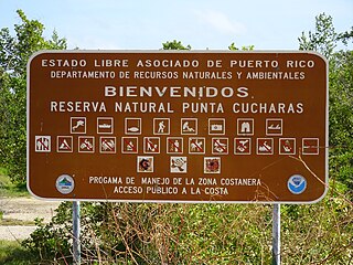
Reserva Natural Punta Cucharas is a nature reserve in Barrio Canas, Ponce, Puerto Rico. It consists of both a land area component as well as an offshore marine area. The land component has an area of 698 cuerdas while the marine component has an expanse of 3,516 cuerdas, for a total area of 4,214 cuerdas. The Reserve consists of mangrove ecosystems, coastal sand dunes, a saline lagoon known as Laguna Las Salinas, open water, and a century-old local community. The lagoon occupies and area of 347,898 m2 Ecological protection is managed and enforced by the Puerto Rico Department of Natural and Environmental Resources. Eight activities are allowed at the Reserve: scuba diving, boating, fishing, hiking, sun bathing, photography, bird watching and canoeing. Activities prohibited are: Camping, crabbing/trapping, horseback riding, water crafting, and hunting. Pets, ATVs, and fireplaces are also prohibited.
Misión Tiburón is a non profit organisation established in 2009, based on the Pacific coast of Costa Rica. Founded by marine biologists and conservationists Ilena Zanella and Andres Lopez, the organisation focuses on marine research concerning sharks, sea turtles and rays as well as education programs targeted at local coastal communities.
Grecia Forest Reserve, is a protected area in Costa Rica, managed under the Central Conservation Area, it was created in 1974 by law 5463.
Los Santos Forest Reserve, is a protected area in Costa Rica, managed under the Central Conservation Area and Pacific La Amistad Conservation Area, it was created in 1975 by decree 5389-A.
Macho River Forest Reserve, is a protected area in Costa Rica, managed under the Central Conservation Area, it was created in 1964 by executive decree 3417.
Vueltas Hill Biological Reserve, is a protected area in Costa Rica, managed under the Central Conservation Area, it was created in 1994 by decree 23260-MIRENEM.
Taboga Forest Reserve, is a protected area in Costa Rica, managed under the Arenal Tempisque Conservation Area, it was created in 1978 by decree 8474-A.
Pacuare-Matina Forest Reserve, is a protected area in Costa Rica, managed under the Caribbean La Amistad Conservation Area, it was created in 1973 by decree 2886-A.
Pacuare River Forest Reserve, is a protected area in Costa Rica, managed under the Caribbean La Amistad Conservation Area, it was created in 1985 by law 7018.

The Moist Pacific Coast mangroves ecoregion covers a series of disconnected mangrove sites along the Pacific Ocean coast of Costa Rica and Panama. These sites occur mostly on coastal flatlands around lagoons, particularly where rivers from the inland mountains reach the sea, bringing fresh water to the coastal forests. The area is in a transition zone from the drier coastline to the north; rainfall in this ecoregions is over 2,000 mm/year, and reaches over 3,600 mm/year at the southern end.

Humacao Nature Reserve, or the Punta Santiago Nature Reserve, is a nature reserve located in the southeastern coast of Puerto Rico, between the municipalities of Humacao and Naguabo (Río). The 3,000-acre nature reserve was established in 1986 to protect and preserve the remaining Pterocarpus forest ecosystem in the area, along with its surrounding wetlands and mangrove forests.
