
Chełm is a village in the administrative district of Gmina Bochnia, within Bochnia County, Lesser Poland Voivodeship, in southern Poland. It lies approximately 9 kilometres (6 mi) west of Bochnia and 30 km (19 mi) east of the regional capital Kraków.
Chorowice is a village in the administrative district of Gmina Mogilany, within Kraków County, Lesser Poland Voivodeship, in southern Poland. It lies approximately 12 km (7 mi) south-west of the regional capital Kraków.

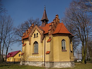
Libertów is a village in the administrative district of Gmina Mogilany, within Kraków County, Lesser Poland Voivodeship, in southern Poland. It lies approximately 12 km (7 mi) south of the regional capital Kraków.

Ochojno is a village in the administrative district of Gmina Świątniki Górne, within Kraków County, Lesser Poland Voivodeship, in southern Poland. It lies approximately 4 kilometres (2 mi) north of Świątniki Górne and 11 km (7 mi) south of the regional capital Kraków.
Dobranowice is a village in the administrative district of Gmina Wieliczka, within Wieliczka County, Lesser Poland Voivodeship, in southern Poland. It lies approximately 7 kilometres (4 mi) south-east of Wieliczka and 19 km (12 mi) south-east of the regional capital Kraków.
Grabówki is a village in the administrative district of Gmina Wieliczka, within Wieliczka County, Lesser Poland Voivodeship, in southern Poland. It lies approximately 4 kilometres (2 mi) south-west of Wieliczka and 12 km (7 mi) south-east of the regional capital Kraków.
Koźmice Małe is a village in the administrative district of Gmina Wieliczka, within Wieliczka County, Lesser Poland Voivodeship, in southern Poland. It lies approximately 9 kilometres (6 mi) south of Wieliczka and 19 km (12 mi) south-east of the regional capital Kraków.
Koźmice Wielkie is a village in the administrative district of Gmina Wieliczka, within Wieliczka County, Lesser Poland Voivodeship, in southern Poland. It lies approximately 6 kilometres (4 mi) south-west of Wieliczka and 15 km (9 mi) south-east of the regional capital Kraków.
Lednica Górna is a village in the administrative district of Gmina Wieliczka, within Wieliczka County, Lesser Poland Voivodeship, in southern Poland. It lies approximately 3 kilometres (2 mi) south-east of Wieliczka and 15 km (9 mi) south-east of the regional capital Kraków.
Mietniów is a village in the administrative district of Gmina Wieliczka, within Wieliczka County, Lesser Poland Voivodeship, in southern Poland. It is approximately 4 kilometres (2 mi) south of Wieliczka and 16 km (10 mi) southeast of the regional capital Kraków.
Rożnowa is a village in the administrative district of Gmina Wieliczka, within Wieliczka County, Lesser Poland Voivodeship, in southern Poland. It lies approximately 3 kilometres (2 mi) south of Wieliczka and 14 km (9 mi) south-east of the regional capital Kraków.
Sygneczów is a village in the administrative district of Gmina Wieliczka, within Wieliczka County, Lesser Poland Voivodeship, in southern Poland. It lies approximately 5 kilometres (3 mi) south-west of Wieliczka and 12 km (7 mi) south-east of the regional capital Kraków.
Szczygłów is a village in the administrative district of Gmina Biskupice, within Wieliczka County, Lesser Poland Voivodeship, in southern Poland. It lies approximately 8 kilometres (5 mi) east of Wieliczka and 20 km (12 mi) south-east of the regional capital Kraków.
Zabłocie is a village in the administrative district of Gmina Biskupice, within Wieliczka County, Lesser Poland Voivodeship, in southern Poland. It lies approximately 3 kilometres (2 mi) east of Trąbki, 9 km (6 mi) east of Wieliczka, and 21 km (13 mi) south-east of the regional capital Kraków.
Czyżów is a village in the administrative district of Gmina Gdów, within Wieliczka County, Lesser Poland Voivodeship, in southern Poland. It lies approximately 11 kilometres (7 mi) east of Wieliczka and 22 km (14 mi) south-east of the regional capital Kraków.
Krakuszowice is a village in the administrative district of Gmina Gdów, within Wieliczka County, Lesser Poland Voivodeship, in southern Poland. It lies approximately 8 kilometres (5 mi) north-east of Gdów, 14 km (9 mi) east of Wieliczka, and 25 km (16 mi) south-east of the regional capital Kraków.
Książnice is a village in the administrative district of Gmina Gdów, within Wieliczka County, Lesser Poland Voivodeship, in southern Poland. It lies approximately 10 kilometres (6 mi) north-east of Gdów, 19 km (12 mi) east of Wieliczka, and 30 km (19 mi) south-east of the regional capital Kraków.
Szczytniki is a village in the administrative district of Gmina Gdów, within Wieliczka County, Lesser Poland Voivodeship, in southern Poland. It lies approximately 8 kilometres (5 mi) north of Gdów, 13 km (8 mi) east of Wieliczka, and 24 km (15 mi) south-east of the regional capital Kraków.
Zagórzany is a village in the administrative district of Gmina Gdów, within Wieliczka County, Lesser Poland Voivodeship, in southern Poland. It lies approximately 5 kilometres (3 mi) south-east of Gdów, 18 km (11 mi) south-east of Wieliczka, and 30 km (19 mi) south-east of the regional capital Kraków.
Zborczyce is a village in the administrative district of Gmina Gdów, within Wieliczka County, Lesser Poland Voivodeship, in southern Poland. It lies approximately 12 kilometres (7 mi) east of Wieliczka and 23 km (14 mi) south-east of the regional capital Kraków.


