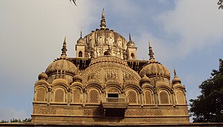
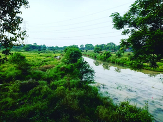
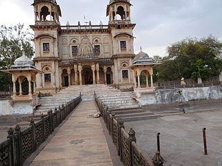
Lalitpur is a city and a municipal board in Lalitpur District, India in the Indian state of Uttar Pradesh. It is also district headquarters of Lalitpur district. The city is part of Bundelkhand region.

Orchha is a town, near city of Niwari in Niwari district of Madhya Pradesh state, India. The town was established by a Bundela rajput ruler Rudra Pratap Singh some time after 1501, as the seat of an eponymous former princely state of covering parts of central & north India, in the Bundelkhand region. Orchha lies on the Betwa River, 80 km from Tikamgarh & 15 km from Jhansi in Uttar Pradesh.

Chhatarpur is a city and a municipality in Chhatarpur district in the state of Madhya Pradesh, India. It is the administrative headquarters of Chhatarpur District. Chhatarpur is a city and a municipality in Chhatarpur district in the state of Madhya Pradesh, India. It is the administrative headquarters of Chhatarpur District.
Ashoknagar is a city and a Municipality Council in Ashoknagar District in Madhya Pradesh state of central India. It is the administrative headquarters of Ashoknagar District. Earlier it was part of Guna district. Ashoknagar is well known for its Grain Mandi and "Sharbati Gaihu", a type of wheat. The nearest city Guna 45 km from the city. Ashoknagar was formerly known as Pachar. The railway line passes from the middle of the city. Ashoknagar has a railway station and Two Bus stations. Ashoknagar is connected to the main cities of Madhya Pradesh by road and railway.

Bhind district is a district in the Chambal division of the Indian state of Madhya Pradesh. The town of Bhind is the district headquarters. Bhind District is situated in Chambal region in the northwest of the state. It is bounded by Agra, Etawah, Jalaun and Jhansi districts of Uttar Pradesh state to the north and the east, and the Madhya Pradesh districts of Datia to the south, Gwalior to the southwest, and Morena to the west. The geography of the district is characterised by uneven ravines, plain fertile fields and scanty forests. The total area of the district is 4,459 km2 (1,722 sq mi).

Bhadohi District is a district of Uttar Pradesh state in northern India. The city of Bhadohi is the district headquarters. Bhadohi is one of largest centres of Carpet Industries in India and is worldwide known as 'Carpet City of India'. Carpets of Bhadohi have 'Geographical Indication' tag attached to it. Bhadohi has huge geographical significance and position attached to it due to its location between two culturally important and rich heritage cities of Prayagraj and Varanasi.

Tikamgarh district is one of the 52 districts of Madhya Pradesh state in central India. Tikamgarh town is the district headquarters. The district is part of Sagar Division.

Lalitpur District is one of the districts of Uttar Pradesh state of India. Lalitpur district is a part of Jhansi Division. Lalitpur is the main town and administrative headquarters. The district occupies an area of 5,039 km².

Shivpuri District is a district of Madhya Pradesh state of India. The town of Shivpuri is the district headquarters. National Highway 3 (NH-3) runs through the district.

Jhansi district is one of the districts of Uttar Pradesh state in northern India. The city of Jhansi is the district headquarters. The district is bordered on the north by Jalaun District, to the east by Hamirpur and Mahoba districts, to the south by Tikamgarh District of Madhya Pradesh state, to the southwest by Lalitpur District, which is joined to Jhansi District by a narrow corridor, and on the east by the Datia and Bhind districts of Madhya Pradesh. Population 19,98,603. Lalitpur District, which extends into the hill country to the south, was added to Jhansi District in 1891, and made a separate district again in 1974.
Mauranipur is a town and a municipal board in Jhansi district state of Uttar Pradesh, India. It is located in the Jhansi District. It is the largest tehsils in India by land area. This town was known for textile production, known in ancient times as Madhupuri. Because of its high density of temples, it is known by some locals as Mini-Ayoddhya. Jalvihar Mela and Viman Yatra are the most famous events in Mauranipur. The Kedareshwar temple and the Saprar Dam are located near Mauranipur.

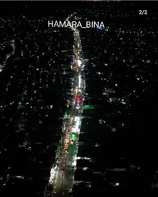
Bina-Etawa, shortened to Bina, is a city in the Bina district in the Indian state of Madhya Pradesh. The name Bina-etawa is derived from the Bina River flowing nearby the city. Four more rivers are flowing through the surrounding area of the city. Motichur, Betwa, Narayani, and Silar. Bina-etawa is an emerging as well as fastest growing city of MP.The Development in City going to be all around in the city as well as outside of City.The city is an important center of economic and industrial activities for the state;a Major Oil Refinery( BPCL Bina Refinery,formerly known as BORL-Bharat Oman Refinery limited) that is located in Bina. This region is known for its high-quality wheat which is exported internationally.

Chitrakoot Dham is a city in the Chitrakoot district, within the state of Uttar Pradesh, India. It is the headquarters of the Chitrakoot district. Situated in the Bundelkhand region, it holds great cultural, historical, religious and archaeological importance and it is said that Lord Rama spent 11 years of exile in Chitrakoot. It is connected to the town of Chitrakoot, situated in the Satna district of Madhya Pradesh.
Garautha is a Tehsil and a Nagar Panchayat city in district of Jhansi, Uttar Pradesh. The Garautha City is divided into 10 wards for which elections are held every 5 years. Garautha is 80 and 36 km away from Jhansi and Tahrauli. There is also tehseel headquarter. There are some religious places near Garautha as Jharkhand dham,Hanuman mandir,lathator dham ashram.
Gursarai is a city and municipal board in the Jhansi district of the Indian state of Uttar Pradesh. Gursarai is situated in the Garautha Tehsil. An emerging city in Jhansi District With having an old and established market, it's a lifeline for the nearby village people who come and sell their farm produces.
Karera is a municipality or Nagar Parishad in the Shivpuri district of the Indian state of Madhya Pradesh.
Talbehat is a nagar panchayat city in Lalitpur district in the Indian state of Uttar Pradesh.
Rath is a small town with a municipal board in Hamirpur district in the Indian state of Uttar Pradesh. Rath is a Tehsil of Hamirpur District. It is situated 506 km southeast of New Delhi.
Kumai is a village in Kumai Bhadon Panchayat in Gaurabauram Block of Darbhanga district in the Indian state of Bihar.
Fatehpur Gayand is a village situated in Shahabad sub district of District Hardoi, Uttar Pradesh. Population of the village is lump som 8000. Fatehpur Gayand is a Gram Panchayat and Nyay Panchayat under Todarpur Block of District Hardoi.


