
The Edwin B. Forsythe National Wildlife Refuge is a U.S. National Wildlife Refuge located in southern and south-central New Jersey, along the Atlantic coast, north of Atlantic City, in Atlantic and Ocean counties. The refuge was created in 1984 out of two existing refuge parcels created to protect tidal wetland and shallow bay habitat for migratory water birds. The Barnegat Division is located in Ocean County on the inland side of Barnegat Bay. The Brigantine Division is located approximately 10 miles (16 km) north of Atlantic City along the south bank of the mouth of the Mullica River. The two divisions are separated by approximately 20 miles (32 km). The refuge is located along most active flight paths of the Atlantic Flyway, making it an important link in the network of national wildlife refuges administered nationwide by the U.S. Fish and Wildlife Service. Forsythe Refuge is a part of the Hudson River/New York Bight Ecosystem and The New Jersey Coastal Heritage Trail Route. The refuge is named for Edwin B. Forsythe, conservationist Congressman from New Jersey. The refuge was named as a Ramsar Site of international importance in 1986.
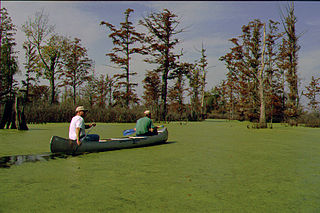
The Cache River is a 92-mile-long (148 km) waterway in southernmost Illinois, in a region sometimes called Little Egypt. The basin spans 737 square miles (1,910 km2) and six counties: Alexander, Johnson, Massac, Pope, Pulaski, and Union. Located at the convergence of four major physiographic regions, the river is part of the largest complex of wetlands in Illinois. The Cache River Wetlands is America's northernmost cypress/tupelo swamp and harbors 91 percent of the state's high quality swamp and wetland communities. It provides habitat for more than 100 threatened and endangered species in Illinois. In 1996, the Cache was designated a Wetland of International Importance under the Ramsar Convention.
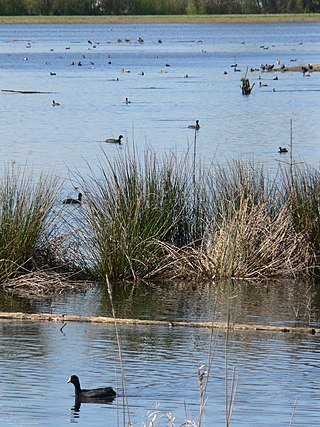
Ankeny National Wildlife Refuge is located in the fertile Willamette Valley of northwestern Oregon, 12 miles (19 km) south of Salem. The valley was once a rich mix of wildlife habitats. Valley wetlands were once extensive, with meandering stream channels and vast seasonal marshes. Today, the valley is a mix of farmland and growing cities, with few areas remaining for wildlife.

Baskett Slough National Wildlife Refuge is in northwestern Oregon, 10 miles (16 km) west of Salem in Polk County. The Refuge consists of 1,173 acres (4.75 km2) of cropland, which provide forage for wintering geese, 300 acres (1.2 km2) of forests, 550 acres (2.2 km2) of grasslands, and 500 acres (2.0 km2) of shallow water seasonal wetlands and 35 acres (0.14 km2) of permanent open water. In 1965, Baskett Slough National Wildlife Refuge was created to help ensure some of the original habitat remained for species preservation. The refuge is managed by the U.S. Fish and Wildlife Service, an agency of the U.S. Department of the Interior.

Sherburne National Wildlife Refuge is a National Wildlife Refuge of the United States in Sherburne County, Minnesota. The 30,700-acre (124 km2) refuge protects mixed habitat types including oak savanna, Big Woods, and wetlands. The St. Francis River flows through the eastern side of the park. Over 230 species of birds, 58 species of mammals, and 25 species of reptiles and amphibians have been recorded in the refuge.

Elkhorn Slough is a 7-mile-long (11 km) tidal slough and estuary on Monterey Bay in Monterey County, California. It is California's second largest estuary and the United States' first estuarine sanctuary. The community of Moss Landing and the Moss Landing Power Plant are located at the mouth of the slough on the bay.
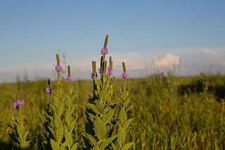
Glacial Ridge National Wildlife Refuge was created on October 12, 2004, the 545th National Wildlife Refuge in the United States. Its creation was the result of cooperation between at least 30 agencies or governmental entities. The creation of the refuge was spearheaded by The Nature Conservancy, and the initial endowment of 2,300 acres (9.3 km2) of land was donated by the Conservancy. In light of its planned final size of 37,756 acres (153 km2), it is described by the US Fish and Wildlife Service as "the largest tallgrass prairie and wetland restoration project in U.S. history."

The Boggs Lake Ecological Reserve is a nature reserve in Lake County, California. The land area is about one quarter of a square mile and contains a large vernal pool as well as endangered plants such as the Boggs Lake hedge-hyssop.
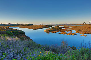
San Elijo Lagoon Ecological Reserve is one of the largest remaining coastal wetlands in San Diego County, California, United States.
The North American Wetlands Conservation Act signed into law by President George H. W. Bush on December 13, 1989 authorizes a wetlands habitat program, administered by the United States Fish and Wildlife Service, which provides grants to protect and manage wetland habitats for migratory birds and other wetland wildlife in the United States, Mexico, and Canada. A nine-member council meets periodically to decide which projects to fund.

Ottawa National Wildlife Refuge is a National Wildlife Refuge of the United States, which is located in the state of Ohio. This refuge was established in 1961, under the Migratory Bird Conservation Act, the purpose of the refuge being created was “… for use as an inviolate sanctuary, or for any other management purpose, for migratory birds.” 16 U.S.C. 715d. This refuge provides ideal habitat for a wide range for migratory birds and waterfowl, along with the native wildlife, and any endangered and threatened species. The property of the refuge was purchased from hunt clubs and farmlands with the Federal Duck Stamps.
The John H. Chafee National Wildlife Refuge is a national wildlife refuge of the United States, located along the Narrow River on the southern coast of Rhode Island.
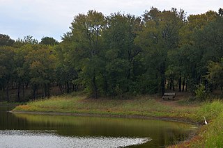
Hagerman National Wildlife Refuge (HNWR), a haven for migratory birds and other wildlife, lies in northwestern Grayson County, Texas, on the Big Mineral Arm of Lake Texoma, on the Red River between Oklahoma and Texas. This National Wildlife Refuge is made up of water, marsh, and upland habitat. Visitors can hike, observe wildlife, hunt, and fish throughout the year.
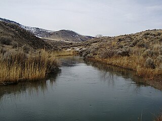
The Ana River is a short spring-fed river in south-central Oregon. It is on the northwestern edge of the Great Basin drainage. It flows 7 miles (11 km) from springs at the foot of Winter Ridge through high desert, range, and wetlands before emptying into Summer Lake. For most of its course, the Ana River flows through the Summer Lake Wildlife Area, which is maintained by the Oregon Department of Fish and Wildlife. The river provides habitat for many mammal and bird species, as well as several fish species, including the rare Summer Lake Tui chub. The largest hybrid striped bass ever caught in Oregon was taken from Ana Reservoir in 2009.

The Summer Lake Wildlife Area is a 29.6-square-mile (77 km2) wildlife refuge located on the northwestern edge of the Great Basin drainage in south-central Oregon. It is administered by the Oregon Department of Fish and Wildlife. The refuge is an important stop for waterfowl traveling along the Pacific Flyway during their spring and fall migrations. The Summer Lake Wildlife Area also provides habitat for shorebirds and other bird species as well as wide variety of mammals and several fish species. The Ana River supplies the water for the refuge wetlands.

Camas Prairie Centennial Marsh Wildlife Management Area at 3,100 acres (13 km2) is an Idaho wildlife management area in Camas County south of the community of Hill City. The WMA is at the base of the Bennett Hills on the Camas Prairie south of the Soldier Mountains and Sawtooth National Forest. The Idaho Department of Fish and Game acquired the land in 1987 with the help of Ducks Unlimited and The Nature Conservancy to provide quality wetland and upland habitat for migratory and resident wildlife.

The Scatter Creek Wildlife Area is a multi-unit protected area and wildlife reserve in southern Thurston County, Washington. Covering seven units, the area is owned and managed by the Washington Department of Fish and Wildlife (WDFW).

Mattaponi Wildlife Management Area is a 2,542-acre (10.29 km2) Wildlife Management Area (WMA) in Caroline County, Virginia. Located west of Bowling Green, the area protects a mixture of wetlands and upland forests at the confluence of the Mattaponi and South rivers.

The San Francisco Bay Salt Ponds are a roughly 16,500-acre (6,700 ha) part of the San Francisco Bay that have been used as salt evaporation ponds since the California Gold Rush era. Most of the ponds were once wetlands in the cities of Redwood City, Newark, and Hayward, and other parts of the bay.
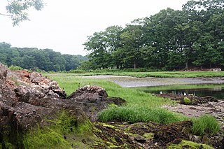
Marshlands Conservancy is a 147-acre nature preserve in the city of Rye, New York, fully owned and operated by Westchester County Parks. It has numerous wildlife habitats, ranging from ponds to creeks to a large meadow area, succession forest, freshwater wetlands, and the only extensive salt marsh in Westchester. It borders Long Island Sound and can be entered via an easement on the historic Boston Post Road. It is one of 5 properties that together constitute the Boston Post Road Historic District. It has high archaeological sensitivity. The conservancy has also been designated an Important Bird Area.


