Related Research Articles

County Down is one of the six counties of Northern Ireland, one of the nine counties of Ulster and one of the traditional thirty-two counties of Ireland. It covers an area of 961 sq mi (2,490 km2) and has a population of 552,261. It borders County Antrim to the north, the Irish Sea to the east, County Armagh to the west, and County Louth across Carlingford Lough to the southwest.

Castle Espie is a wetland reserve managed by the Wildfowl and Wetlands Trust (WWT) on the banks of Strangford Lough, three miles south of Comber, County Down, Northern Ireland, in the townland of the same name. It is part of the Strangford Lough Ramsar Site. It provides an early wintering site for almost the entire Nearctic population of pale-bellied brent geese. The Castle which gave the reserve its name no longer exists.
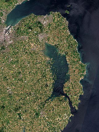
Strangford Lough is a large sea lough or inlet in County Down, in the east of Northern Ireland. It is the largest inlet in Ireland and the wider British Isles, covering 150 km2 (58 sq mi). The lough is almost fully enclosed by the Ards Peninsula and is linked to the Irish Sea by a long narrow channel at its southeastern edge. The main body of the lough has at least seventy islands along with many islets (pladdies), bays, coves, headlands and mudflats. It is part of the Strangford and Lecale Area of Outstanding Natural Beauty. Strangford Lough was designated as Northern Ireland's first Marine Conservation Zone in 2013, and has been designated a Special Area of Conservation for its important wildlife.

Portaferry is a small town in County Down, Northern Ireland, at the southern end of the Ards Peninsula, near the Narrows at the entrance to Strangford Lough. It is home to the Exploris aquarium and is well known for the annual Gala Week Float Parade. It hosts its own small Marina, the Portaferry Marina. The Portaferry – Strangford Ferry service operates daily at 30-minute intervals between the villages of Portaferry and Strangford, less than 1500 metres apart, conveying about 500,000 passengers per annum. It had a population of 2,514 people in the 2011 Census. The town is located within the Barony of Ards Upper.

Killyleagh is a village and civil parish in County Down, Northern Ireland. It is on the A22 road between Belfast and Downpatrick, on the western side of Strangford Lough. It had a population of 2,787 people in the 2021 Census. It is best known for its twelfth century Killyleagh Castle. Killyleagh lies within the Newry, Mourne and Down district.

The Quoile is a river in County Down, Northern Ireland.

Belfast Lough is a large, intertidal sea inlet on the east coast of Northern Ireland. At its head is the city and port of Belfast, which sits at the mouth of the River Lagan. The lough opens into the North Channel and connects Belfast to the Irish Sea.

Ardglass Marina, also known as Phennick Cove Marina, is situated in Ardglass, County Down, one of three major fishing ports in Northern Ireland. Ardglass is now one of the safest small harbours on the east coast of Ireland, following improvements made in recent years.

Clough is a village and townland in County Down, Northern Ireland. It sits about 3 miles from Dundrum on the A2 between Newcastle and Belfast. The A2 continues via Downpatrick and the coast via Strangford and the Portaferry – Strangford Ferry to Portaferry to Belfast, whilst most road traffic heads along from Clough along the A24 via Carryduff to Belfast. It had a population of 255 people in the 2001 census. Clough is situated within the Newry, Mourne and Down area.

Saul is a village in County Down, Northern Ireland, within the civil parish of Saul and Ballee.

Quoile Castle is a castle situated 1.5 miles (2.4km) from Downpatrick, County Down, Northern Ireland, just off the main road from Downpatrick to Strangford, on the east bank of the River Quoile. The castle was built during the late 16th / early 17th Century and was continuously used up to the 1700s. It has been suggested that it was built by Captain Richard West. Quoile Castle is a State Care Historic Monument in the townland of Quoile, in Down District Council area, at grid ref: J4963 4701.

Whiterock is a small village in County Down, Northern Ireland. It is within the townland of Killinakin, in the civil parish of Killinchy and historic barony of Dufferin, on the western shore of Strangford Lough, near to the village of Killinchy. It is in the Ards and North Down Borough. It had a population of 355 people in the 2011 Census.

A tide mill is a water mill driven by tidal rise and fall. A dam with a sluice is created across a suitable tidal inlet, or a section of river estuary is made into a reservoir. As the tide comes in, it enters the mill pond through a one-way gate, and this gate closes automatically when the tide begins to fall. When the tide is low enough, the stored water can be released to turn a water wheel.
Campbell Douglas Deane O.B.E., M.Sc., F.L.S. was an Irish ornithologist. His father Arthur Deane M.R.I A., F.R.S.E, a botanist, was curator of the then Belfast Museum and Art Gallery from 1905-1942. C.D. Deane, known as Jimmy, was educated at Methodist College Belfast. He joined the museum in 1932, was promoted to Keeper of Natural History in 1950 and was from 1957 Deputy Director and the Keeper of Natural Science in the, by then, Ulster Museum. He served in the Royal Air Force in Peterborough and in the Royal Flying Corps Canada during the Second World War.

Nendrum Monastery was a Christian monastery on Mahee Island in Strangford Lough, County Down, Northern Ireland. Medieval records say it was founded in the 5th century, but this is uncertain. The monastery came to an end at some time between 974 and 1178, but its church served a parish until the site was abandoned in the 15th century. Some remains of the monastery can still be seen.

Ringhaddy is a townland on the shores of Strangford Lough, County Down, Northern Ireland, 5 km south of Whiterock. It is in the civil parish of Killinchy and the historic barony of Dufferin.

Lecale is a peninsula in the east of County Down, Northern Ireland. It lies between Strangford Lough and Dundrum Bay. In the Middle Ages it was a district or túath in the Gaelic Irish kingdom of Ulaid, then became a county in the Anglo-Norman Earldom of Ulster. Later it became a barony, which was split into Lecale Lower and Lecale Upper by 1851. Its largest settlement is the town of Downpatrick. Other settlements include Ardglass, Killough and Strangford. The peninsula has a high concentration of tower houses. Much of it is part of the 'Strangford and Lecale' Area of Outstanding Natural Beauty.
Oxford Island is a National Nature Reserve and public recreation site on the southern shores of Lough Neagh at Lurgan, County Armagh. The site covers 282 acres and is owned and maintained by Armagh City, Banbridge and Craigavon Borough Council. Much of the area is designated as a National Nature Reserve due to its wide variety of natural habitats. The purpose of all work on the island is to maintain biodiversity and to provide a recreation area for everyone.

Mahee Castle, also known as Nendrum Castle, is a small ruined tower house near Nendrum Monastery on Mahee Island in Strangford Lough, County Down, Northern Ireland. It was built in 1570 by Captain Thomas Browne. It was abandoned by the early 17th century, and fell into disrepair. In 1923, H.C. Lawlor and the Belfast Natural History and Philosophical Society partly renovated the tower house to avoid further erosion and built a buttress wall to support the northwest corner of the tower.
References
- ↑ "Gores Island". Google Maps. Retrieved 6 March 2020.
- ↑ John Falconer (1869). The Irish Law Times and Solicitors' Journal. Vol. 3. p. 168.
- ↑ "In pictures: Strangford Lough". BBC News. p. Image 8. Archived from the original on 2 February 2012.
- 1 2 "An Island Camp". Belfast News-Letter. 12 July 1848. p. 6.
- ↑ Angélique Day; Patrick McWilliams (1992). Parishes of County Down IV, 1833-7: East Down and Lecale. Institute of Irish Studies. p. 111. ISBN 9780853894391.
- ↑ "Destination Strangford Lough Cano" (PDF). Visit Strangford Lough. Sketrick to Salt Island.
- ↑ Calendars of Wills (PDF). p. 411. Retrieved 6 March 2020.
{{cite book}}:|work=ignored (help) - ↑ "County Down Longevity". Irish News and Belfast Morning News. 10 May 1910. p. 3.
- ↑ "Malone Training School Camp". Northern Whig. 29 June 1957. p. 3.
- ↑ "Borstal Girl Recaptured in Belfast". Northern Whig. 9 August 1957. p. 1.
- ↑ "THE FAMOUS GORE's ISLAND RACE" (PDF). Quoile Yacht Club.
- ↑ Roger L H Dennis; Peter B Hardy (2018). British and Irish Butterflies: An Island Perspective. CABI. p. 275. ISBN 9781786395061.