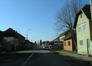
Šamac, formerly Bosanski Šamac is a town and municipality located in the northeastern part of Republika Srpska, an entity of Bosnia and Herzegovina. There are also small, uninhabited, parts located in Odžak municipality and in Domaljevac-Šamac municipality, Federation of Bosnia and Herzegovina.

The Serbian Autonomous Oblast of Bosanska Krajina was a self-proclaimed Serbian Autonomous Oblast within today's Bosnia and Herzegovina. It was sometimes called the Autonomous Oblast of Krajina, or the Autonomous Region of Krajina (ARK). SAO Bosanska Krajina was located in the geographical region named Bosanska Krajina. Its capital was Banja Luka. The region was subsequently included into Republika Srpska.

The SAO of Herzegovina was a self-proclaimed Serbian Autonomous Oblast within today's Bosnia and Herzegovina. It was proclaimed by the Assembly of the Association of Municipalities of Bosnian Krajina in 1991 and was subsequently included into Republika Srpska. SAO Herzegovina was located in the geographical region of Herzegovina. It was also known as SAO Eastern Herzegovina.

Prozor-Rama is a municipality located in Herzegovina-Neretva Canton of the Federation of Bosnia and Herzegovina, an entity of Bosnia and Herzegovina. Its seat is Prozor. Also, Ramsko lake is located in the municipality.

This article is about the Demographic history of Bosnia and Herzegovina, and deals with the country's documented demographics over time. For an overview of the various ethnic groups and their historical development, see Ethnic groups in Bosnia and Herzegovina.

Kostajnica is a town and municipality located in northern Republika Srpska, an entity of Bosnia and Herzegovina. It is situated in the part of the Кrajina region. As of 2013, it had a population of 5,977 inhabitants, while the town of Kostajnica has a population of 4,047 inhabitants.

Čelić is a town and municipality located in Tuzla Canton of the Federation of Bosnia and Herzegovina, an entity of Bosnia and Herzegovina.

Hrvatska Dubica is a village and a municipality in central Croatia in the Sisak-Moslavina County. It is located on the northern bank of the river Una, east of Hrvatska Kostajnica and southwest of Jasenovac and Novska. The town of Bosanska Dubica lies to the south of the municipality, in Bosnia and Herzegovina. Hrvatska Dubica is underdeveloped municipality which is statistically classified as the First Category Area of Special State Concern by the Government of Croatia.
Donja Slabinja is a village in the municipality of Kozarska Dubica, Republika Srpska, Bosnia and Herzegovina.
Vranovina is a village in the municipality of Bosanski Petrovac, Bosnia and Herzegovina.
Bučje is a village in the municipalities of Novo Goražde, Republika Srpska and Goražde, Bosnia and Herzegovina.
Podhomara is a village in the municipalities of Novo Goražde, Republika Srpska and Goražde, Bosnia and Herzegovina.
Podkozara Donja is a village in the municipality of Novo Goražde, Republika Srpska, Bosnia and Herzegovina.
Radijevići is a village in the municipalities of Novo Goražde, Republika Srpska and Goražde, Bosnia and Herzegovina.
Šućurići is a village in the municipalities of Novo Goražde, Republika Srpska and Goražde, Bosnia and Herzegovina.
Žuželo is a village in the municipalities of Novo Goražde, Republika Srpska and Goražde, Bosnia and Herzegovina.
Ćesim is a village in the municipalities of Konjic and Nevesinje, Bosnia and Herzegovina.

Slabinja is a village in the Sisak-Moslavina County in the central part of Croatia. It is in the Una Valley near the border with Bosnia and Herzegovina, 12.6 kilometres (7.8 mi) southeast of the town of Hrvatska Kostajnica, 9.7 kilometres (6 mi) northwest of the village of Hrvatska Dubica, and 106 kilometres (66 mi) southeast of Croatian capital Zagreb, at the south fringe of the Banovina region. Slabinja is a dormitory village with a resident population of just over 250 people.
Slabinja is a toponym used for two villages divided by the state border at the Una river:


