
Karlovac County is a county in central Croatia, with the administrative center in Karlovac.

Brod-Posavina County is the southern Slavonian county in Croatia. Its center is the city of Slavonski Brod and it spreads along the left bank of the Sava river, hence the name Posavina. Other notable towns include Nova Gradiška.

Stara Gradiška is a village and a municipality in Slavonia, in the Brod-Posavina County of Croatia. It is located on the left bank of the river Sava, across Gradiška in Bosnia and Herzegovina. The total population is 1,363, distributed in the following settlements:

Maksimir is one of the districts of Zagreb, Croatia, population 48,902. Maksimir stadium and Maksimir Park are located in it. It was named for Bishop Maksimilijan Vrhovac.
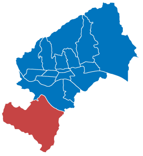
Brezovica is a city district of Zagreb, Croatia. It is located in the southwestern part of the city and has 12,030 inhabitants. It is one of the more rural districts in Zagreb. The A1 highway passes through Brezovica, although it has no exits there.
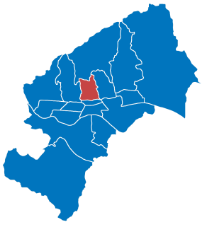
Gornji Grad–Medveščak is one of the districts of Zagreb, Croatia; "Gornji Grad" translates as "upper town", referring to its historical location on city's hillside, being above Donji grad. The district is located in the central part of the city and, according to the 2011 census, it has 30,962 inhabitants spread over 10.12 km2 (3.91 sq mi).

Sesvete is the easternmost city district of Zagreb, Croatia. With a population of 70,009 it is the most populated district as well as the second largest by area (165.255 km2).

Podsused – Vrapče is one of the districts of Zagreb, Croatia. It is located in the north-western part of the city. In 2011, the district had 45,759 inhabitants. Its area is 36.188 km2.
Majur is a settlement and a municipality in central Croatia in the Sisak-Moslavina County. It has a population of 1,185, 70.04% of whom are Croats and 27.26% are ethnic Serbs.
Dubrava is a village and a municipality ("općina") in Zagreb County, Croatia.
Žumberak is a village and a municipality in Croatia in the Zagreb County. According to the 2011 census, there are 883 inhabitants, 98% of which are Croats. Žumberak municipality covers an area of 110 km2 (42 sq mi).
Garešnica is a town and municipality in Bjelovar-Bilogora County, Croatia. It is part of Moslavina. There are a total of 10,472 inhabitants, of whom 85% are Croats.
Sirač is a settlement and municipality in Bjelovar-Bilogora County, Croatia. There are 2,218 inhabitants; 73% are Croats, 14% Serbs, and 11% Czechs. The following settlements make up the municipality: Barica, Bijela, Donji Borki, Gornji Borki, Kip, Miljanovac, Pakrani, Sirač, Šibovac.
Gornji Bogićevci is a municipality in Brod-Posavina County, Croatia. There are 1,975 inhabitants of which 89% declare themselves Croats.
Nova Kapela is a municipality in Brod-Posavina County, Croatia. There are 4,227 inhabitants in the following settlements:
Barilović is a village and a municipality in central Croatia, in the Karlovac County.

Gornji Mihaljevec is a municipality in Međimurje County, Croatia. There are 1,917 inhabitants, an absolute majority of whom are Croats.

Selnica is a municipality in Međimurje County, Croatia. There are 2,991 inhabitants, absolute majority who are Croats.
Donji Hrastovac is a village in Croatia. It is connected by the D224 highway.
Gornji Desinec is a settlement in the Jastrebarsko administrative area of Zagreb County, Croatia. As of 2011 it had a population of 651.

