Cisownica is a village in Gmina Goleszów, Cieszyn County, Silesian Voivodeship, southern Poland, close to the border with the Czech Republic. In 2008 it had a population of 1,705. It lies in the historical region of Cieszyn Silesia on the slopes of Mała Czantoria mountain.

Dzięgielów is a village in Gmina Goleszów, Cieszyn County, Silesian Voivodeship, southern Poland, near the border with the Czech Republic. It lies in the Silesian Foothills and in the historical region of Cieszyn Silesia.

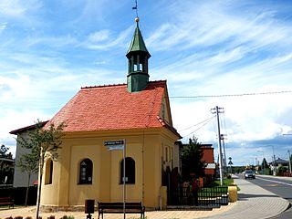
Pogórze is a village in Gmina Skoczów, Cieszyn County, Silesian Voivodeship, southern Poland. It lies in the historical region of Cieszyn Silesia.
Iłownica is a village in Gmina Jasienica, Bielsko County, Silesian Voivodeship, southern Poland.
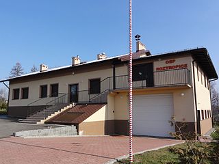
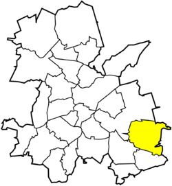
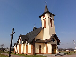
Roztropice is a village in Gmina Jasienica, Bielsko County, Silesian Voivodeship, southern Poland. It lies in the Silesian Foothills and in the historical region of Cieszyn Silesia.

Golasowice is a village in the administrative district of Gmina Pawłowice, within Pszczyna County, Silesian Voivodeship, in southern Poland. It lies approximately 5 kilometres (3 mi) south-west of Pawłowice, 20 km (12 mi) west of Pszczyna, and 43 km (27 mi) south-west of the regional capital Katowice.

Krzyżowice is a village in the administrative district of Gmina Pawłowice, within Pszczyna County, Silesian Voivodeship, in southern Poland. It lies approximately 5 kilometres (3 mi) north-west of Pawłowice, 20 km (12 mi) west of Pszczyna, and 38 km (24 mi) south-west of the regional capital Katowice.
Warszowice is a village in the administrative district of Gmina Pawłowice, within Pszczyna County, Silesian Voivodeship, in southern Poland. It lies approximately 17 kilometres (11 mi) west of Pszczyna and 35 km (22 mi) south-west of the regional capital Katowice.

Ruptawa is a sołectwo in the south of Jastrzębie-Zdrój, Silesian Voivodeship, southern Poland. It was an independent village but became administratively part of Jastrzębie-Zdrój in 1975.

Szeroka is a sołectwo of Jastrzębie-Zdrój, Silesian Voivodeship, southern Poland. It was an independent village but became administratively part of Jastrzębie-Zdrój in 1975. It has na area of 1026.64 ha and on December 31, 2012 it had 2,325 inhabitants.

Borynia is a sołectwo in the northern part of Jastrzębie-Zdrój, Silesian Voivodeship, southern Poland. It was an independent village but became administratively part of Jastrzębie-Zdrój in 1975. It has na area of 822.92 ha and on December 31, 2012 it had 1,909 inhabitants.
Skrzeczkowice is a sołectwo in the northern part Jastrzębie-Zdrój, Silesian Voivodeship, southern Poland. It was an independent village but became administratively part of Jastrzębie-Zdrój in 1975. It has na area of 248,84 ha and on December 31, 2012 it had 728 inhabitants.

Bzie is a sołectwo in the south-east of Jastrzębie-Zdrój, Silesian Voivodeship, southern Poland. It was an independent village but became administratively part of Jastrzębie-Zdrój in 1975.

Chwałowice is a district of Rybnik, Silesian Voivodeship, southern Poland. On December 31, 2013 it had 7,700 inhabitants.

Boguszowice Stare is a district of Rybnik, Silesian Voivodeship, southern Poland. In the late 2013 it had about 7,700 inhabitants.

Kłokocin is a district of Rybnik, Silesian Voivodeship, southern Poland. In the late 2013 it had about 2,550 inhabitants.
Rowień-Folwarki is a district in the north-west of Żory, Silesian Voivodeship, southern Poland. It has an area of 6.1884 km2 and in January, 2013 had 1,927 inhabitants.

Rój is a district in the south-west of Żory, Silesian Voivodeship, southern Poland.

Rogoźna is a district in the south-west of Żory, Silesian Voivodeship, southern Poland, built near the provincinal road no. 932

Ruda is a district in the north-west of Ruda Śląska, Silesian Voivodeship, southern Poland. It has an area of 11.9 km2 and in 2006 it was inhabited by 23,134 people.