Kolar district is a district in the state of Karnataka, India.

Madanapalle is the largest city in Annamayya district and Rajampet Lok Sabha constituency of the Indian state of Andhra Pradesh. It is a Selection Grade Municipal City Council. Madanapalle is headquarters of Madanapalle Mandal,Madanapalle revenue division and PKM Urban Development Authority.

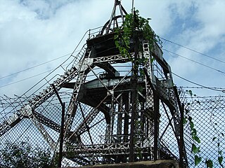
Kolar Gold Fields (K.G.F.) is a mining region in K.G.F. taluk (township), Kolar district, Karnataka, India. It is headquartered in Robertsonpet, where employees of Bharat Gold Mines Limited (BGML) and BEML Limited and their families live. K.G.F. is about 30 kilometres (19 mi) from Kolar, 100 kilometres (62 mi) from Bengaluru, capital of Karnataka. Over a century, the town has been known for gold mining. The mine closed on 28 February 2001 due to a fall in gold prices, despite gold still being present there. One of India's first power-generation units was built in 1889 to support mining operations. The mine complex hosted some particle physics experiments between the 1960s and 1992.

Hulkuru or Guttahalli is a small village in the Kolar Gold Fields Taluk of Kolar district in Karnataka, India. It is situated about 15 kilometers from Kolar Gold Fields.

Budikote or Budhikote is a village situated in Bangarapet taluk of Kolar district in the Indian state of Karnataka. It is located about 15 mi (24 km) from the district headquarters Kolar Gold Fields, the nearest city; Bangarpet the nearest town is 12 km (7.5 mi) away and Bangalore is 125 km (78 mi). It is a gram panchayat and covers an area of 355.65 ha. According to the 2011 census data, Budikote village has a population of 3,347—of which 1,743 are male and 1,604 are female—and a household count of 600.

Bethamangala is a small town in the Kolar Gold Field taluk of Kolar district in the state of Karnataka, India. The town is centred around a large man-made lake created by damming the Palar river. The lake supplies drinking water to the nearby mining city of Kolar Gold Fields ("KGF"). The Bethamangala water works was established in 1903-04 and is a popular tourist site.
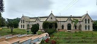
King George Hall is the town hall of the city of Kolar Gold Fields in India. It is situated in the centre of Robertsonpet and was built in honour of the then emperor of India, King George. It is built in the Victorian style with a lawn and garden in front of it.

Vaniyambadi is a town in the Tirupattur district of Tamil Nadu and the headquarter for the Vaniyambadi Revenue district comprising Vaniyambadi and Ambur. It is located about 200 km from Chennai and 178 kilometer from Bengaluru. The Vaniyambadi Municipality was formed by the G.O. MS. No. 421 Local & Municipality Dept. in April 1886. In 1996 this Municipality was upgraded to Grade II Municipality by G.O. MS. NO. 118 Rural Development Local Administration Dept. dated 01.05.1996. In 1998 this Municipality was upgraded to 1st Grade.

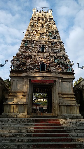
Kolar or Kolara is a city in the Indian state of Karnataka. It is the headquarters of Kolar district. The city is known for its milk production and gold mines. It is also known for Someshwara temple and Kolaramma temple.

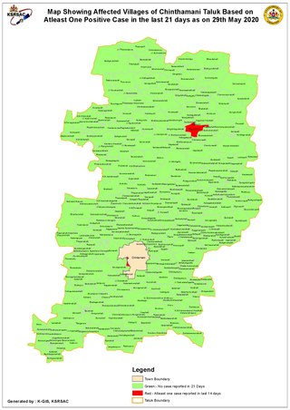
Chintamani is a Taluk Headquarters in the Indian state of Karnataka. Located on the Deccan Plateau in the south-eastern part of Karnataka. Chintamani is one of the well planned and developed Towns in the District of Kolar and presently Chikkaballapur. Chintamani is known for its silk and tomato production and their largest markets in Karnataka.

Srinivaspur is a town located in the Kolar district of Karnataka state, India. The latitude 13.33 and longitude 78.22 are the geocoordinate of the Srinivaspur. Bengaluru is the nearby state capital for Srinivaspur town. It is located around 106 km away from Bengaluru and 80 km from BIAL. The other surrounding state capitals are Chennai 225.9 km., Pondicherry 233.2 km., Hyderabad 453.4 km.,

Bangalore University (BU) is a public state university located in Bangalore, Karnataka, India. The university is a part of the Association of Indian Universities (AIU), Association of Commonwealth Universities (ACU) and affiliated by University Grants Commission (UGC). Bangalore University is accredited by the NAAC with grade A++ in 2023 under the new grading system. Bangalore University was trifurcated into Bengaluru City University and Bengaluru North University.

Samaritan Residential School is a co-educational boarding school in Elagiri Hills, Tamil Nadu, South India, providing education for students from all over India, Nepal and several other countries from around the world. The school is promoted and run by the Samaritan Educational Trust, Chennai. The management of the school consists of the Founder-Correspondent of the SBOA Schools of Chennai and other eminent educational consultants.
Aalamaram is located in the mining city of Kolar Gold Fields. The surrounding residential places include Palar Nagar, Bharath Nagar, HP Nagar, Hanumantha Nagar, MV Nagar, and Officer's Quarters.
Kuruburu is a village in Chintamani Taluk in the Chikballapur district in the state of Karnataka, India.

Tayalur is a panchayat village in the southern state of Karnataka, India. It is located in the Mulbagal Taluka of Kolar district in Karnataka.
Lavelle Road is an upmarket residential and commercial street in the city of Bangalore, Karnataka in India. It is an important connection between Mahatma Gandhi Square and Richmond Circle. The road starts from the Queens Road end of the M. Chinnaswamy Stadium and after curving in a serpentine manner meets the junction of Bangalore Club with Richmond Circle. Lavelle Road was named after Michael F Lavelle, an Irish soldier who later made his money in the Kolar Gold Fields.

Coromandel is a mining area in Kolar Gold Fields(KGF), Karnataka, India. Where major mining units are located.

Kolar Gold Fields Assembly constituency is one of the constituencies in Karnataka Legislative Assembly in India. It is a segment of Kolar Lok Sabha constituency.


