
Baramulla district or Varmul is one of the 20 districts in the Indian-administered union territory of Jammu and Kashmir in the disputed Kashmir region. Baramulla town is the administrative headquarters of this district. The district covered an area of 4,588 km2 (1,771 sq mi) in 2001, but it was reduced to 4,243 km2 (1,638 sq mi) at the time of 2011 census. In 2016, the district administration said that the area was 4,190 km2 (1,620 sq mi). Muslims constitute about 98% of the population.

Baramulla, also known as Varmul in Kashmiri, is a City and municipality of the Baramulla district of the Indian-administered Jammu and Kashmir in the disputed Kashmir region. It is also the administrative headquarters of the Baramulla district, located on the banks of the River Jhelum downstream from Srinagar, the summer capital of Jammu and Kashmir. The town was earlier known as gateway of Kashmir, serving as the major distribution centre for goods arriving in Kashmir valley through the Jhelum valley cart road.
Sopore or Sopur, known as Suyyapura in antiquity, is a city in the Baramulla district of Jammu and Kashmir, India. It is 45 km (28 mi) north-west of Srinagar, and 16 km (10 mi) north-east from the city of Baramulla.
Kupwara is a city, District headquarter and a municipal council in Kupwara district in the Indian union territory of Jammu and Kashmir.
Magam is a tehsil in central Kashmir's Beerwah sub-district. It is also a town, notified area committee, and a block in Budgam district in the Indian administered union territory of Jammu and Kashmir. It is 11 km (6.8 mi) away from sub-district headquarter Beerwah and 20 km (12 mi) away from Srinagar, the summer capital of Jammu and Kashmir. Magam is the top business hub in this locality, located on the way to Gulmarg. Magam comes both in baramulla district and budgam which makes this famous across these districts for business. The Idara Abu Fazal Abbas Islamic Library, opened in Magam in 1985, is the largest Islamic private library in Jammu and Kashmir.
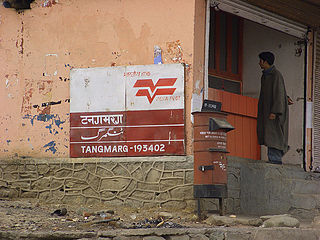
Tangmarg is a town and tehsil in Baramulla district in Indian union territory of Jammu and Kashmir. In 2014, Tangmarg was granted a sub division and trifurcated into three Tehsils, with Sub Divisional Magistrate SDM Office located at Tangmarg. The Tangmarg town is central to more than 100 villages in the vicinity. Tangmarg is gateway of gulmarg which is just 13kms away, also drung waterfall is 3kms away which makes tangmarg most crowded place in the evening due to clean & fresh environment.

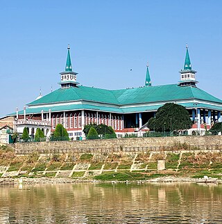
The University of Kashmir (UoK), informally known as Kashmir University (KU), is a collegiate public state university located on the western side of Dal Lake in the city of Srinagar in Jammu and Kashmir which was established in 1948. The main campus of the university is divided into three parts; Hazratbal Campus, Naseem Bagh Campus, and Mirza Bagh Campus.

Government Degree CollegeSopore is an educational institution located in the town of Sopore in the Baramulla District of Jammu and Kashmir, India. The college was established in 1951 to provide higher education to the students of the area. It is one of the oldest institutes in the valley of Kashmir and is National Assessment and Accreditation Council (NAAC) accredited. In its third cycle of NAAC assessment, the college was awarded grade A, for the first time in its history, after a NAAC peer team visit took place on May 10-11, 2023.
Durhama is a small village in Baramulla district in the Indian union territory of Jammu and Kashmir. It is about 20 km from district headquarters Baramulla, 13 km from the apple town Sopore and 50 km from Batmaloo, Srinagar via Putukhah- Wagoora road and 44 km via Tapper-Kreeri road. It is about 100m away from the Tehsil headquarter Wagoora and about 3.5 km from the medical block Kreeri. It is situated on the left side of the link road which connects Baramulla and Babareshi-Gulmarg. The village has three mosques and 95 households. The population of Durhama is about 698. There is a primary and a middle school in the outskirts of the village. The literacy rate of Durhama is about 67.37% as per 2011 census. A building of the block development office Wagoora is located at the entrance of Durhama. A medical sub centre is also located alongside B.D.O. office.
Achabal is the village in Baramulla district, Jammu and Kashmir |Jammu and Kashmir. It is around 5 km (3.1 mi) away from Sopore town. The village is surrounded by the villages of like Lorihama, Alsafa Colony, Ladoora and Ferozpora. This village is accessible by the National Highway from Ferozpora-Achabal link road which connects it to Handwara, Kupwara and other northern regions of Kashmir. It is also accessible by Ladoora-Sopore road. There is a branch of Jammu & Kashmir Bank in the main market.
Rafiabad is a Tehsil town in Baramulla of Jammu and Kashmir, India. The tehsil headquarters is Rafiabad town. It is located to the west of Baramulla, about 12 km from district headquarters, and 70 km from the state capital Srinagar to the east. The headquarter of Rafiabad Assembly Constituency is in Watergam.
Ladoora is a notified area and village in the Baramulla district, Jammu and Kashmir, India. It is located on the banks of River Jhelum. It is approximately seven kilometers from Sopore and 8 kilometres from Baramulla. Ladoora has a playground known by the name of Nagbal cricket ground. Ladoora Rafiabad is known for fruit business.There are various essential departments like Flood control and irrigation department,PHE,Fisheries Department,Animal and sheep Husbandry Department etc.Moving to education There are various educational institutions including Middle, High and Higher secondary schools.

Sopore Railway Station is situated in the outskirts of Sopore town. It lies on Northern Railway Network Zone of Indian Railways. It is one of the northernmost station of Indian Railways.
Doabgah is a small village in Baramulla district of Jammu and Kashmir, India. The nearest town is Sopore . The name "Doabgah" literally means "a place with two waters". The village has been named so as two prominent rivers of Kashmir meet here, namely Pohru River and Jhelum River. Doabgah was given backward status in 2012 by the government of Jammu and Kashmir. The village is bestowed with two beautiful rivers, Jhelum River on the southern side and Pohru River along the eastern face. The other neighboring villages of Doabgah are Vijabal on the western side and Achabal, Baramulla on the northern front.
The Government Degree College for Women, Sopore commonly known as Women's College Sopore is a University of Kashmir affiliated autonomous women's degree college located at Sopore in Baramulla district in the Indian union territory of Jammu and Kashmir. The college is affiliated with University of Kashmir and is recognised by University Grants Commission of India under articles 2(f) and 12(B) of UGC Act, 1956.

Hathlangoo previously known as Hashmatpora is a village in the Sopore tehsil of Baramulla district, in the Indian union territory of Jammu and Kashmir. It is located 8 km (5.0 mi) away from sub-district headquarter Sopore and 22 km (14 mi) away from district headquarters Baramulla. It is one of the largest villages in Zaingair. The Hathlangoo village has Janwara Village in the South, Magraypora in the North, Botingoo in the Northwest, Malmapanpora in the West and Wular Lake in the East.

Indian Army operations in Jammu and Kashmir include security operations such as Operation Rakshak, which began in 1990, Operation Sarp Vinash in 2003 and Operation Randori Behak in 2020. Other operations include humanitarian missions such as Operation Megh Rahat and operations with a social aim such as Operation Goodwill and Operation Calm Down. The Indian Army works in tandem with the other arms of the Indian Armed Forces and security forces in Jammu and Kashmir such as during Mission Sahayata or joint operations.

Zaingair is a group of villages in the Sopore constituency of Baramulla district, Jammu and Kashmir. It is the largest area in Sopore. It comprises about 38 villages spread over three tehsils of Sopore.
Lolipora, also known as Lolipur, is a village and a Panchayat Halqa in Pattan tehsil of Baramulla district in the Indian union territory of Jammu and Kashmir. It is located 23 km (14 mi) towards east of district headquarters, Baramulla and 32 km (20 mi) from the summer capital of Jammu and Kashmir, Srinagar. Sopore, Baramulla, Bandipora and Srinagar are the nearby cities to Lolipora.
Drugmulla is a village and tehsil headquarter in Kupwara district of the Indian union territory of Jammu and Kashmir. It is located 5 kilometres from the district headquarters Kupwara.