Castlereagh was a local government district with the status of borough in Northern Ireland. It merged with Lisburn City Council in May 2015 under local government reorganisation in Northern Ireland to become Lisburn and Castlereagh City Council, with a small amount being transferred to Belfast City Council.

Harland & Wolff is a shipyard in Belfast, Northern Ireland. It specialises in ship repair, conversion and offshore construction. Harland & Wolff is famous for having built the majority of the ocean liners for the White Star Line, including Olympic-class trio – RMS Titanic, RMS Olympic and HMHS Britannic. Outside of White Star Line, other ships that have been built include the Royal Navy's HMS Belfast; Royal Mail Line's Andes; Shaw, Savill & Albion's Southern Cross; Union-Castle's RMS Pendennis Castle; and P&O's Canberra. Harland and Wolff's official history, Shipbuilders to the World, was published in 1986.

The A1 is a major route in Northern Ireland. It runs from Belfast via Lisburn and Banbridge to the border with the Republic of Ireland south of Newry, from where the road continues to Dublin, becoming the N1 road and M1 motorway. Between Sprucefield and Carrickcarnan the road forms part of the European route E01.
Education in Northern Ireland differs from education systems elsewhere in the United Kingdom, but is similar to the Republic of Ireland in sharing in the development of the national school system and serving a similar society with a relatively rural population. A child's age on 1 July determines the point of entry into the relevant stage of education in the region, compared to 1 September in England and Wales. Northern Ireland's results at GCSE and A-Level are consistently higher than those in England and Wales; Scotland uses a different examination system.

The governor of Northern Ireland was the principal officer and representative in Northern Ireland of the British monarch. The office was established on 9 December 1922 and abolished on 18 July 1973.
Stranmillis University College is a university college of Queen's University Belfast. The institution is located on the Stranmillis Road in Belfast. It had 1,210 students in 2019/20. The school offers the BEd, PGCE and TESOL, as well as other courses.

The River Lagan is a major river in Northern Ireland which runs 53.5 miles (86 km) from the Slieve Croob mountain in County Down to Belfast where it enters Belfast Lough, an inlet of the Irish Sea. The Lagan forms much of the border between County Antrim and County Down in the east of Ulster. It rises as a tiny, fast-moving stream near to the summit of Slieve Croob; Transmitter Road runs nearby. It runs to Belfast through Dromara, Donaghcloney and Dromore. On the lower slopes of the mountain, it combines with a branch from Legananny Mountain, just opposite Slieve Croob. The river then turns east to Magheralin into a broad plain between the plateaus of Antrim and Down.

The Malone Road is a radial road in Belfast, Northern Ireland, leading from the university quarter southwards to the affluent suburbs of Malone and Upper Malone, each a separate electoral ward. The road runs parallel to the Lisburn Road and is linked by over a dozen side streets, while at its northern end, the Stranmillis Road rejoins the Malone Road to form University Road, which in turn joins with the Lisburn Road to become Bradbury Place. Most of the road is in the BT9 postcode district.
This is a chronology of activities by the Provisional Irish Republican Army (IRA) from 1970 to 1979.

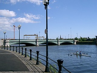
Albert Bridge is a bridge in Belfast, Northern Ireland. Its three flat arches span the River Lagan. It was completed in 1890 by Belfast city surveyor J C Bretland and is named after Prince Albert Victor. It is located close to the city centre between East Bridge Street and the Albertbridge Road.

Stranmillis is an area in south Belfast, Northern Ireland. It is also an electoral ward for Belfast City Council, part of the Laganbank district electoral area. As part of the Queen's Quarter, it is the location for prominent attractions such as the Ulster Museum and Botanic Gardens. The area is located on Stranmillis Road, with Malone Road to the west and the River Lagan to the east. Its name, meaning "the sweet stream" in Irish, refers to the Lagan, whose waters are still fresh at this point, before becoming brackish as the river flows onward toward its mouth in Belfast Lough.

Lisburn Road is a main arterial route linking Belfast and Lisburn, Northern Ireland.

The Lyric Theatre, or simply The Lyric, is the principal, full-time producing theatre in Belfast, Northern Ireland.

Banbridge is a town in County Down, Northern Ireland. It lies on the River Bann and the A1 road and is named after a bridge built over the River Bann in 1712. It is situated in the civil parish of Seapatrick and the historic barony of Iveagh Upper, Upper Half. The town began as a coaching stop on the road from Belfast to Dublin and thrived from Irish linen manufacturing. The town was home to the headquarters of the former Banbridge District Council. Following a reform of local government in Northern Ireland in 2015, Banbridge became part of Armagh City, Banbridge and Craigavon Borough Council. It had a population of 16,637 in the 2011 Census.

The Blackstaff River is a watercourse in County Antrim, Northern Ireland. It rises on the eastern slope of the Black Mountain before flowing down into the Bog Meadows and passing under the city of Belfast, where it enters the River Lagan. Much of its course has been culverted and built upon since the 19th century, making it largely invisible today. Its tributaries include the Forth or Clowney River, which meets it beneath the Broadway Roundabout in West Belfast.

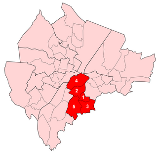
Laganbank was one of the nine district electoral areas in Belfast, Northern Ireland which existed from 1985 to 2014. Located in the south of the city, the district elected five members to Belfast City Council and contained the wards of Ballynafeigh, Botanic, Shaftesbury, Stranmillis, and Rosetta. Laganbank, along with neighbouring Balmoral, formed the greater part of the Belfast South constituencies for the Northern Ireland Assembly and UK Parliament.

Bog Meadows is an area on the outskirts of west Belfast of 47 acres of grassland and woodland managed by the Ulster Wildlife Trust - grid reference: J3172. The M1 motorway passes through this area. To the west of the area lies Milltown Cemetery and St. Louise's Comprehensive College. To the east of the motorway is the Boucher Road area now mostly drained land with industrial units in the grounds along with underdeveloped areas. It is drained by the Blackstaff River.

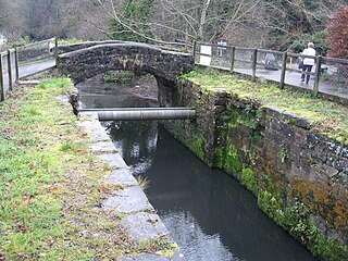
The Lagan Canal was a 44-kilometre (27 mi) canal built to connect Belfast to Lough Neagh. The first section, which is a river navigation, was opened in 1763, and linked Belfast to Lisburn. The second section from Lisburn to Lough Neagh includes a small amount of river navigation, but was largely built as a canal. At its peak it was one of the most successful of the Irish canals, but ultimately it was unable to compete with road and rail transport, and the two sections were closed in 1954 and 1958. The central section from Sprucefield to Moira was destroyed by the construction of the M1 motorway in the 1960s. Responsibility for most of its remains passed first to the Department of Agriculture and then to the Department of Culture, Arts and Leisure, although the section between Aghalee Bridge and Lough Neagh, including the final ten locks, passed into private ownership. There is an active campaign to re-open the canal, including reinstatement of the central section.

The Ormeau Bridge is a road bridge in Belfast, roughly 80m long, carrying the A24 Ormeau Road across the River Lagan from Stranmillis Embankment to Ormeau Embankment.

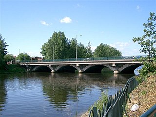
King's Bridge is a road bridge across the River Lagan in South Belfast, Northern Ireland. It opened in 1912 and is named after King George V. Made of reinforced concrete, it is believed to be the first road bridge of this type in Ireland.


