Grafling

Last updated

Grafling
Grafling-pfarrhaus-kirche-kindergarten.jpg
Saint Andrew Church
Wappen Grafling.svg
Coat of arms
Location of Grafling within Deggendorf district
Grafling in DEG.svg
Germany adm location map.svg
Red pog.svg
Grafling
Bavaria location map.svg
Red pog.svg
Grafling
Coordinates: 48°54′N12°59′E / 48.900°N 12.983°E / 48.900; 12.983 Coordinates: 48°54′N12°59′E / 48.900°N 12.983°E / 48.900; 12.983
Country Germany
State Bavaria
Admin. region Niederbayern
District Deggendorf
Government
   Mayor (202026) Anton Stettmer [1] (CSU)
Area
  Total46.28 km2 (17.87 sq mi)
Elevation
433 m (1,421 ft)
Population
 (2020-12-31) [2]
  Total2,772
  Density60/km2 (160/sq mi)
Time zone UTC+01:00 (CET)
  Summer (DST) UTC+02:00 (CEST)
Postal codes
94539
Dialling codes 0991
Vehicle registration DEG
Website www.grafling.de

Grafling is a municipality in the district of Deggendorf in Bavaria in Germany.

Geography

Grafling lies in the Danube Forest Planning Region (Planungsregion Donau-Wald). Its lowest point is in Großtiefenbach at 326 m above sea level (NN). The highest points of the municipality are the Steinberg (999 m), the Geißriegel (1,043 m), the Dreitannenriegel (1,090 m) and the Einödriegel (1,121 m) which rise above the valley of the Graflinger Tal to the east. To the north the valley ends at the Hochberg (727 m), to the west it is guarded by the Butzen (775 m) and the Vogelsang (1,022 m) in the municipality of Bernried. To the south the valley opens up towards Deggendorf, the Danube Plain, and the Gäuboden.

Related Research Articles

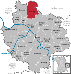
Deggendorf is a Landkreis (district) in Bavaria, Germany. It is bordered by the districts of Regen, Freyung-Grafenau, Passau, Rottal-Inn, Dingolfing-Landau and Straubing-Bogen.

Aholming Place in Bavaria, Germany

Aholming is a municipality in the district of Deggendorf, Germany.

Hunding Place in Bavaria, Germany

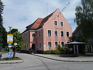
Hunding is a municipality in the district of Deggendorf in Bavaria in Germany.

Osterhofen Place in Bavaria, Germany

Osterhofen is a town in the district of Deggendorf, in Bavaria, Germany. It is situated on the right bank of the Danube, 16 km south of Deggendorf.

Moos, Bavaria Place in Bavaria, Germany

Moos is a municipality in the district of Deggendorf in Bavaria in Germany.

Auerbach, Lower Bavaria Place in Bavaria, Germany

Auerbach is a municipality in the district of Deggendorf in Bavaria in Germany.

Bernried Place in Bavaria, Germany

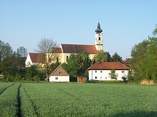
Bernried is a municipality in the district of Deggendorf in Bavaria in Germany.

Grattersdorf Place in Bavaria, Germany

Grattersdorf is a municipality in the district of Deggendorf, Bavaria, Germany.

Iggensbach Place in Bavaria, Germany

Iggensbach is a municipality in the district of Deggendorf in Bavaria in Germany.

Künzing Place in Bavaria, Germany

Künzing is a municipality in the district of Deggendorf in Bavaria in Germany.

Lalling Place in Bavaria, Germany

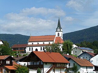
Lalling is a municipality in the Lower Bavarian district of Deggendorf in Germany. It is a nationally recognized resort town.

Oberpöring Place in Bavaria, Germany

Oberpöring is a municipality in the district of Deggendorf in Bavaria in Germany.

Offenberg Place in Bavaria, Germany

Offenberg is a municipality in the district of Deggendorf in Bavaria in Germany.

Otzing Place in Bavaria, Germany

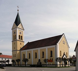
Otzing is a municipality in the district of Deggendorf in Bavaria in Germany.

Schöllnach Place in Bavaria, Germany

Schöllnach is a municipality in the district of Deggendorf in Bavaria in Germany.

Stephansposching Place in Bavaria, Germany

Stephansposching is a municipality in the district of Deggendorf in Bavaria in Germany.

Wallerfing Place in Bavaria, Germany

Wallerfing is a municipality in the district of Deggendorf in Bavaria in Germany.

Winzer Place in Bavaria, Germany

Winzer is a municipality in the district of Deggendorf in Bavaria in Germany.

Zenting Place in Bavaria, Germany

Zenting is a municipality in the district of Freyung-Grafenau in Bavaria in Germany.

Frauenau Place in Bavaria, Germany

Frauenau is a municipality in the district of Regen, in Bavaria, Germany. It is known for its artificial lake, which is used as a water supply of the area around Deggendorf and Passau.

References

  1. Liste der ersten Bürgermeister/Oberbürgermeister in kreisangehörigen Gemeinden, Bayerisches Landesamt für Statistik, 15 July 2021.
  2. "Tabellenblatt "Daten 2", Statistischer Bericht A1200C 202041 Einwohnerzahlen der Gemeinden, Kreise und Regierungsbezirke". Bayerisches Landesamt für Statistik und Datenverarbeitung (in German). June 2021.