Related Research Articles

Worcester County is a county in the U.S. state of Massachusetts. At the 2020 census, the population was 862,111, making it the second-most populous county in Massachusetts. It is also the largest county in Massachusetts by geographic area. The largest city and traditional shire town is Worcester. Worcester County is part of the Worcester, MA–CT metropolitan statistical area and the Boston-Worcester-Providence combined statistical area.
Union Square is a neighborhood in the southeastern part of Somerville, Massachusetts, United States. It is centered on Union Square proper, which is located at the intersection of Washington Street, Webster Avenue, and Somerville Avenue.

Brighton is a former town and current neighborhood of Boston, Massachusetts, United States, located in the northwestern corner of the city. It is named after the English city of Brighton. Initially Brighton was part of Cambridge, and known as "Little Cambridge". Brighton separated from Cambridge in 1807 after a bridge dispute, and was annexed to Boston in 1874. For much of its early history, it was a rural town with a significant commercial center at its eastern end.

Wollaston, Massachusetts, is a neighborhood in the city of Quincy, Massachusetts. Divided by Hancock Street or Route 3A, the Wollaston Beach side is known as Wollaston Park, while the Wollaston Hill side is known as Wollaston Heights.
Allston–Brighton is a set of two interlocking neighborhoods, Allston and Brighton, both part of the city of Boston, Massachusetts.

Newtonville is one of the thirteen villages within the city of Newton in Middlesex County, Massachusetts, United States.

Bay Village is the smallest officially recognized neighborhood of Boston, Massachusetts, United States. As of 2010, its population was approximately 1,312 residents living in 837 housing units, most of which are small brick rowhouses.

Readville is part of the Hyde Park neighborhood of Boston. Readville's ZIP Code is 02136. It was called Dedham Low Plains from 1655 until it was renamed after the mill owner James Read in 1847. It was part of Dedham until 1867. It is served by Readville station on the MBTA Commuter Rail. It is on the original alignment of Route 128, later part of a since-discontinued section of Route 135. Readville is bordered by the Town of Milton to the south and the Town of Dedham to the west. Paul's Bridge, which is at the neighborhood's entrance as one approaches Milton, is one of the oldest bridges in the Commonwealth. The name comes from James Read, a resident and cotton mill owner. Readville is covered by Boston Police Department District E-18 in Hyde Park and a fire station on Neponset Valley Parkway houses Boston Engine Company 49. Readville is also home to several light industries.
Founded in Worcester, Massachusetts in 1987, the Greater Worcester Land Trust is a non-profit land conservation organization dedicated to the protection of important lands in Worcester and the surrounding towns. As a conservation land trust the trust's properties are managed simultaneously for wildlife habitat and passive recreation
Park Street is a short but historic road in the center of Boston, Massachusetts. It begins at the top of Beacon Hill, at the intersection of Beacon Street, where it is lined up with the front of the Massachusetts State House. It then spills down the hill toward Tremont Street, with Boston Common to its west.

The Quinsigamond River is a river in central Massachusetts. It is a tributary of the Blackstone River and ultimately drains into Narragansett Bay.

Louisburg Square is a street in the Beacon Hill neighborhood of Boston, Massachusetts, bisected by a small private park. The park, which is bounded by Pinckney Street to the north and Mount Vernon Street to the south, is maintained by the Louisburg Square Proprietors. While the Proprietors pay taxes to the City of Boston, the city does not own the park or its garden.
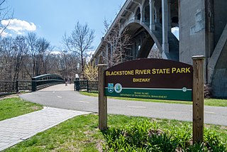
The Blackstone River Greenway is a partially completed 48-mile (77 km) paved rail trail defining the course of the East Coast Greenway through the Blackstone Valley from Worcester, Massachusetts to Providence, Rhode Island in the United States.
The West River, in the US state of Massachusetts, is a 13.4-mile-long (21.6 km) tributary of the Blackstone River.

University Park, also called Crystal Park, is a public park in the Main South neighborhood of Worcester, Massachusetts. The 13-acre (53,000 m2) park was acquired by the city from 1887 to 1889, costing nearly 62,000 dollars. It is located across Main Street from Clark University, thus the name. University Park Campus School, a local nearby public high school founded with help from Clark, is named after the park.

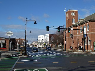
Main South is a neighborhood in southern Worcester, Massachusetts. The area's eponymous feature is Main Street, the central roadway of the city. Main South experienced rapid economic development from the 1890s until the 1950s.
Boulevard Park was a ballpark located in Worcester, Massachusetts, United States. It served as the home park of the Worcester Busters, Worcester Boosters and Worcester Panthers. It lasted approximately two decades, opening on April 19, 1906, and burning in 1926. The capacity of the ballpark was 3,500.

Worcester Public Schools (WPS) is a school district serving the city of Worcester, Massachusetts, United States. It is the second-largest school district in the state behind Boston Public Schools.

Rural Cemetery is located on 180 Grove Street in Worcester, Massachusetts. More than 13,000 people are buried at the cemetery, including congressmen, mayors, governors, and professional people.
The city of Worcester, Massachusetts consists of six regions: North Worcester, West Side, East Side, Central City, Downtown, and South Worcester. It can be further subdivided into smaller neighborhoods:
References
- ↑ Moynihan, Kenneth J. "A History of Worcester, 1674-1848" The History Press, 2007.
- ↑ "Trivia - Geography | City of Worcester, MA". Archived from the original on 2010-05-28.
| | This Worcester County, Massachusetts geography–related article is a stub. You can help Wikipedia by expanding it. |