Graham Lakes | |
---|---|
Children wading in Graham Lakes in this 1905 photograph by Emil King | |
Map of Graham Lakes Township, 1914 | |
Location | Nobles County, Minnesota |
Coordinates | 43°47′35″N95°30′31″W / 43.79306°N 95.50861°W Coordinates: 43°47′35″N95°30′31″W / 43.79306°N 95.50861°W |
Type | Glacial lakes |
Primary inflows | Several small creeks |
Max. length | West Graham Lake 3⁄4 mile (1.2 km) - East Graham Lake 1 1⁄2 miles (2.4 km) |
Max. width | West Graham Lake 1⁄2 mile (0.80 km) - East Graham Lake 1⁄2 mile (0.80 km) |
Surface area | West Graham Lake 519.28 acres (210.15 ha) - East Graham Lake 511.32 acres (206.92 ha) |
Average depth | 7 ft (2.1 m) |
Max. depth | 43 ft (13 m) [1] |
Water volume | 10,000 US gal (38,000 l; 8,300 imp gal) |
Shore length1 | 3 mi (4.8 km) |
Surface elevation | West Graham Lake 1,438.6 feet (438.5 m) - East Graham Lake 1,435 feet (437 m) |
Islands | 2 Rock Piles |
1 Shore length is not a well-defined measure. |
The Graham Lakes are a pair of lakes located in the northeastern corner of Nobles County, Minnesota. The lakes are known as West Graham Lake and East Graham Lake. West Graham Lake is an oval shaped body of water that extends east-to-west slightly more than one mile (1.6 km). The north-to-south width of the lake is approximately 3/4 of a mile. The area of West Graham Lake is 519.28 acres (2.1015 km2), the average depth is 5 feet (1.5 m), and the maximum depth is 8 feet (2.4 m). The elevation of West Graham Lake is 1,438.7 feet (438.5 m), or 438.52 meters. East Graham Lake is a longer, narrower lake that extends from northeast-to-southwest for 11⁄2 miles. Its width is less than 1/2 mile. The area of East Graham Lake is 511.32 acres (2.0692 km2), the average depth is 5 feet (1.5 m), and the maximum depth is 8 feet (2.4 m). The elevation of East Graham Lake is 1,435.08 feet (437.41 m), or 437.41 meters. A small creek runs from West Graham Lake and empties into East Graham Lake. Another creek runs from East Graham Lake, and eventually flows into the Des Moines River.
In the month of May, 1867, a pioneer named Stephen Muck pushed out into the unsettled Graham Lakes region and squatted on land on the bank of West Graham Lake. When surveyed, this land proved to be on section 22 of Graham Lakes Township. There he built a log structure from timber growing near the lake, the first house of wood in the county. In the fall of 1867, Muck brought his family from Jackson County, Minnesota. He earned his livelihood by trapping for a few years, then turned to farming. He lived continuously on his farm from 1867 until the time of his death in 1897. Stephen Muck was the first permanent resident of Nobles County. [2]
The first town to appear on any map of Nobles County was a curious place called Gretchtown. According to an 1856 map - a map drawn 11 years before the arrival of Stephen Muck - Gretchtown was located on the south bank of West Graham Lake, very near to Muck's claim. Rumors of a railroad to be built through southwestern Minnesota had circulated in the 1850s, and even though no survey had been taken for the railroad, the town of Gretchtown had been created - at least on paper - to serve as a stopping point. When Nobles County was formally created by the Minnesota legislature on May 23, 1857, Gretchtown was briefly designated as the county seat of Nobles County, an imaginary county seat for a county that, at that time, had no residents. [3] [4]
When a route for the St. Paul and Sioux City Railway was surveyed in 1871, it was located far south of the Graham Lakes region. No towns or villages existed in Graham Lakes Township until 1879 when Kinbrae and Dundee were established. Neither town grew beyond a few hundred residents. Thus, the Graham Lakes region has remained entirely rural, and the lake shores of both East Graham Lake and West Graham Lake remain undeveloped.
These lakes were first noted on Joseph Nicollet's 1842 map based upon his explorations of the late 1830s and early 1840s. Nicollet named the lakes after Joseph Duncan Graham. Graham served as a commissioner for the survey of the northeast segment of the boundary between the United States and Canada from 1840 until 1843. [5]
Graham Lakes are known as exceptionally good fishing lakes. East Graham is managed primarily for walleye and northern pike and secondarily for black crappie and yellow perch. A population assessment was conducted during the week of June 4, 2007 using 3 gill nets and 8 trap nets. Black Crappies ranged from 7.4 inches (190 mm) to 13.0 inches (330 mm), and their numbers were the highest since sampling of the lake has been conducted. Northern Pike ranged from 17.6 inches (450 mm) to 30 inches (760 mm). Walleye were also abundant, and 59% of those sampled were 14 inches (360 mm) or greater. Most fish from East Graham Lake are safe to eat. However, pregnant women, women who may become pregnant and children under age 15 are advised to refrain from eating walleye more than once per week due to mercury levels. West Graham is primarily managed for walleye with black crappie and channel catfish as secondary species. Walleye fry and fingerlings are stocked in successive years, with the third year left blank. A population assessment conducted on June 4, 2007 found that walleye range from 6.9 to 20 inches (510 mm) in length. Black crappies range from 5.8 inches (150 mm) to 11.9 inches (300 mm). The average black crappie swimming in West Graham Lake is thought to be nearly 1/2 pound. Channel catfish average 13.3 inches (340 mm). There are no advisories for consumption of fish from West Graham Lake. [6]
Fury Island and Maka-Oicu County Parks are located on East and West Graham Lakes. Maka-Oicu County Park is located on the northeast shore of West Graham Lake and provides for camping, lake access, natural areas, swimming beach, picnic areas, historic site and general park activities. The park has on-site showers, a large picnic shelter for reunions and gatherings. Maka-Oicu Park also has a one-room cabin with four padded bunks, a table inside and a small refrigerator. Campers have access to electricity and a water supply. Maka-Oicu Park consists of 46 acres (190,000 m2) of developed land. Fury's Island County Park is located on the west side of East Graham Lake, and provides for camping, natural areas, lake access, showers, a large picnic shelter for gatherings, and also has a playground for the little ones. Fury's Island Park is one mile (1.6 km) south of Maka-Oicu County Park and consists of 10 acres (40,000 m2) of developed land. [7]
Nobles County is a county in the U.S. state of Minnesota. As of the 2010 United States Census, the population was 21,378. Its county seat is Worthington.
Graham Lakes Township is a township in Nobles County, Minnesota, United States. The population was 251 at the 2000 census.
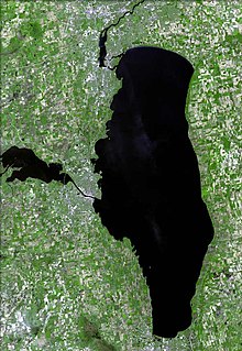
Lake Winnebago is a shallow freshwater lake in the north central United States, located in east central Wisconsin. At 137,700 acres it is the largest lake entirely within the state, covering an area of about 30 miles by 10 miles, with 88 miles of shoreline, an average depth of 15.5 feet, and a maximum depth of 21 feet. It has many shallow reefs along the west shore, and a drop-off type shoreline on the east. There are several islands along the west shore.
Lake Nokomis is one of several lakes in Minneapolis, Minnesota, United States. The lake was previously named Lake Amelia in honor of Captain George Gooding's daughter, Amelia, in 1819. Its current name was adopted in 1910 to honor Nokomis, grandmother of Hiawatha. It is located in the southern part of the city, west of the Mississippi River and south of Lake Hiawatha. The lake is oval in shape, with a long axis running southwest to northeast. Two pathways circle the lake, a 2.7-mile (4.3 km) pedestrian tail and a 2.8-mile (4.5 km) bicycle trail. Because the lower part of the lake is crossed by Cedar Avenue running north–south, the impression from the ground is that the lake is shaped like an L. The lake has an area of 204 acres (0.83 km2).
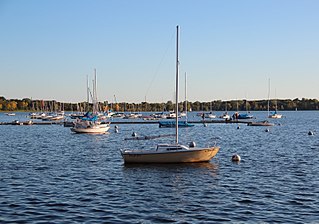
Bde Maka Ska is the largest lake in Minneapolis, Minnesota, United States, and part of the city's Chain of Lakes. Surrounded by city park land and circled by bike and walking trails, it is popular for many outdoor activities. The lake has an area of 401 acres (1.62 km2) and a maximum depth of 87 feet (27 m).
Okamanpeedan Lake, partially located in Martin County, Minnesota, and Emmet County, Iowa, is also known as Tuttle Lake. Okamanpeedan Lake is a roughly 2,300-acre (9.3 km²) riverine lake located on the East Fork of the Des Moines River. It has an average depth of about four to six feet. The lake has a contributing watershed of approximately 120,056 acres (486 km²) and watershed:lake ratio on the order of about 50:1. The lake is situated in a glacial till plain and is generally in an area dominated by loamy, poorly drained soils. The area is primarily level but does have some rolling hills.
Lake of the Isles is a lake in Minneapolis, Minnesota, United States, connected to Cedar Lake and Bde Maka Ska. In winter it is used for ice skating and hockey and serves as the location of a New Year's Eve celebration featuring roasted marshmallows and hot chocolate. The lake has an area of 109 acres (0.4 km2), 2.86 miles (4.6 km) of shoreline with a little under three miles of paved walking and biking paths, and a maximum depth of 31 feet (9 m).
Lake Vermilion is a freshwater lake in northeastern Minnesota, United States. The Ojibwe originally called the lake Nee-Man-Nee, which means “the evening sun tinting the water a reddish color”. French fur traders translated this to the Latin word Vermilion, which is a red pigment. Lake Vermilion is located between the towns of Tower on the east and Cook on the west, in the heart of Minnesota's Arrowhead Region at Vermilion Iron Range. The area was mined from the late 19th century until the 1960s, and the Soudan Mine operated just south of the lake.
Lake Harriet is a lake in the southwest part of Minneapolis, just south of Bde Maka Ska and north of Minnehaha Creek. The lake is surrounded by parkland as part of the Minneapolis Chain of Lakes. The lake has an area of 335 acres (1.36 km2) and a maximum depth of 85 feet (26 m).
Cedar Lake is a lake in Minneapolis, Minnesota, United States, and part of the city's Chain of Lakes. It is located on the west side of the city, north of Bde Maka Ska and west of Lake of the Isles. The lake is surrounded by parkland on the west side, while the east side borders the Kenwood residential area. The north side is bordered by the Cedar Lake Trail and the BNSF Railway. Cedar Lake has an area of 169 acres (0.68 km2) and a maximum depth of 51 feet (16 m). Minneapolis Park and Recreation Board manages parkland around the lake.
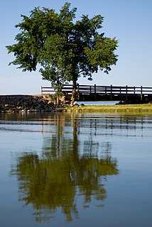
Lake Shetek is the largest lake in southwestern Minnesota, United States, and the headwaters of the Des Moines River. It is located in The Lakes, an unincorporated community in Murray County a few miles north-northwest of Currie. The name Shetek is derived from "pelican" in the Ojibwe language.
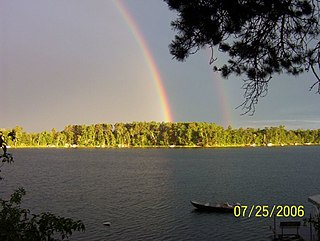
Ponto Lake is a 347-acre (1.4 km²) lake located 2 miles (3.2 km) north and 8 miles (13 km) east of Backus, Minnesota.
Kinkaid Lake is a reservoir located in southwestern Illinois. Entirely within Jackson County, the lake is approximately 5 miles (8.0 km) northwest of Murphysboro and 100 miles (160 km) southeast of St. Louis.
Lake Osakis is a lake in Todd and Douglas counties in west-central Minnesota. The town of Osakis is situated on the southwest shore of the lake.
Kabetogama is an unincorporated community in Kabetogama Township, Saint Louis County, Minnesota, United States, located within the Kabetogama State Forest.
Bear Island Lake is a lake which is about 15 miles (24 km) southwest of Ely in the U.S. state of Minnesota. The lake measures 2,351 acres (9.51 km2), or about 2 miles (3.2 km) by 4 miles (6.4 km). There are at least 20 other islands in the lake. The shoreline of the natural glacial lake is about two-thirds state and national forest, including Bear Island State Forest. While deep in parts, several shallow bays and natural sand beaches make it a popular swimming spot.
Mille Lacs Lake is a large but shallow lake in the U.S. state of Minnesota. It is located in the counties of Mille Lacs, Aitkin, and Crow Wing, roughly 75 miles north of the Minneapolis-St. Paul metropolitan area.
Green Lake is a lake in Chisago City, Minnesota, United States. This lake is sometimes also referred to as "Big Green Lake" because it is connected to Little Green Lake by a channel. Green Lake was named from the fact its waters are green from the high algae content.