One Arrow First Nation is a Cree First Nations band government in Bellevue, Saskatchewan, Canada. Its main reserve is located just south of Batoche near the South Saskatchewan River about 100 km North-east of Saskatoon. The One Arrow First Nation's reserve is in the aspen parkland biome. It is bordered by the Rural Municipalities of St. Louis No. 431, Fish Creek No. 402, and Duck Lake No. 463.

Furdale, Saskatchewan is an unincorporated community adjacent to the southern city limits of Saskatoon, west of Highway 219 and on the east bank of the South Saskatchewan River.
Highway 16 is a provincial highway in the Canadian province of Saskatchewan. It is the Saskatchewan section of the Yellowhead Highway, and also the Trans-Canada Highway Yellowhead section. The main purpose of this highway is to connect Saskatchewan with Canadian cities such as Edmonton and Winnipeg. The highway runs from the Alberta boundary in Lloydminster to the Manitoba boundary near Marchwell. Major cities it passes through are Saskatoon, North Battleford in the central part of the province, Yorkton in the far east and Lloydminster to the far west.
The Saskatchewan Railway Museum is a railway museum located west of Saskatoon, Saskatchewan at the intersection of the Pike Lake Highway and the Canadian National Railway tracks. It is operated by the Saskatchewan Railroad Historical Association (SRHA) and was opened in 1990.

Wanuskewin Heritage Park is an archaeological site and non-profit cultural and historical centre of the First Nations just outside the city of Saskatoon, Saskatchewan. The faculty's name comes from the Cree language word ᐋᐧᓇᐢᑫᐃᐧᐣ or wânaskêwin, meaning, "being at peace with oneself". The site is a National Historic Site of Canada due to the importance of its archaeological resources representing nearly 6000 years of the history of the Northern Plains peoples. In 2016, it was announced that Wanuskewin intends to seek UNESCO World Heritage designation, which would make it the first World Heritage Site in Saskatchewan.

Whitewood is a town in the Canadian province of Saskatchewan. It is located approximately 175 kilometres (109 mi) east of Regina on the Trans-Canada Highway Sk Hwy 1. It is situated at the crossroads of two major highways systems – the Trans-Canada, which runs east and west, and Sk Hwy 9, which runs north and south from the US border to Hudson Bay, Saskatchewan. Located midway between Brandon, Manitoba and Regina, Whitewood was and continues to be an ideal place to stop and rest.

Hodgeville is a village in the Canadian province of Saskatchewan within the Rural Municipality of Lawtonia No. 135 and Census Division No. 7. The village is located approximately 34 km south of the Trans Canada Highway, 97 km southeast of the City of Swift Current.

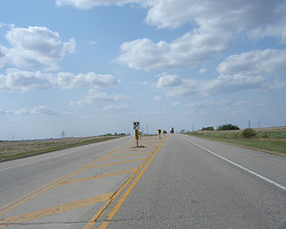
Highway 11 is a major north-south highway in Saskatchewan, Canada that connects the province's three largest cities: Regina, Saskatoon and Prince Albert. It is a structural pavement major arterial highway which is approximately 391 kilometres (243 mi) long. It is also known as the Louis Riel Trail (LRT) after the 19th century Métis leader. It runs from Highway 1 in Regina until Highway 2 south of Prince Albert. Historically the southern portion between Regina and Saskatoon was Provincial Highway 11, and followed the Dominion Survey lines on the square, and the northern portion between Saskatoon and Prince Albert was Provincial Highway 12.
Highway 6 is a paved undivided major provincial highway in the Canadian province of Saskatchewan. It runs from Montana Highway 16 at the Canada–US border near the Canada customs port of Regway to Highway 55 near Choiceland. Highway 6 is about 523 km (325 mi) long. The CanAm Highway comprises Saskatchewan Highways from south to north: SK 35, Sk 39, Sk 6, Sk 3, as well as Sk 2. 330 kilometres (210 mi) of Saskatchewan Highway 6 contribute to the CanAm Highway between Corinne and Melfort.
Highway 3 is a major provincial paved undivided highway in the Canadian province of Saskatchewan. It runs from the Alberta border, where it continues west as Alberta Highway 45, to the Manitoba border, and then continues east as Highway 77. Highway 3 is about 615 km (382 mi.) long. The CanAm Highway comprises Saskatchewan Highways 35, 39, 6, 3, as well as 2. 59.7 miles (96.1 km) of Saskatchewan Highway 3 contribute to the CanAm Highway between Melfort and Prince Albert.

Highway 316 is a highway in the Canadian province of Saskatchewan. It runs from Highway 16 near Clavet to Highway 5. Highway 316 is about 17 km (11 mi.) long. This area is an industrial commercial area along Highway #316 which extends from Clavet north to the PCS Patience Lake Mine which is just 10 miles from the city of Saskatoon. Highway 316 is a primary weight highway, and also runs near the Canadian National Railway line which goes from Saskatoon through Clavet. In 1941, the Canadian Pacific Railway ran from Saskatoon through Cheviot and on south eastward.

The Blairmore Suburban Centre is a community service/commercial/residential community currently under development in western Saskatoon, Saskatchewan. It is part of the city's Blairmore Suburban Development Area, a large region annexed from the Rural Municipality of Corman Park No. 344 in 2005. Ultimately, the SDA will consist of seven new neighbourhoods, plus the Blairmore Suburban Centre, which is the first component of the SDA to be developed.

The Red Coat Trail is a 1,300-kilometre (810 mi) route that approximates the path taken in 1874 by the North-West Mounted Police in their March West from Fort Dufferin to Fort Whoop-Up.
Mistatim is a village in the Canadian province of Saskatchewan within the Rural Municipality of Bjorkdale No. 426 and Census Division No. 14. It is just north of Highway 3. Mistatim is 35 miles (56 km) east of the Town of Tisdale and 40 miles (64 km) west of Hudson Bay. The Greenwater Lake Provincial Park is 30 miles (48 km) to the south.
Wingard is an unincorporated community in Duck Lake No. 436, Saskatchewan, Canada. Wingard is seven miles north-east of Fort Carlton and twelve miles north-west of Duck Lake.
The United States Border Patrol operates 71 traffic checkpoints, including 33 permanent traffic checkpoints, near the Mexico–United States border. The stated primary purpose of these inspection stations is to deter illegal immigration and smuggling activities. After the September 11 attacks in 2001, they took on the additional role of terrorism deterrence. These checkpoints are located between 25 and 75 miles of the Mexico–United States border along major U.S. highways; near the southern border of the contiguous United States. Their situation at interior locations allow them to deter illegal activities that may have bypassed official border crossings along the frontier. The checkpoints are divided among nine Border Patrol sectors. There are a number of these checkpoints near the northern border of the contiguous U.S. as well, within 100 miles (160 km) of the Canada–U.S. border.

Cree Lake is a lake in Saskatchewan, Canada. The lake is the fourth largest in the province and is located west of Reindeer Lake and south of Lake Athabasca. There is no highway access, but the lake is reachable by float plane.

Grasswood, also known as Grasswood Park, is an unincorporated hamlet in Saskatchewan. It is part of the Corman Park rural municipality and is located just south of the city limits of Saskatoon. A second unincorporated hamlet, Furdale, is directly to the west.
Titanic is an unincorporated community in Duck Lake No. 463, Saskatchewan, Canada, midway between Saskatoon and Prince Albert National Park.

The English River Dene Nation is a Dene First Nation band government in Patuanak, Saskatchewan, Canada. Their reserve is in the northern section of the province. Its territories are in the boreal forest of the Canadian Shield. This First Nation is a member of the Meadow Lake Tribal Council (MLTC).
