Related Research Articles

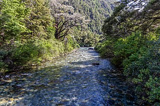
The Sabine River is in the South Island of New Zealand. It is located in Nelson Lakes National Park.

Arthur's Pass National Park is located in the South Island of New Zealand and covers 1,185 km2 of mostly mountainous terrain. Adjacent to it lies Craigieburn Forest Park.

Mount Aspiring / Tititea is New Zealand's 23rd-highest mountain. It is the country's highest outside the Aoraki / Mount Cook region.

Kiewa River, a perennial river that is part of the Murray catchment within the Murray-Darling basin, is located in the Alpine bioregion, in the Australian state of Victoria.

The Heaphy Track is a popular tramping and mountain biking track in the north west of the South Island of New Zealand. It is located within the Kahurangi National Park and classified as one of New Zealand's ten Great Walks by the Department of Conservation. Named after Charles Heaphy, the track is 78.4 kilometres (48.7 mi) long and is usually walked in four or five days. The track is open for shared use with mountain bikers in the winter season from 1 May to 30 September each year. The southern end of the track is at Kōhaihai, north of Karamea on the northern West Coast, and the northern end is in the upper valley of the Aorere River, Golden Bay.
Mount Owen is in the Tasman District of the South Island of New Zealand. It stands at 1875 metres (6150 feet) above sea level and is part of the Marino Mountains.
The Owen River is located in the northwest of New Zealand's South Island. This short river is an upper tributary of the Buller River. It flows south for 20 kilometres from its headwaters on the slopes of Mount Owen, flowing into the Buller at the small settlement of Owen River 18 kilometres northeast of Murchison.
Kahurangi Point is a headland on the West Coast of New Zealand's South Island, overlooking the Tasman Sea. It is located in Kahurangi National Park between Karamea and Farewell Spit.
Lake Sparrow is a mountain tarn in New Zealand's Anatoki Range. It is located within Kahurangi National Park in the South Island's Tasman Region. It lies at an elevation of some 1,400 metres (4,600 ft), and covers approximately 4 hectares.

The Grose River, a perennial river that is part of the Hawkesbury-Nepean catchment, is located in the Blue Mountains region of New South Wales, Australia.
The Wolgan River, a watercourse of the Hawkesbury-Nepean catchment, is located in the Central Tablelands region of New South Wales, Australia.
The Ellis River is a river of the northwestern South Island of New Zealand. It arises near Mount Arthur in the Arthur Range and flows south-east within Kahurangi National Park. It is a tributary of the Baton River.
The Fyfe River is a river in the Tasman District of New Zealand. It arises in the Marino Mountains near Mount Owen and flows north, then south-west, south and south-east to join the Owen River, a tributary of the Buller River, which eventually exits into the Tasman Sea.
The Leslie River is a river of the northwest of New Zealand's South Island located in the Buller District. A tributary of the Karamea River, the Leslie flows west from the Arthur Range, meeting the Karamea 28 kilometres (17 mi) east of the town of Karamea. The river's entire length is within Kahurangi National Park.
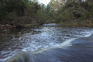
The Rolling River is a short river of the Tasman Region of New Zealand's South Island. It is formed by the confluence of several streams - Nuggety Creek, Blue Creek, and Granity Creek - and flows north to reach the Wangapeka River 12 kilometres north of Mount Owen.

The Buckland River, a perennial river of the North-East Murray catchment of the Murray-Darling basin, is located in the alpine region of Victoria, Australia. It flows from the eastern slopes of the Buffalo Range in the Australian Alps, joining with the Ovens River at Porepunkah.
The Robinson River is a river in the West Coast Region of the South Island of New Zealand. It is a tributary of the Upper Grey River and much of the river lies within the Lake Sumner Conservation Park. Rising on the slopes of Mount Boscawen on the main divide about 12 kilometres (7.5 mi) south of the Lewis Pass, the river runs west-southwest along a straight, narrow valley before turning northwest to reach the Upper Grey.
The Waingaro River is a river of the Tasman Region of New Zealand's South Island.

The Lewis River is a tributary of the Heaphy River in New Zealand's Kahurangi National Park. The Lewis River is located in the Buller District. It was named for C. Lewis, one of the contractors who built the Heaphy Track in 1886. The Lewis River flows into the Heaphy River at Lewis Hut. After the river was encroaching the hut, it was removed and replaced nearby by Lewis Shelter. Land Information New Zealand lists the name of the river as "official", i.e. the name is confirmed by the New Zealand Geographic Board.

The Wangapeka Track is a tramping track in the north west of the South Island of New Zealand. It traverses the southern end of the Kahurangi National Park from the historic Wangapeka goldfields area west of Tapawera, to the coastal plains of the West Coast at Little Wanganui. The route is 59 km (37 mi) long, and crosses two saddles, each over 1,000 m (3,300 ft) in elevation. It typically takes walkers 4–6 days to complete. The route passes through the valleys of the Wangapeka River, Karamea River, Taipō River and Little Wanganui River. The majority of the track is in river valleys and under forest cover, with small sections in tussock land at Stag Flat and the Little Wanganui Saddle.
References
- 1 2 "Granity Pass Hut," New Zealand Department of Conservation. Retrieved 22 August 2022.
Coordinates: 41°31′28″S172°33′55″E / 41.52444°S 172.56528°E
| | This West Coast Region (New Zealand) geography article is a stub. You can help Wikipedia by expanding it. |