
Bigfork is a census-designated place (CDP) in Flathead County, Montana, United States. It is within Montana's Rocky Mountains. The population was 4,270 at the 2010 census, up from 1,421 in 2000.

Lake Missoula was a prehistoric proglacial lake in western Montana that existed periodically at the end of the last ice age between 15,000 and 13,000 years ago. The lake measured about 7,770 square kilometres (3,000 sq mi) and contained about 2,100 cubic kilometres (500 cu mi) of water, half the volume of Lake Michigan.

The Sun River is a tributary of the Missouri River in the Great Plains, approximately 130 mi (209 km) long, in Montana in the United States.

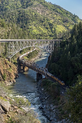
The Clark Fork, or the Clark Fork of the Columbia River, is a river in the U.S. states of Montana and Idaho, approximately 310 miles (500 km) long. The largest river by volume in Montana, it drains an extensive region of the Rocky Mountains in western Montana and northern Idaho in the watershed of the Columbia River. The river flows northwest through a long valley at the base of the Cabinet Mountains and empties into Lake Pend Oreille in the Idaho Panhandle. The Pend Oreille River in Idaho, Washington, and British Columbia, Canada which drains the lake to the Columbia in Washington, is sometimes included as part of the Clark Fork, giving it a total length of 479 miles (771 km), with a drainage area of 25,820 square miles (66,900 km2). In its upper 20 miles (32 km) in Montana near Butte, it is known as Silver Bow Creek. Interstate 90 follows much of the upper course of the river from Butte to Saint Regis. The highest point within the river's watershed is Mount Evans at 10,641 feet (3,243 m) in Deer Lodge County, Montana along the Continental Divide.

The Pend Oreille River is a tributary of the Columbia River, approximately 130 miles (209 km) long, in northern Idaho and northeastern Washington in the United States, as well as southeastern British Columbia in Canada. In its passage through British Columbia its name is spelled Pend-d'Oreille River. It drains a scenic area of the Rocky Mountains along the U.S.-Canada border on the east side of the Columbia. The river is sometimes defined as the lower part of the Clark Fork, which rises in western Montana. The river drains an area of 66,800 square kilometres (25,792 sq mi), mostly through the Clark Fork and its tributaries in western Montana and including a portion of the Flathead River in southeastern British Columbia. The full drainage basin of the river and its tributaries accounts for 43% of the entire Columbia River Basin above the confluence with the Columbia. The total area of the Pend Oreille basin is just under 10% of the entire 258,000-square-mile (670,000 km2) Columbia Basin. Box Canyon Dam is currently underway on a multimillion-dollar project for a fish ladder.

The Flathead River, in the northwestern part of the U.S. state of Montana, originates in the Canadian Rockies to the north of Glacier National Park and flows southwest into Flathead Lake, then after a journey of 158 miles (254 km), empties into the Clark Fork. The river is part of the Columbia River drainage basin, as the Clark Fork is a tributary of the Pend Oreille River, a Columbia River tributary. With a drainage basin extending over 8,795 square miles (22,780 km2) and an average discharge of 11,380 cubic feet per second (322 m3/s), the Flathead is the largest tributary of the Clark Fork and constitutes over half of its flow.

The Flathead National Forest is a national forest in the western part of the U.S. state of Montana. The forest lies primarily in Flathead County, south of Glacier National Park. The forest covers 2,404,935 acres of which about 1 million acres (4,000 km2) is designated wilderness. It is named after the Flathead Native Americans who live in the area.
The North Fork Feather River is a watercourse of the northern Sierra Nevada and southern Cascades in the U.S. state of California. It flows generally southwards from its headwaters near Lassen Peak to Lake Oroville, a reservoir formed by Oroville Dam in the foothills of the Sierra, where it runs into the Feather River. The river drains about 2,100 square miles (5,400 km2) of the western slope of the Sierras. By discharge, it is the largest tributary of the Feather.
The Whitefish River is a 24.8-mile-long (39.9 km) southward-flowing stream originating at the outlet of Whitefish Lake. The river is a tributary of the Stillwater River just before it reaches the Flathead River in Flathead County, in the U.S. state of Montana. The Whitefish River is part of the Columbia River basin, as the Flathead River is a tributary of Clark Fork, which is tributary to the Pend Oreille River, which is tributary to the Columbia River.

The Montana Stream Access Law says that anglers, floaters and other recreationists in Montana have full use of most natural waterways between the high-water marks for fishing and floating, along with swimming and other river or stream-related activities. In 1984, the Montana Supreme Court held that the streambed of any river or stream that has the capability to be used for recreation can be accessed by the public regardless of whether the river is navigable or who owns the streambed property. On January 16, 2014, the Montana Supreme Court, in a lawsuit filed by the Public Land/Water Access Association over access via county bridges on the Ruby river in Madison County, Montana reaffirmed the Montana Stream Access Law and the public's right to access rivers in Montana from public easements.

U.S. Highway 2 is an east–west United States Numbered Highway in the state of Montana. It extends approximately 666.6 miles (1,072.8 km) from the Idaho state line east to the North Dakota state line.

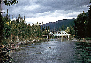
The North Fork Flathead River is a 153-mile (246 km) river flowing through British Columbia, Canada, south into the U.S. state of Montana. It is one of the three primary forks of the Flathead River, the main inflow of Flathead Lake and a tributary of the Columbia River via the Clark Fork River and the Pend Oreille River. The river is sometimes considered the upper headwaters of the Flathead River, although the North Fork is its official name in the U.S. Other naming conventions for the river include Flathead River - North Fork, North Fork of Flathead River, and North Fork of the Flathead River.
The Middle Fork Flathead River is a 92-mile (148 km) river in western Montana in the United States, forming the southwestern boundary of Glacier National Park. Its drainage basin lies to the east of the South Fork Flathead River and the Hungry Horse Reservoir. Towns along the river include West Glacier, Nyack, Pinnacle, Essex, and Nimrod.

The Swan Range is a mountain range in western Montana in the United States. Its peaks typically rise to around 8,000 to 9,000 feet. The range is bounded by the South Fork Flathead River to the east, the Flathead River to the north and northwest, the Swan River to the west, and lie to the southwest of Glacier National Park, just south of the Canada–US border. It runs about 99 miles (159 km) from north-northwest to south-southeast. Major cities near the Swan Range include Kalispell and Bigfork to the northeast, and Seeley Lake on the south.

Glacier View Dam was proposed in 1943 on the North Fork of the Flathead River, on the western border of Glacier National Park in Montana. The 416-foot (127 m) tall dam, to be designed and constructed by the U.S. Army Corps of Engineers in the canyon between Huckleberry Mountain and Glacier View Mountain, would have flooded in excess of 10,000 acres (4,000 ha) of the park. In the face of determined opposition from the National Park Service and conservation groups, the dam was never built.
Aeneas Creek is a stream in the U.S. state of Montana. It is a tributary to Graves Creek.
Addition Creek is a stream in the U.S. state of Montana. It is a tributary to South Fork Flathead River.
Little Bitterroot River is in northwestern Montana. It in the mountains west of Kalispell north of Marion or about 25 miles (40 km) west-northwest of Flathead Lake. It flows south-southeastward for 65 miles (105 km) to the Flathead River, which goes into the Clark Fork of the Columbia. The basin covers about 600 square miles (1,600 km2), or about 385,000 acres (156,000 ha). The upper basin as mountainous area with interior plains, from 1 to 8 miles wide and about 100 square miles (260 km2) in extent. The plain area traversed by the 40 miles (64 km) its length. The Little Bitterroot valley, is an arm of the Lake Missoula glacial plain south of Flathead Lake.

