The Thuringian Forest, is a mountain range in the southern parts of the German state of Thuringia, running northwest to southeast between the valley of the river Werra near Eisenach and the Thuringian-Vogtlandian Slate Mountains. The geographical boundary with the latter range follows approximately a line from Gehren via Großbreitenbach to Schönbrunn near Schleusingen, defined by the rivers Schleuse and Neubrunn on the southwestern slope, and Talwasser, Wohlrose and Möhre on the northeastern slope.

The Great Basin Desert is part of the Great Basin between the Sierra Nevada and the Wasatch Range. The desert is a geographical region that largely overlaps the Great Basin shrub steppe defined by the World Wildlife Fund, and the Central Basin and Range ecoregion defined by the U.S. Environmental Protection Agency and United States Geological Survey. It is a temperate desert with hot, dry summers and snowy winters. The desert spans a large part of the state of Nevada, and extends into western Utah, eastern California, and Idaho. The desert is one of the four biologically defined deserts in North America, in addition to the Mojave, Sonoran, and Chihuahuan Deserts.

The Central Eastern Alps, also referred to as Austrian Central Alps or just Central Alps comprise the main chain of the Eastern Alps in Austria and the adjacent regions of Switzerland, Liechtenstein, Italy and Slovenia.

The Noric Alps is a collective term denoting various mountain ranges of the Eastern Alps. The name derives from the ancient Noricum province of the Roman Empire on the territory of present-day Austria and the adjacent Bavarian and Slovenian area.

The Radstadt Tauern are a subrange of the Central Eastern Alps in Austria. Together with the Schladming Tauern, the Rottenmann and Wölz Tauern and the Seckau Tauern the Radstadt Tauern form the major range of mountains known as the Low Tauern. The mountains are found in the southeast of the Austrian state of Salzburg, between the upper reaches of the Enns and Mur rivers.

The Alpine foothills, or Prealps can refer generally to any foothills at the base of the European Alps. They are the transition zone between the High Alps to the Swiss Plateau and the Bavarian Alpine Foreland in the north, as well as to the Pannonian Basin (Alpokalja) in the east, the Padan Plain in the south and the Rhone Valley in the west.

The Universalmuseum Joanneum is a multidisciplinary museum with buildings in several locations in the province of Styria, Austria. It has galleries and collections in many subject areas including archaeology, geology, paleontology, mineralogy, botany, zoology, history, art and folk culture. It is the oldest museum in Austria as well as the largest universal museum in central Europe with over 4.5 million objects in 13 departments and 12 locations in the Styrian cities of Graz, Stainz, Trautenfels, and Wagna. To reflect this status and its growth over the last two centuries, as well as to present a more recognizable image internationally, the Landesmuseum Joanneum was officially renamed to Universalmuseum Joanneum on 10 September 2009.

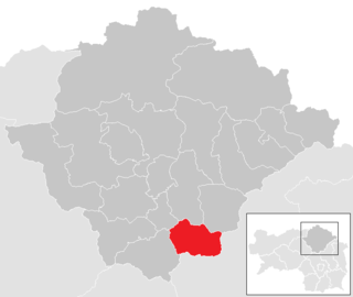
Mellach was a municipality in Austria which merged in January 2015 into Fernitz-Mellach in the Graz-Umgebung District of Styria, Austria.

Gösting is the 13th city district of Graz, in the Austrian province of Styria. It is situated in the north-west of the city between the river Mur and the Plabutsch mountain and the range north of it on which the ruined Gösting Castle is located.

The West Hesse Highlands, also known as the West Hessian Lowlands and Highlands, refers to a heavily forested region of the Central Uplands in Germany that lies mostly within the state of Hesse, between those elements of the Rhenish Massif right of the Rhine in the west, the Weser Uplands to the north, the Hessian Central Uplands to the east and the Wetterau to the south.

The Gladenbach Uplands, named after their central town of Gladenbach, is a range of hills up to 609 m high in the Rhine Massif in Germany, on the junction of the Rothaar Mountains, Westerwald (southwest), (Eastern) Hintertaunus and West Hesse Highlands in the east. It lies in Central Hesse within the districts of Marburg-Biedenkopf, Lahn-Dill and Gießen within the so-called Lahn-Dill-(Dietzhölze-) loop. Small parts of the Upper Lahn Valley in the northwest belong, together with the town of Bad Laasphe, also to the district of Siegen-Wittgenstein, North Rhine-Westphalia.

SOIUSA is a proposal for a new classification system of the Alps from the geographic and toponomastic point of view. It was designed by Sergio Marazzi, Italian researcher and author of the Orographic Atlas of the Alps SOIUSA. His book was presented with the patronage of the Italian Alpine Club on 23 Jan 2006, but has yet to receive any formal acceptance.

The Mürzsteg Alps or Mürztal Alps are a mountain range in the Eastern Alps, which lie in the Austrian state of Styria, with a small part of the range in Lower Austria. The highest peak is the Hohe Veitsch in the centre of the group, while largest massif is the Schneealpe in the northwest, near the Rax.

The Prealps East of the Mur are the easternmost mountain range of the Central Eastern Alps. They comprise the eastern foothills of the Alpine crest beyond the Mur river and the adjacent southeastern Alpine Foreland.

The Lavanttal Alps are part of the Central Eastern Alps in Austria and Slovenia, between the river Mur in the north and the Drava in the south.

The Fischbach Alps are part of the Prealps East of the Mur.

The Joglland is a heavily forested low mountain region in northeastern Styria in the districts of Hartberg-Fürstenfeld and Weiz. Today it forms the tourist region of Joglland–Waldheimat .

The Wechsel is a low mountain range in eastern Austria whose highest summit is the Hochwechsel. It also has two other summits over 1700 m. The massif forms the border between the states of Lower Austria and Styria for about 15 km, southeast of the Semmering and northeast of the Graz Basin, between the Feistritz Saddle and the eponymous pass of Wechsel.