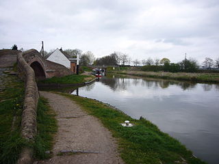
Great Haywood is a village in central Staffordshire, England, just off the A51 and about 4.5 miles (7.2 km) northwest of Rugeley and 7.1 miles (11.4 km) southeast of the county town of Stafford. Population details taken at the 2011 census can be found under Colwich.

Long Eaton railway station serves the town of Long Eaton in Derbyshire, England. It lies on the Midland Main Line and the Derby-Nottingham line 120 miles 28 chains (193.7 km) north of London St Pancras. The station is managed by East Midlands Railway, but CrossCountry operates some services.

Penkridge railway station is a railway station serving the village of Penkridge in Staffordshire, England.

Haughton is a village in Staffordshire, England, approximately 4 miles outside and to the west of the county town of Stafford. It lies on the A518 between Stafford and Gnosall. The name derives from a combination of the Mercian word halh meaning 'nook' and the Old English word tun meaning 'settlement', 'enclosure' or 'village.'

Wilnecote railway station is a railway station serving the town of Fazeley and suburb of Wilnecote in Staffordshire, England. It is 1.5 miles (2 km) south of Tamworth town centre. The station is situated beneath a bridge which carries the former A5 Watling Street.

Burton-on-Trent railway station is a mainline railway station located in the town of Burton upon Trent, Staffordshire, England. It is owned by Network Rail and managed by East Midlands Railway, although only CrossCountry services call at this station.
Norton Bridge is a village in Staffordshire, England. Until May 2004 it was served by Norton Bridge railway station.

Whalley railway station serves the village of Whalley in Lancashire, England. The station lies on the Ribble Valley Line 7+1⁄4 miles (11.7 km) north of Blackburn. The station has two platforms, slightly offset from each other. It is unstaffed, with shelters on each platform. Immediately beyond its eastern end, the line crosses the River Calder on a 678-yard (620 m) long, brick viaduct of 48 arches.

Tutbury and Hatton Station is a railway station in England, served by trains on the Crewe to Derby Line, which is a Community Rail line known as the North Staffordshire line. The station is owned by Network Rail and managed by East Midlands Railway.
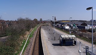
Netherfield railway station serves the town of Netherfield in the Borough of Gedling in Nottinghamshire, England. It comprises a single island platform with two tracks, with only a single waiting shelter. Access is via a flight of steps down from Chaworth Road, which crosses the line at a bridge at this point.
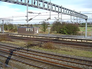
Norton Bridge railway station was a railway station located on the West Coast Main Line and served both the village of Norton Bridge and the town of Eccleshall in Staffordshire, England.

Derby Friargate railway station was the main station in Derby on the Great Northern Railway Derbyshire Extension, popularly known as the (Derby) Friargate Line.
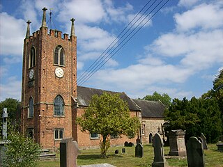
Seighford is a village and civil parish about 3 miles (5 km) west of Stafford in Staffordshire, England. The population of this civil parish at the 2011 census was 1,793. The ford across a small stream is the origin of the village's toponym. The village has a red brick Church of England parish church, St Chad's, and Seighford Hall, a 16th-century Tudor mansion.
The South Staffordshire Railway Walk is located in Staffordshire, England. It runs for five and a half miles from Castlecroft to Wall Heath. It is a local nature reserve.
Colwich is a civil parish and village in Staffordshire, England. It is situated off the A51 road, about 3 miles (5 km) north-west of Rugeley and 7 miles (11 km) south-east of Stafford. It lies principally on the north-east bank of the River Trent, near Wolseley Bridge and just north of The Chase. The parish comprises about 2,862 hectares (28.62 km2) of land in the villages and hamlets of Colwich, Great Haywood, Little Haywood, Moreton, Bishton and Wolseley Bridge.

Postland railway station was a station on the Great Northern and Great Eastern Joint Railway in Crowland, Lincolnshire, which is now closed. It took its name from the Postland estate, owned by the Marquess of Exeter. It originally opened in 1867, and remained open to passengers until 1961. Services to Cambridge and Doncaster ran from here.
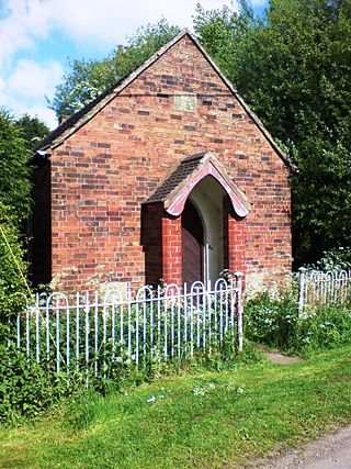
Coton Clanford is a small dispersed Staffordshire village lying in gently rolling countryside 3 miles (4.8 km) due west of Stafford, England, and 1 mile (1.6 km) southeast of Seighford. The name of the village is sometimes hyphenated to Coton-Clanford, appearing this way on some cottage names locally. The population for this village as taken at the 2011 census can be found under Seighford. It lies midway between the B5405 road, 1½ miles to the north and the A518 1½ miles to the south.

Derrington is a village west of the town of Stafford, in Staffordshire, England. For population details from the 2011 census see under Seighford.

Tetbury railway station was the terminus station on the Tetbury branch line, serving the Gloucestershire town of Tetbury.

Great Bridgeford railway station served the village of Great Bridgeford, Staffordshire, England from 1837 to 1959 on the Stafford-Manchester line.


