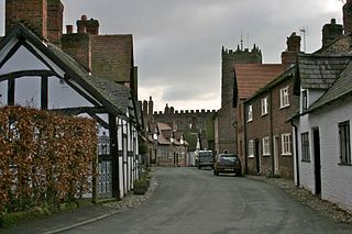
Great Budworth is a village and civil parish in Cheshire, England, four miles (6.4 km) north of Northwich off the A559 road, east of Comberbach, northwest of Higher Marston and southeast of Budworth Heath. Until 1948, Great Budworth was part of the Arley Hall estate.
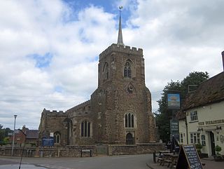
Gamlingay is a village and civil parish in the South Cambridgeshire district of Cambridgeshire, England about 14 miles (23 km) west southwest of Cambridge.

Lechlade is a town at the edge of the Cotswolds in Gloucestershire, England, 55 miles (89 km) south of Birmingham and 68 miles (109 km) west of London. It is the highest point at which the River Thames is navigable, although there is a right of navigation that continues south-west into Cricklade, in the neighbouring county of Wiltshire. The town is named after the River Leach that joins the Thames near the Trout Inn and St. John's Bridge.

Broadway is a large village and civil parish in the Cotswolds, England, with a population of 2,540 at the 2011 census. It is in the far southeast of Worcestershire, close to the Gloucestershire border, midway between Evesham and Moreton-in-Marsh. It is sometimes referred to as the "Jewel of the Cotswolds".

Arreton is a village and civil parish in the central eastern part of the Isle of Wight, England. It is about 3 miles south east of Newport.
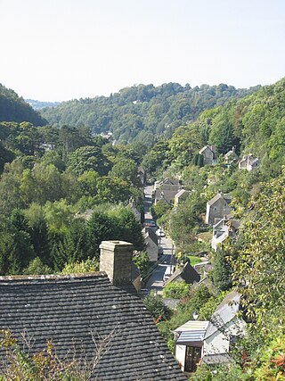
Chalford is a large village in the Frome Valley of the Cotswolds in Gloucestershire, England. It is to the southeast of Stroud about four miles upstream. It gives its name to Chalford parish, which covers the villages of Chalford, Chalford Hill, France Lynch, Bussage and Brownshill, spread over two square miles of the Cotswold countryside. At this point the valley is also called the Golden Valley.

Hillesley is a village in Gloucestershire, England. It was transferred from the county of Avon in 1991 and is now in Stroud District. The village forms part of the civil parish of Hillesley and Tresham. It is close to the Cotswold Edge, near the Cotswold Way and about 2+1⁄2 miles (4.0 km) south of the town of Wotton under Edge.

Barnsley is a village and civil parish in the Cotswold district of Gloucestershire, England, 3.7 miles (6.0 km) northeast of Cirencester. It is 125 kilometres (78 mi) (geodesically) west of London.

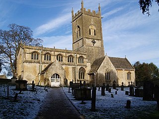
Bledington is a village and civil parish in the Cotswold district of Gloucestershire, England, about four miles southeast of Stow-on-the-Wold and six miles southwest of Chipping Norton. The population of the civil parish in 2014 was estimated to be 490.

Brooke is a village and civil parish in the English county of Norfolk.

Shipton-under-Wychwood is a village and civil parish in the Evenlode valley about 4 miles (6.4 km) north of Burford, in the West Oxfordshire district, in the county of Oxfordshire, England. The village is one of three named after the ancient forest of Wychwood. The others are Milton-under-Wychwood immediately to the west of the village and Ascott-under-Wychwood about 1.5 miles (2.4 km) to the east. The 2011 Census recorded Shipton-under-Wychwood's parish population as 1,244.

Fen Ditton is a village and civil parish in the South Cambridgeshire district, on the northeast edge of Cambridge in Cambridgeshire, England. In 2011 the parish had a population of 760. The parish covers an area of 5.99 square kilometres (2 sq mi).

Stanton is a village and civil parish in Tewkesbury Borough, Gloucestershire, England. The village is a spring line settlement at the foot of the Cotswold escarpment, about 2.5 miles (4 km) southwest of Broadway in neighbouring Worcestershire. Broadway is Stanton's postal town. The 2011 Census recorded the parish's population as 198.

Wyck Rissington is a village and civil parish in the picturesque Cotswold hills of Gloucestershire, England. The village is located 1.5 miles (2.4 km) north-east of Bourton-on-the-Water. The name 'Wyck Rissington' translates from the Saxon as "A building of special significance on a hill covered with brushwood".
Withington is a Cotswold village and civil parish in Gloucestershire, England, about 7 miles (11 km) southeast of Cheltenham and 8 miles (13 km) north of Cirencester. The River Coln runs through the village. The parish includes the hamlets of Hilcot, Foxcote and Cassey Compton. The parish population taken at the 2011 census was 532.

Stalisfield is a village in the borough of Swale in Kent, England, located on a secondary road about 1½ miles (2.4 km) north of Charing and 5 miles south west of Faversham. The parish includes the hamlet of Stalisfield Green.

Leonard Stanley, or Stanley St.Leonard, is a village and parish in Gloucestershire, England, 95 miles (150 km) west of London and 3.5 miles (5.5 km) southwest of the town of Stroud. Situated beneath the Cotswold escarpment overlooking the Severn Vale, the surrounding land is mainly given over to agricultural use. The village is made up of some 600 houses and has an estimated population of 1,545 as of 2019. The hamlet of Stanley Downton lies less than a mile to the north and lies within the parish. In 1970, the village was twinned with the commune of Dozulé in the Calvados region of Normandy, northern France.
Thirkleby High and Low with Osgodby is a civil parish in North Yorkshire, England. The parish includes the villages of Great Thirkleby and Little Thirkleby and the scattered hamlet of Osgodby. The similarly named medieval settlement of Thirkleby Manor is around 30 miles north, in the parish of Kirby Grindalythe, Ryedale District. The population of the civil parish taken at the 2011 Census was 266.
Dr Victor Ambrose Eyles FRSE FGS (1895–1978) was a British geologist and science historian. He was the founder of the Society for the Bibliography of Natural History in 1936. Joan Eyles, his wife, donated the Eyles Collection, their collection of papers on the history and practice of geology, to the University of Bristol.

Bourton-on-the-Water model village is a scale model village in the grounds of the Old New Inn in Bourton-on-the-Water, Gloucestershire, England. One of the first model villages in the country, it was started in 1936 and completed in 1940. The model represents the core of Bourton-on-the-Water as it appeared in 1936 in 1:9 scale. The model village contains around 100 buildings. It is open to the public and includes exhibitions of other models on smaller scales.
 Bridleway to Great Rissington
 Entering Great Rissington
 Turning to Great Rissington
 Village Green in Great Rissington
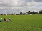 Cricket green in Great Rissington
 Typical village cottages in Great Rissington
 Another cottage in Great Rissington
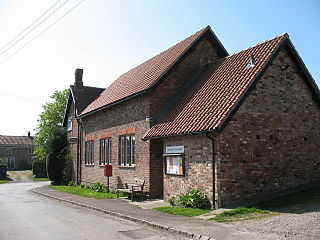
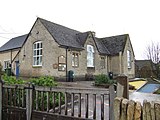 Primary school in Great Rissington
 The Lamb Inn, a pub in Great Rissington
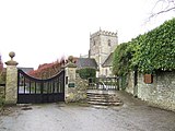 St John the Baptist's Church in Great Rissington


