
Interstate 595 (I-595), also known as the Port Everglades Expressway and unsigned FloridaState Road 862, is a 12.86-mile (20.70 km) auxiliary Interstate Highway that connects I-75 and Alligator Alley in the west with Florida's Turnpike, I-95, Fort Lauderdale–Hollywood International Airport, U.S. Highway 1, and SR A1A before terminating at Port Everglades in the east. The Interstate route was conceived in 1969 and planned as an Interstate starting in 1974. Construction began in 1984, with the expressway opening in stages in the late 1980s, with completion in 1991. The reversible tolled express lanes opened in 2014.

Florida State Road 9 (SR 9) is a state road in the U.S. state of Florida. While SR 9 is mainly used as a state designation for Interstate 95 in Florida from the Golden Glades Interchange in Miami Gardens to the Georgia border, a signed SR 9, which is locally known in the Miami area as West 27th Avenue, Unity Boulevard, and historically Grapeland Boulevard, extends 13 miles (21 km) from the Coconut Grove section of Miami to the Golden Glades Interchange. The segment of I-95 south of the Golden Glades Interchange carries the designation of State Road 9A.
State Road 874 (SR 874), named the South Miami Dade Don Shula Expressway for its length, is a controlled-access toll road in southern Miami-Dade County, Florida. It extends 7 miles (11 km) northeast from the Homestead Extension of Florida's Turnpike (HEFT) in southwestern Kendall to SR 826 in Glenvar Heights, allowing traffic from the far south of Miami-Dade County and the Florida Keys to move to more central regions of metropolitan Miami and vice versa, bypassing communities along US 1, while also permitting local access to the Kendall district. The road, named in honor of the long-serving coach of the Miami Dolphins NFL team, is maintained and tolled by the Miami-Dade Expressway Authority (MDX). Contrary to the numbering plan of Florida State Roads, SR 874 is signed north–south.
State Road 878 (SR 878), named the Snapper Creek Expressway, is a 2.7-mile (4.3 km) east–west controlled-access toll road south of Miami, Florida. The expressway is named for the nearby Snapper Creek which runs parallel to SR 878. It acts as a spur route of SR 874, providing access to U.S. Route 1 (US 1) near South Miami and local access to the eastern Kendall area while bypassing the Dadeland district. The road is maintained and tolled by the Greater Miami Expressway Agency (GMX).
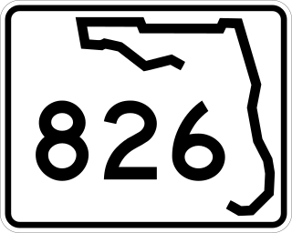
State Road 826 is a bypass route around the greater Miami area, traveling approximately 30 miles (48 km) in a northeasterly arc from U.S. Route 1 in Pinecrest to its terminus at State Road A1A in Sunny Isles Beach. Between its southern terminus and the Golden Glades Interchange, State Road 826 is known as the Palmetto Expressway, a heavily traveled freeway with portions of the road carrying in excess of 250,000 vehicles a day. Unlike many of the other non-interstate freeways in Miami-Dade County, the Palmetto Expressway is untolled. East of the interchange, State Road 826 is a surface road connecting North Miami and North Miami Beach to Sunny Isles Beach over the Intracoastal Waterway.

State Road 112 (SR 112) is a 9.9-mile-long (15.9 km) east–west state highway connecting Miami International Airport in Miami to Miami Beach in the U.S. state of Florida. Between the airport and Interstate 95, it is locally known as the Airport Expressway, and is a controlled-access toll road between SR 9 and I-95. Between I-95 and Alton Road (SR 907A) in Miami Beach, SR 112 is signed only as Interstate 195 as it crosses Biscayne Bay by way of the Julia Tuttle Causeway. Between I-195 and its eastern terminus at Collins Avenue (SR A1A), the SR 112 signs are present but infrequent, and the road is locally maintained as Arthur Godfrey Road.
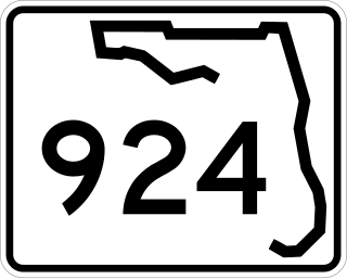
State Road 924 (SR 924) is an 8.5-mile (13.7 km) east–west highway connecting I-75 and SR 826 in Hialeah and SR 909 in North Miami. The westernmost 4.85 miles, named Gratigny Parkway, is a controlled-access toll road maintained by the Greater Miami Expressway Agency ; the easternmost 3.6 miles (5.8 km) is a surface street also known as Gratigny Road. Despite its relatively short length, SR 924 is a major east–west artery in northern Miami-Dade County.

The Dolphin East-West Expressway is a 15.4-mile (24.8 km) freeway, with the westernmost 14 miles (23 km) as an all-electronic tollway signed as State Road 836, and the easternmost 1.292 miles (2.079 km) between Interstate 95 (I-95) and SR A1A cosigned as Interstate 395 (I-395).

State Road 985, locally known as West 107th Avenue, FIU Avenue, and Avenue of the Americas, is a 7.604-mile (12.237 km) long north–south street in western Miami-Dade County, Florida, serving the communities of Kendall, University Park, Sweetwater, Fontainebleau, and Doral.
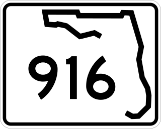
State Road 916, locally known as Northwest 138th Street, West 84th Street, North 135th Street, Opa-locka Boulevard, and Natural Bridge Road is a 10.253 miles (16.501 km) long east–west highway crossing northern Miami-Dade County, Florida. Its western terminus is at an interchange with Interstate 75 (I-75), the Palmetto Expressway, and the Gratigny Parkway on the boundary between Hialeah and Miami Lakes, traveling east to Biscayne Boulevard.

State Road 969, locally known as Milam Dairy Road and West 72nd Avenue, is a 5.2-mile-long (8.4 km) north–south street west of Miami International Airport in western Miami-Dade County, Florida. The southern terminus is currently an intersection with SR 968 in the city of Miami, and its northern terminus is an intersection with SR 934, just south of Medley.

Locally known as Northwest 36th Street and Doral Boulevard, the 3.998-mile-long (6.434 km) State Road 948 is a commercially important east–west highway in central Miami-Dade County, Florida. Its western terminus is a cloverleaf interchange with the Palmetto Expressway in Doral; its eastern terminus is an intersection with US 27 just east of LeJeune Road in the southern tip of Hialeah, just outside the city limits of Miami. Some maps incorrectly indicate a continuation of SR 948 to the east of the intersection with US 27. State Road 948 serves as a primary access for the cities of Miami Springs and Virginia Gardens and a maintenance and business access for Miami International Airport.

State Road 990 is the 2.97-mile-long (4.78 km) central section of the approximately 11.6-mile-long (18.7 km) Killian Drive, also known as Killian Parkway, Southwest 104th Street and Southwest 112th Street and historically South Kendall Drive, located in southern Miami-Dade County, Florida. Running from east to west, it serves to connect the community of The Hammocks with the village of Pinecrest via the community of Kendall, with State Road 990 connecting Southwest 107th Avenue and the Don Shula Expressway to the South Dixie Highway. Recognising the role the road played in southern Miami-Dade County's history and development, the section of State Road 990 between the Expressway and US 1 was designated the Killian Drive State Historic Highway by the Florida Senate in 1995.
The Homestead Extension of Florida's Turnpike (HEFT), designated as unsigned State Road 821 (SR 821), is the southern extension of Florida's Turnpike, a controlled-access toll road in the U.S. state of Florida maintained by Florida's Turnpike Enterprise (FTE). Spanning approximately 48 miles (77 km) along a north–south axis, it supplements the 265-mile (426 km) mainline to form the complete 309-mile (497 km) turnpike. The extension begins at its southern terminus at U.S. Route 1 (US 1) in Florida City, and transitions into the SR 91 mainline in Miramar at its northern end. Despite their designations as different state roads, the mainline and the extension are continuous in their exit numbering.

Sunset Drive, also known as Southwest 72nd Street is a 12.5-mile-long (20.1 km) east–west arterial road traversing the southwestern suburbs of Miami, Florida, from the northwestern portions of the Kendall area to Coral Gables. A central portion of Sunset Drive is maintained by the Florida Department of Transportation as State Road 986, which runs from the Homestead Extension (HEFT) underpass to Southwest 69th Avenue and is signed through South Miami to US 1.
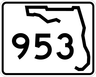
State Road 953, locally known as Le Jeune Road, is a 11.735 miles (18.886 km) long north–south street in Miami-Dade County, Florida running a few miles west of central Miami from U.S. Route 1 in Coral Gables to State Road 916 in Opa-locka. It is also known as West 42nd Avenue on the greater Miami grid plan and East 8th Avenue in the Hialeah grid plan.

Red Road, also known as West 57th Avenue, is a 20.6-mile (33.2 km) main north-south street running west of downtown Miami in Miami-Dade County, Florida and into Broward County. Red Road is signed as State Road 959 from U.S. 1 to the south end of the Miami International Airport, and State Road 823 from U.S. 27 to the Broward County line.

Interstate 75 (I-75) is a part of the Interstate Highway System that runs from the Hialeah–Miami Lakes border, a few miles northwest of Miami, to Sault Ste. Marie in the Upper Peninsula of Michigan. I-75 begins its national northward journey near Miami, running along the western parts of the Miami metropolitan area before traveling westward across Alligator Alley, resuming its northward direction in Naples, running along Florida's Gulf Coast, and passing the cities of Fort Myers, Punta Gorda, Venice, and Sarasota. The freeway passes through the Tampa Bay area before turning inward toward Ocala, Gainesville, and Lake City before leaving the state and entering Georgia. I-75 runs for 471 miles (758 km) in Florida, making it the longest Interstate in the state and also the longest in any state east of the Mississippi River. The Interstate's speed limit is 70 mph (110 km/h) for its entire length in Florida.
There have been plans in Florida for expressways, but some were never constructed due to financial problems, community opposition and environmental issues.
Kendall Drive, also known as Southwest 88th Street and historically North Kendall Drive, runs for 13.3 miles (21.4 km) in an east–west orientation across mid-southern Miami-Dade County, Florida. The majority of Kendall Drive, between State Road 997 at The Hammocks and US 1 on the Kendall–Pinecrest border, is signed as the 10.7-mile-long (17.2 km) State Road 94. The road serves as a major arterial road through the suburbs of the southern Miami metropolitan area, connecting its predominantly residential neighborhoods to shopping districts and to three freeways, allowing commuter travel.