Greenbooth Reservoir

Last updated
Greenbooth Reservoir
Greenbooth Reservoir, Rochdale.jpg
Location Rochdale, Greater Manchester
Coordinates 53°38′14″N2°13′07″W / 53.6373°N 2.2187°W / 53.6373; -2.2187 Coordinates: 53°38′14″N2°13′07″W / 53.6373°N 2.2187°W / 53.6373; -2.2187
Type reservoir
Basin  countries United Kingdom
Water volume 700×10^6 imp gal (2,600 acre⋅ft)

Greenbooth Reservoir is a reservoir to the north of Heywood and close to Norden in the Metropolitan Borough of Rochdale, within Greater Manchester, England.

Heywood, Greater Manchester town in the Metropolitan Borough of Rochdale, Greater Manchester, England

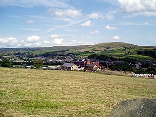
Heywood is a town in the Metropolitan Borough of Rochdale, Greater Manchester, England. Historically part of Lancashire, it had a population of 28,205 at the 2011 Census. The town lies on the south bank of the River Roch, 2.4 miles (3.9 km) east of Bury, 3.7 miles (6.0 km) west-southwest of Rochdale, and 7.4 miles (11.9 km) north of Manchester. Middleton lies to the south, whilst to the north is the Cheesden Valley, open moorland, and the Pennines. Heywood's nickname, Monkey Town, is known to date back to 1857.

Norden, Greater Manchester village in United Kingdom

Norden is a suburban village in the Metropolitan Borough of Rochdale, in Greater Manchester, England. Historically part of Lancashire, the village is situated on the western outskirts of Rochdale. There is a Rochdale Ward with the same name. At the 2011 Census this ward had a population of 9,766.

Metropolitan Borough of Rochdale Metropolitan borough in England

The Metropolitan Borough of Rochdale is a metropolitan borough of Greater Manchester in North West England. It is named after its largest town, Rochdale, but spans a far larger area which includes the towns of Middleton, Heywood, Littleborough and Milnrow, and the village of Wardle.

In 1846, Heywood Waterworks Company finished constructing the Naden Reservoirs (Lower Naden, Middle Naden and Higher Naden) in the valley above the village of Greenbooth. By the 1950s, the village consisted of around 80 cottages, a sweet shop, a Co-op store and a school. There was also a woollen mill. [1]

In 1958, Heywood and Middleton Water Board decided that another reservoir was needed to supply water to the growing population of Rochdale and started construction of Greenbooth Reservoir that same year. It took over two years to build, with the village abandoned, mostly demolished and then submerged. The reservoir was completed in 1961 and officially opened in August 1965. [2]

Rochdale town in Greater Manchester, England

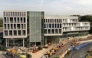
Rochdale is a town in Greater Manchester, England, at the foothills of the South Pennines on the River Roch, 5.3 miles (8.5 km) northwest of Oldham and 9.8 miles (15.8 km) northeast of Manchester. It is the administrative centre of the Metropolitan Borough of Rochdale, which had a population of 211,699 in 2011.

The only visible reminder of Greenbooth village today is a plaque on the side of the reservoir dam wall which reads: "This tablet commemorates the village of Greenbooth, the site of which is submerged beneath the waters of this reservoir." [3]

The four reservoirs are in a peaceful area for a country walk with good views of Manchester in the distance. Some of the wind turbines of Scout Moor Wind Farm are also visible from the surrounding paths.

Manchester City and metropolitan borough in England

Manchester is a city and metropolitan borough in Greater Manchester, England, with a population of 545,500 as of 2017. It lies within the United Kingdom's second-most populous built-up area, with a population of 3.2 million. It is fringed by the Cheshire Plain to the south, the Pennines to the north and east, and an arc of towns with which it forms a continuous conurbation. The local authority is Manchester City Council.

Scout Moor Wind Farm

Scout Moor Wind Farm is the second largest onshore wind farm in England. The wind farm, which was built for Peel Wind Power Ltd, produces electricity from 26 Nordex N80 wind turbines. It has a total nameplate capacity of 65 MW of electricity, providing 154,000 MW·h per year; enough to serve the average needs of 40,000 homes. The site occupies 1,347 acres (545 ha) of open moorland between Edenfield, Rawtenstall and Rochdale, and is split between the Metropolitan Borough of Rochdale in northern Greater Manchester and the Borough of Rossendale in south-eastern Lancashire. The turbines are visible from as far away as south Manchester, 15–20 miles (24–32 km) away.

Related Research Articles

River Derwent, Derbyshire principal river of Derbyshire, England

The Derwent is a river in Derbyshire, England. It is 66 miles (106 km) long and is a tributary of the River Trent, which it joins south of Derby. Throughout its course, the river mostly flows through the Peak District and its foothills.

River Roch river in Lancashire, United Kingdom

The River Roch is a river in Greater Manchester in North West England, a tributary of the River Irwell, that gives Rochdale its name.

Deanhead Reservoir reservoir in the United Kingdom

Deanhead Reservoir is a reservoir near Scammonden, in the metropolitan district of Kirklees, West Yorkshire, England.

Rochdale Canal

The Rochdale Canal is a navigable broad canal in Northern England, between Manchester and Sowerby Bridge, part of the connected system of the canals of Great Britain. Its name refers to the town of Rochdale, in Greater Manchester, through which it passes.

Heywood and Middleton (UK Parliament constituency) Parliamentary constituency in the United Kingdom

Heywood and Middleton is a constituency in Greater Manchester represented in the House of Commons of the UK Parliament since 2014 by Liz McInnes of the Labour Party.

River Ryburn river in the United Kingdom

The River Ryburn is a river in West Yorkshire, England. It flows through the villages of Rishworth, Ripponden and Triangle before flowing into the River Calder at Sowerby Bridge.

Capel Celyn village in United Kingdom

Capel Celyn was a rural community to the north west of Bala in Gwynedd, Wales, in the Afon Tryweryn valley. The village and other parts of the valley were flooded to create a reservoir, Llyn Celyn, in order to supply Liverpool and Wirral with water for industry. The village contained, among other things, a chapel, as the name suggests, capel being Welsh for chapel, while celyn is Welsh for holly.

Whitworth, Lancashire town and civil parish in Rossendale, Lancashire, England

Whitworth is a small town and civil parish in Rossendale, Lancashire, England, amongst the foothills of the Pennines between Bacup, to the north, and Rochdale, to the south. It had a population of 7,500 at the 2011 Census.

Castleton railway station

Castleton railway station serves Castleton in the Metropolitan Borough of Rochdale, Greater Manchester, England. It is 8¾ miles (14 km) north of Manchester Victoria on the Caldervale Line operated and managed by Northern.

River Nidd river in the United Kingdom

The River Nidd is a tributary of the River Ouse in the English county of North Yorkshire. In its first few miles it is dammed three times to create Angram Reservoir, Scar House Reservoir and Gouthwaite Reservoir which attract around 150,000 visitors a year. The Nidd can overflow the reservoirs, flooding the caves in the valley, in which case the river then flows along the normally dry river bed past Lofthouse through to Gouthwaite Reservoir. The Yorkshire Dales Rivers Trust YDRT has a remit to conserve the ecological condition of the River Nidd from its headwaters to the Humber estuary. The river gets its name for the Celtic word for brilliant.

Llanwddyn village in the United Kingdom

Llanwddyn is a village and community in Montgomeryshire, Powys, Wales. The community is centred on the Lake Vyrnwy reservoir. The original Llanwddyn village was submerged when the reservoir was created in the 1880s.

Mardale human settlement in United Kingdom

Mardale is a glacial valley in the Lake District, in northern England. The valley used to have a hamlet at its head, called Mardale Green, but this village was submerged in the late 1930s when the water level of the valley's lake, Haweswater, was raised to form Haweswater Reservoir by Manchester Corporation.

Cheesden Valley

The Cheesden Valley is a valley in the Heywood area of Greater Manchester, England. It runs on a north-south alignment between Bury and Rochdale in the Metropolitan Borough of Rochdale. Cheesden Brook runs through the valley, joining with Naden Brook to eventually run into the River Roch near Heywood. During the industrial age the valley became a centre of cotton production dependent on running water. The valley is now a conservation area.

Watergrove Reservoir lake in the United Kingdom

Watergrove Reservoir is a reservoir close to Wardle in the Metropolitan Borough of Rochdale, within Greater Manchester, England.

The Rochdale Way is a circular 45-mile (72 km) walking route around the Metropolitan Borough of Rochdale in Greater Manchester, which takes in the best scenery and interesting buildings of the area.

References

  1. "Greenbooth and naden valley" . Retrieved 2014-08-27.
  2. "Greenbooth and naden valley" . Retrieved 2014-08-27.
  3. "The Lost World of Green Booth". 2012. Retrieved 2014-08-27.