
A site of special scientific interest (SSSI) in Great Britain, or an area of special scientific interest (ASSI) in the Isle of Man and Northern Ireland, is a conservation designation denoting a protected area in the United Kingdom and Isle of Man. SSSI/ASSIs are the basic building block of site-based nature conservation legislation and most other legal nature/geological conservation designations in the United Kingdom are based upon them, including national nature reserves, Ramsar sites, Special Protection Areas, and Special Areas of Conservation. The acronym "SSSI" is often pronounced "triple-S I".
Derbyshire Wildlife Trust is one of 46 local Wildlife Trusts around the UK working to promote and protect local wildlife. It covers the whole of Derbyshire and was founded in 1962 in response to environmental threats to the local countryside, since when it has continued to grow. The trust is now based at East Mill on the River Derwent in the town of Belper, Derbyshire. It is a registered charity, supported by more than 14,000 members and over 500 volunteers.
Charnwood Forest is a hilly tract in north-western Leicestershire, England, bounded by Leicester, Loughborough and Coalville. The area is undulating, rocky and picturesque, with barren areas. It also has some extensive tracts of woodland, and significant Precambrian geology. Its elevation is generally 600 feet (180 m)and upwards, the area exceeding this height being about 6,100 acres (25 km2). The highest point, Bardon Hill, is 912 feet (278 m). On its western flank lies an abandoned coalfield, with Coalville and other former mining villages, now being regenerated and replanted as part of the National Forest. The M1 motorway, between junctions 22 and 23, cuts through Charnwood Forest.

Newtown River is a large natural inland harbour located on the Isle of Wight's northwestern coast, named after the nearby village of Newtown. It is sometimes also referred to as Newtown Creek.

Wotton Hill is a hill on the edge of the Cotswold Hills in Gloucestershire, England, 0.5 miles (0.80 km) north of Wotton-under-Edge. The Cotswold Way passes over the hill.
Swift's Hill is a 9.15-hectare (22.6-acre) biological and geological Site of Special Scientific Interest in Gloucestershire, notified in 1966 and renotified in 1984.
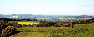
Cleeve Common is a 455-hectare (1,120-acre) biological and geological Site of Special Scientific Interest in Gloucestershire, England, notified in 1974. It is looked after by a small charity called Cleeve Common Trust, formally Cleeve Common Board of Conservators.

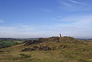
Minchinhampton Common is a 182.7-hectare (451-acre) biological and geological Site of Special Scientific Interest in Minchinhampton, Gloucestershire, England, notified in 1972.

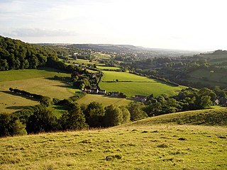
Rodborough Common is a 116.0-hectare (287-acre) biological and geological Site of Special Scientific Interest in Rodborough, Gloucestershire, England, notified in 1954. The site is listed in the ‘Stroud District’ Local Plan, adopted November 2005, Appendix 6 as an SSSI and a Regionally Important Geological Site (RIGS). The Common is also a Special Area of Conservation (SAC) under the EU Habitats Directive

Meadowtown is a hamlet in west Shropshire, England, in the civil parish of Worthen with Shelve. Neighbouring hamlets include Marton, Ox Wood, Crest Wood, and Rorrington.

Ripon Parks is a Site of Special Scientific Interest, or SSSI, situated north of Ripon, to the west of the River Ure and to the east of the village of North Stainley, in North Yorkshire, England. It was once part of the land held since the Middle Ages as a deer park by the archbishops of York and the canons of Ripon. The site was designated as an SSSI in 1983, because its varied habitats are valued for their breeding birds, amphibians and varied flora. The woods here are "of note" for the parasitic flowers of common toothwort and yellow star-of-Bethlehem. A small part of the site is accessible via public footpaths; there are no public facilities or dedicated car parks. The site incorporates the High Batts Nature Reserve, which is privately run for training, recording and educational purposes, and accessible to members only, except for its annual open day. Ripon Parks is now owned by the Ministry of Defence, and parts of the site are used as military training areas.
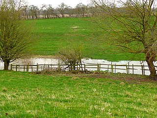
Kirk Deighton SSSI is a Site of Special Scientific Interest (SSSI) in Alton's Field, Kirk Deighton, North Yorkshire, England. This site has been recognised as having one of the largest known breeding populations of great crested newts in the United Kingdom. It is a Special Area of Conservation, and is listed for protection under a number of directives. This ordinary-looking grassland field, with a couple of ponds in it, is ideal habitat for the newts, which use the grassland for foraging, the ponds for breeding, and surrounding walls, hedges and woodpiles for hibernation. The site is not accessible to the public, and it is not permissible to survey the ponds without a licence.

Harbottle Moors is a Site of Special Scientific Interest (SSSI) within Northumberland National Park, in Northumberland, England. It is located near the village of Alwinton. The River Coquet forms the northern border of this protected area.
Otterburn Mires is a Site of Special Scientific Interest made up of eight separate patches of land. It is located within Northumberland National Park, in Northumberland, England, 3km east of Byrness,.
Bushy Hazels & Cwmma Moors is a Site of Special Scientific Interest (SSSI) near Eardisley in Herefordshire, England. This protected area contains patches of ancient woodland.
Fishpool Valley is a Site of Special Scientific Interest (SSSI) near Yarpole, Herefordshire, England. This protected area is an area of woodland that is important because of its bird diversity. This protected area is within the Croft Castle estate, owned by the National Trust.
Haugh Wood is a Site of Special Scientific Interest near Woolhope in Herefordshire, England. The protected area is recognised for its diversity of its insects. The Forestry Commission has provided waymarked butterfly trails in this protected area.
Ledbury Cutting is a Site of Special Scientific Interest near Ledbury, Hereforshire, England. The protected area is centred on a railway cutting on the Worcester and Hereford Railway, near to the entrance to the Ledbury Tunnel. The protected area is important because of the fossils of jawed fishes found in the local sediments.
Cottonshope Head Quarry is a Site of Special Scientific Interest within Northumberland National Park, Northumberland, England. It is located north of the hamlet of Cottonshopeburnfoot. The site is an abandoned quarry within a military training area.
Durtrees Burn Grassland is a Site of Special Scientific Interest (SSSI) in Northumberland National Park, Northumberland, England. It is located north of the village of Otterburn.
