Grenoble flood 1859

Last updated

Historically, centenarian floods did extensive damage in the Isere valley. In October 1859, it rained continuously for five days. A warm wind melted the snow, and the temperature suddenly increased from 12 to 19 degrees on 2 November. The simultaneity of those two events resulted in an exceptional flood. In a single night, the water in Grenoble rose at a rate of 15 to 20 cm per hour. [1]

Contents

Grenoble Flood 1859

On 2 November, water levels in the city reached 5.35m above the average low water mark, rising so quickly that people who went out with dry feet couldn't go home half an hour later. The whole inner city was flooded. [2] In the streets, the water rose from 1m 32 cm to 1m 50 cm, making normal movement impossible and forcing people to move in rafts. The violence of the water current aggravated the destruction, especially city infrastructure such as the Saint-Laurent bridge. Six people died during this flood, and the hospital had to retain its dead until 17 November, because they couldn't bury them in Saint Roch Cemetery . Casualty figures stayed low because the river rose relatively gently in the actual city of Grenoble. [3]

From an economic point of view, stocks of goods were destroyed. Stocks that had been set up by traders in order to prepare for big markets in November, like the market of Saint Andre, and military stocks, were washed away. [3]

There was at that time a wall around Grenoble, dating from Roman times. Parts of these remains are still visible. The objective was to prevent flood water from entering into the city. The cost of the 1859 flood damage to these walls added up to over 400 000 French Francs, valued in the local currency at the time of the event. [3]

Existing risks

Since then, public works have been done on the rivers, hydraulic dams and flood barrier river development. These developments have limited the subsequent extent of flooding. A government entity has been created, called "le Syndicat Mixte des Bassins Hydrauliques", which now manages the landscapes and provides prevention against the potential risks of modern flooding. [4]

Despite the construction of dams, which were designed to protect the people living next to the Isère, the town of Grenoble is still threatened by floods. [5] [6] Although for more than a century big floods haven't occurred, that doesn't exclude the threat. Eleven ruptures were noticed after the flood of 1859. These ruptures occurred at weak spots including boucle du bois Francais, [7] boucle de la Taillat (although the dam here is being reinforced), boucle de Gières, [7] courbe du campus. In 2001, the Isère attained a volume of 1000 m³/s, which caused local flooding almost everywhere there were modern weak spots. Some dams in the Grenoble catchment area are very weak, in bad condition and not large enough to contain flooding.[ citation needed ] It was only in 2011 that the government took action, and decided to invest in 112 projects, called SYMBHI [4] that will take seven years and will help reinforce the dam system. These were financed on the basis that it is cheaper to prevent that to repair. This project is 42% financed by the General Council of Isere, [8] 30% by the government, the ‘'intercomunalite ‘’ finances 20% and the "Eau Rhône-Méditerranée et Corse" 8%. Projects will start in pont de Charat and will end in Grenoble centre. In case of a major crisis, the losses could be evaluated at 400 or 500 million euros if the a disaster similar to that of 1859 were to happen again. Modern technology can predict a flood in the Isère 6 to 10 hours before it occurs. [9] An estimated 300,000 Grenoble citizens are directly exposed to floods. Finally, even though the flood of Isere in 1859 caused much damage, only 6 people died. [10]

The Flow of the Isère during the flood

There is currently a probability of one in ten that the flow of the Isere could attain 900 square metres per second (m/s), which would cause very little overflow. There is a probability of one in a hundred that this could rise to 1200 m/s, which is regarded as a dangerous scenario. There is a one in two hundred probability of flow rates of 1600 m/s,as in the flood of 1859. [11] [12]

Le Serpent et le Dragon Fountain

Le Serpent et le Dragon Fountain, Grenoble Climaise fontaine.jpg
Le Serpent et le Dragon Fountain, Grenoble

Next to the Saint-Laurent Bridge in the Place de la Cymaise, there is a fountain which represents the struggle against the waters. It was built by Pierre-Victor Sappey in 1840.[ citation needed ] The sculpture consists of a lion and a snake. Next to the fountain is written an Arpitan proverb: "La serpen et lo dragon mettront Grenoblo en savon" which means "the snake and the dragon will destroy Grenoble". The serpent symbolizes the Isère and the Dragon symbolizes the Drac. On the statue there is a lion's head instead of a dragon.

Related Research Articles

<span class="mw-page-title-main">Grenoble</span> Prefecture and commune in Auvergne-Rhône-Alpes, France

Grenoble is the prefecture and largest city of the Isère department in the Auvergne-Rhône-Alpes region of southeastern France. It was the capital of the Dauphiné historical province and lies where the river Drac flows into the Isère at the foot of the French Alps.

<span class="mw-page-title-main">Vercors Massif</span> Mountain range in southeastern France

The Vercors Massif is a range in France consisting of rugged plateaus and mountains straddling the départements of Isère and Drôme in the French Prealps. It lies west of the Dauphiné Alps, from which it is separated by the rivers Drac and Isère. The cliffs at the massif's eastern limit face the city of Grenoble.

<span class="mw-page-title-main">Isère (river)</span> River in Auvergne-Rhône-Alpes, France

The Isère is a river in the Auvergne-Rhône-Alpes region of southeastern France. Its source, a glacier known as the Sources de l'Isère, lies in the Vanoise National Park in the Graian Alps of Savoie, near the ski resort in Val-d'Isère on the border with Italy. An important left-bank tributary of the Rhône, the Isère merges with it a few kilometers north of Valence.

<span class="mw-page-title-main">Romanche</span> River in southeastern France

The Romanche is a 78.3-kilometre (48.7 mi) long mountain river in southeastern France. It is a right tributary of the Drac, which is itself a tributary of the Isère. Its drainage basin is 1,221 km2 (471 sq mi). Its source is in the northern part of the Massif des Écrins, Dauphiné Alps. It flows into the Drac in Champ-sur-Drac, south of Grenoble. The road from Grenoble to Briançon over the Col du Lautaret runs through the Romanche valley. There are several mountain and ski resorts in the valley, including Alpe d'Huez, La Grave and Les Deux Alpes.

<span class="mw-page-title-main">Drac (river)</span> River in southeastern France

The Drac is a 130-kilometre (81 mi) long river in southeastern France. It is a left tributary of the river Isère. It is formed at the confluence of the Drac Noir and the Drac Blanc, which both rise in the southern part of the Massif des Écrins, high in the French Alps. It flows through several reservoirs on its course, including the Lac de Monteynard-Avignonet. It flows into the Isère at Grenoble. Its major tributary is the Romanche.

<span class="mw-page-title-main">Le Bourg-d'Oisans</span> Commune in Auvergne-Rhône-Alpes, France

Le Bourg-d'Oisans is a commune in the Isère department in southeastern France.

The following is a list of the 29 cantons of the Isère department, in France, following the French canton reorganisation which came into effect in March 2015:

<span class="mw-page-title-main">Champ-sur-Drac</span> Commune in Auvergne-Rhône-Alpes, France

Champ-sur-Drac is a commune in the Isère department in southeastern France. It is situated at the foot of the Alps, at the confluence of the Romanche and the Drac. Its population was 3,007 in 2017. It is part of the Grenoble urban unit (agglomeration).

<span class="mw-page-title-main">Belledonne</span> Mountain range in the French Alps

Belledonne is a mountain range in the Dauphiné Alps in southeast France. The southern end of the range forms the eastern wall of the mountains that surround the city of Grenoble.

<span class="mw-page-title-main">Mayres-Savel</span> Commune in Auvergne-Rhône-Alpes, France

Mayres-Savel is a commune in the Isère department in southeastern France. Its inhabitants are called Mayrants or Mayrantes in French. It borders the communes of Marcieu to the west, Saint-Arey to the east and Prunières to the north.

<span class="mw-page-title-main">Auris, Isère</span> Commune in Auvergne-Rhône-Alpes, France

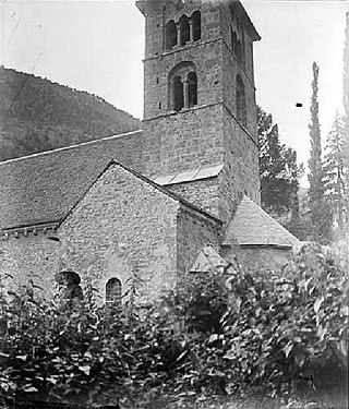
Auris is a commune in the Isère department in the Auvergne-Rhône-Alpes region of south-eastern France.

<span class="mw-page-title-main">Vaujany</span> Commune in Auvergne-Rhône-Alpes, France

Vaujany is a commune in the canton of Oisans-Romanche, in the Isère department in southeastern France. The village is picturesque, with excellent views of the Grand Galbert mountain at the head of the valley.

<span class="mw-page-title-main">Biviers</span> Commune in Auvergne-Rhône-Alpes, France

Biviers is a commune in the Isère département in southeastern France.

<span class="mw-page-title-main">Avignonet</span> Commune in Auvergne-Rhône-Alpes, France

Avignonet is a commune in the Isère department in the Auvergne-Rhône-Alpes region of south-eastern France.

<span class="mw-page-title-main">Livet-et-Gavet</span> Commune in Auvergne-Rhône-Alpes, France

Livet-et-Gavet is a commune in the Isère department in southeastern France.

<span class="mw-page-title-main">Victor Sappey</span> 19th-century French sculptor

Victor Sappey, also known as Pierre-Victor Sappey, was a French sculptor.

The Isère-Drac-Romanche Departmental Association is a public administrative establishment in France formed by the Conseil d'État in 1936. Its purpose is to maintain the system of flood-risk protection in the plains of the Isère, Drac, and Romanche rivers by preserving the integrity of embankments and their associated works. The organization performs all research and labor necessary for their preservation and keeps the system under constant surveillance in order to guarantee its efficiency in protecting the land and property at stake behind the embankments.

Grenoble Internet eXchange or GrenoblIX is the Internet eXchange point (IXP) of Grenoble in Isère and Auvergne – Rhône-Alpes region. GrenoblIX allows to the connected members to exchange the traffic in order to avoid passing by faraway infrastructures. This Internet eXchange point is managed by the non-profit organization Rezopole, founded in 2001.

<span class="mw-page-title-main">Flood of Grenoble (1219)</span>

The flood of Grenoble in 1219 was a natural disaster that took place in the plain of Grenoble on the night of 14 to 15 September 1219. It happened from the rupture of a natural dam near the village, of "Saint-Laurent-du-Lac."that had formed 28 year prior about 30 kilometers southeast of Grenoble, in the Romanch valley.

<span class="mw-page-title-main">Maquis de l'Oisans</span> French resistance group

During the Second World War, the Oisans maquis was an important center for the French Resistance, in the Oisans region between the Belledonne range and Grenoble to the north, the Grandes Rousses massif of the Alps and the Croix de Fer pass to the east, the Drac valley to the west and the Barre des Écrins and the Provencal Alps to the south.

References

  1. "Dossier thématique : l'inondation de grenoble lors de la crue du 2 Novembre 1859". Irma-grenoble.com. Retrieved 12 November 2011.
  2. "Galerie". Rdbrmc-travaux.com. Archived from the original on 25 April 2012. Retrieved 12 November 2011.
  3. 1 2 3 EOLAS. "La crue du 2 Novembre 1859" (in French). Symbhi.fr. Archived from the original on 25 April 2012. Retrieved 12 November 2011.
  4. 1 2 EOLAS. "SYMBHI" (in French). Symbhi.fr. Archived from the original on 2 November 2011. Retrieved 12 November 2011.
  5. "La plaine de Grenoble face aux inondations – Cemagref - Institut de recherche en sciences et technologies pour l'environnement" (in French). Cemagref.fr. 28 May 2010. Retrieved 12 November 2011.
  6. Claude, Aurélien; Zin, Isabella; Obled, Charles; Gautheron, Alain; Perret, Christian (2010). "Towards an Operational Flood Forecasting System Taking into Account Hydro-Power Plants Operations" (PDF). BALWHOIS. Archived from the original (PDF) on 25 April 2012. Retrieved 12 November 2011.{{cite journal}}: Cite journal requires |journal= (help)
  7. 1 2 "1968 : la coupure de la boucle de Bois Français - AD Isère Drac Romanche - Toute l'actualité des digues et du système de protection contre les inondations". Isere-drac-romanche.fr. Retrieved 12 November 2011.
  8. "Isere (evenement)". Regionsmd.com. Retrieved 12 November 2011.
  9. "IRMa : Institut des Risques Majeurs de Grenoble (Rhône Alpes)". Irma-grenoble.com. Retrieved 12 November 2011.
  10. Dumas, Dominique (2004). "The two memorable floods on the Isère in Grenoble (1651 and 1859) : An analysis of estimates by M. Pardé". Revue de géographie alpine. 92 (92–3): 39–49. doi:10.3406/rga.2004.2307 . Retrieved 12 November 2011.
  11. EOLAS. "Le risque d'inondation" (in French). Ode38.fr. Archived from the original on 25 April 2012. Retrieved 12 November 2011.
  12. EOLAS. "Informations sur les risques - Ville de Grenoble" (in French). Grenoble.fr. Retrieved 12 November 2011.

Bibliography