
The Marble Arch is a 19th-century white marble-faced triumphal arch in London, England. The structure was designed by John Nash in 1827 as the state entrance to the cour d'honneur of Buckingham Palace; it stood near the site of what is today the three-bayed, central projection of the palace containing the well-known balcony. In 1851, on the initiative of architect and urban planner Decimus Burton, a one-time pupil of John Nash, the arch was relocated to its current site, near the northeast corner of Hyde Park, so that expansion of Buckingham Palace could proceed.
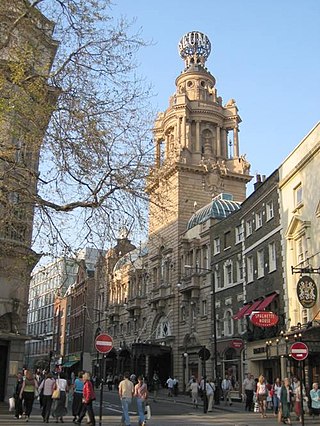
St Martin's Lane is a street in the City of Westminster, which runs from the church of St Martin-in-the-Fields, after which it is named, near Trafalgar Square northwards to Long Acre. At its northern end, it becomes Monmouth Street. St Martin's Lane and Monmouth Street together form the B404.

Coade stone or Lithodipyra or Lithodipra is stoneware that was often described as an artificial stone in the late 18th and early 19th centuries. It was used for moulding neoclassical statues, architectural decorations and garden ornaments of the highest quality that remain virtually weatherproof today.

Campden Hill is a hill in Kensington, West London, bounded by Holland Park Avenue on the north, Kensington High Street on the south, Kensington Palace Gardens on the east and Abbotsbury Road on the west. The name derives from the former Campden House, built by Baptist Hicks, 1st Viscount Campden whose country seat was Campden House in the Gloucestershire town of Chipping Campden.

Camberwell Grove is a residential street in Camberwell, London, England, in the Borough of Southwark. It follows the line of a grove of trees, hence the name. The street once led from a Tudor manor house south to the top of a hill, which afforded a view of the City of London, approximately three miles to the north. Today, the grove is part of Camberwell Grove Conservation area.
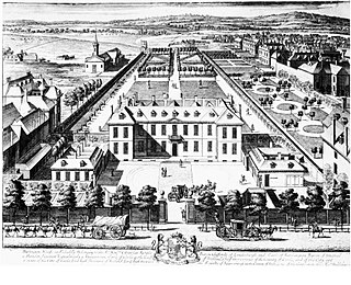
Burlington Gardens is a street in central London, on land that was once part of the Burlington Estate.

Vigo Street is a short street in central London that is named after the Anglo-Dutch naval victory over the French and Spanish in the 1702 Battle of Vigo Bay. It has important literary connections.
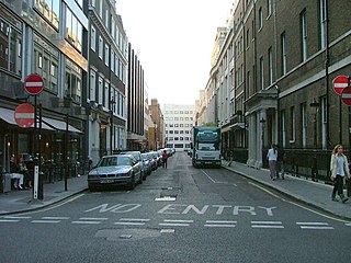
Old Burlington Street is a street in central London that is on land that was once part of the Burlington Estate.
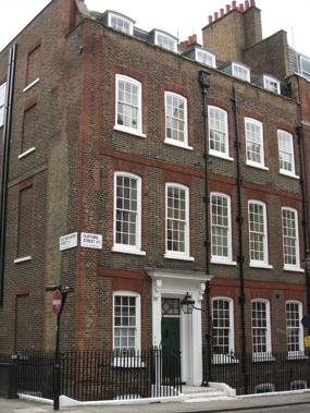
Clifford Street is a street in central London, built in the early 18th century, on land that once formed part of the Burlington Estate. It is named after the Clifford family, Earls of Cumberland. The daughter and heiress of the last holder of that title was the mother of the first Lord Burlington.

Fore Street is a street in the City of London, England, near the Barbican Centre. It runs from Wood Street to Fore Street Avenue and is joined by Moor Lane on its north side. The street was extensively damaged by Nazi bombing during World War II and, following later development, nothing now remains of its original buildings other than St Giles-without-Cripplegate, which is a short distance away from the modern street.

Rathbone Place is a street in central London that runs roughly north-west from Oxford Street to Percy Street. it is joined on its eastern side by Percy Mews, Gresse Street, and Evelyn Yard. The street is mainly occupied by retail and office premises.

Thayer Street is a street in the Marylebone district of the City of Westminster, London, that contains four listed buildings.
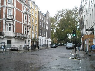
Hinde Street is a street in the Marylebone district of the City of Westminster, London, that contains the Hinde Street Methodist Church and was home to the novelist Rose Macaulay until her death.

Mount Street is an east–west, quite narrow, archetypal street in the Mayfair district of the City of Westminster, London fronted by many mid-rise buildings, mostly of a narrow frontage. The sides of two very grand hotels flank part of either end of the street. Small, high-end property businesses, investment funds and accountancy businesses punctuate the buildings as well as a row of traditional businesses and conversion-style mansion block apartments or, more generally, authentic such homes.

Stratton Street is a street in the Mayfair district of the City of Westminster, London. It runs from Berkeley Street in the north to Piccadilly in the south.

Mayfair Place is a street in the City of Westminster, London. The street joins Stratton Street to Berkeley Street.

Cornwall Gardens is a long narrow garden square in South Kensington, London, England.

Milford Lane is a narrow street in the City of Westminster that runs from Strand in the north to a brief walkway section leading to Temple Place in the south. It is joined by Little Essex Street and Essex Street on its eastern side. Maltravers Street once joined the lane to Arundel Street, but ceased to exist when building work at 190 Strand was completed.

Oakley Street is in the Royal Borough of Kensington and Chelsea, London. It runs roughly north to south from King's Road to the crossroads with Cheyne Walk and the River Thames, where it continues as the Albert Bridge and Albert Bridge Road. The street was named after Baron Cadogan of Oakley.

Chepstow Place is a street in London that runs from the junction of Westbourne Grove and Pembridge Villas in the north to Pembridge Square in the south. It is crossed by Dawson Place and joined on its eastern side by Rede Place. The east side is in the City of Westminster and the west side in the Royal Borough of Kensington and Chelsea.


