Grindle Rock

Last updated

Grindle Rock ( 59°01′06.2″S26°39′27.5″W / 59.018389°S 26.657639°W / -59.018389; -26.657639 Coordinates: 59°01′06.2″S26°39′27.5″W / 59.018389°S 26.657639°W / -59.018389; -26.657639 ) is a conspicuous rock, 213 metres (700 ft) high, lying 0.7 nautical miles (1.3 km) west of Bristol Island in the South Sandwich Islands. It was discovered by a British expedition under James Cook in 1775. It was recharted in 1930 by Discovery Investigations personnel on the Discovery II and named by them for Sir Gilbert E.A. Grindle, Permanent Under-Secretary of State for the British Colonies. [1]

Geographic coordinate system Coordinate system

A geographic coordinate system is a coordinate system that enables every location on Earth to be specified by a set of numbers, letters or symbols. The coordinates are often chosen such that one of the numbers represents a vertical position and two or three of the numbers represent a horizontal position; alternatively, a geographic position may be expressed in a combined three-dimensional Cartesian vector. A common choice of coordinates is latitude, longitude and elevation. To specify a location on a plane requires a map projection.

Bristol Island island

Bristol Island is an 8 km (5-mile) long island lying midway between Montagu Island and Thule Island in the South Sandwich Islands.

James Cook 18th-century British explorer

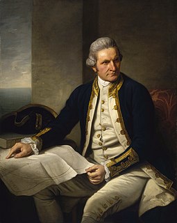
Captain James Cook was a British explorer, navigator, cartographer, and captain in the Royal Navy. He made detailed maps of Newfoundland prior to making three voyages to the Pacific Ocean, during which he achieved the first recorded European contact with the eastern coastline of Australia and the Hawaiian Islands, and the first recorded circumnavigation of New Zealand.

Grindle Rock is the easternmost of a chain of rocks extending WSW from Turmoil Point, the westernmost point of Bristol Island. These are Grindle Rock, Wilson Rock and Freezland Rock.

Turmoil Point is the western point of Bristol Island, South Sandwich Islands. This imposing point, rising to 400 m and culminating in a snow-covered summit, is a distinctive landmark when viewed from the west. Named by United Kingdom Antarctic Place-Names Committee (UK-APC). The name refers to the violent air streams commonly encountered during flying operations from HMS seas typical of the locality.

Wilson Rock is a rock, 183 m high, lying 1.4 nautical miles (2.6 km) west of Bristol Island in the South Sandwich Islands. Discovered by Captain James Cook in 1775, but more accurately charted by Admiral Thaddeus Bellingshausen in 1819-20. Recharted in 1930 by DI personnel on the Discovery II and named for Sir Samuel H. Wilson, Permanent Under-Secretary of State for the British Colonies.

Freezland Rock is a conspicuous sharp-pointed rock, 305 metres (1,000 ft) high, located 2 nautical miles (4 km) west of Bristol Island in the South Sandwich Islands. This feature was originally named "Freezland Peak"" by Captain Cook, after Samuel Freezland, the seaman who first sighted it and so discovered the South Sandwich group in 1775. Cook's chart, showing the feature as an insular rock, was verified in 1930 by Discovery Investigations personnel on the Discovery II and the terminology has been altered accordingly.

Related Research Articles

Possession Bay bay

Possession Bay is a bay 2 miles (3.2 km) wide on the north coast of South Georgia, an island in the southern Atlantic Ocean. It recedes southwest for 5 miles (8 km), and is separated from Cook Bay to the north by Black Head promontory. It is connected to King Haakon Bay by Shackleton Gap, a mountain pass.

Elsehul is a bay along the north coast of South Georgia Island in the southern Atlantic Ocean. Elsehul is approximately 0.5 miles (0.8 km) wide, and is separated from nearby Undine Harbour by the narrow Survey Isthmus. The name "Elsehul" dates back to the period 1905–12 and was probably applied by Norwegian sealers and whalers working in the area. A shoal known as Fairway Patch, first labelled as such on a 1931 British Admiralty chart, lies in the entrance of the bay.

Beach Point is the northeast tip of Thule Island, in the South Sandwich Islands, made conspicuous by a bare rock ridge and a narrow beach of boulders and pebbles. It was charted and named in 1930 by DI personnel on the Discovery II who made a landing there.

Bell Point is a rocky headland lying 11 km (7 mi) southwest of Stigant Point near the western end of King George Island, in the South Shetland Islands of Antarctica. It was charted, and named "Rocky Point", by Discovery Investigations personnel on the Discovery II in 1935; in order to avoid duplication, the name was rejected by the UK Antarctic Place-Names Committee in 1960 and a new one substituted. Bell Point is named for Dennis R. Bell (1934–59), a Falkland Islands Dependencies Survey meteorological assistant at Admiralty Bay from 1958 to July 26, 1959, when he lost his life in a crevasse.

Boot Rock is a rock, 30 metres (100 ft) high, which lies 0.1 nautical miles (0.2 km) off the southeast side of Candlemas Island in the South Sandwich Islands. It was charted and named by Discovery Investigations personnel on the Discovery II in 1930.

Caraquet Rock

Caraquet Rock is a rock lying nearly 4 nautical miles (7 km) west-southwest of Bell Point, off the west part of King George Island in the South Shetland Islands. It was named by the UK Antarctic Place-Names Committee in 1960 for the sealing vessel Caraquet from Liverpool, which visited the South Shetland Islands in 1821–22.

Mount Darnley is a mountain, 1,100 metres (3,600 ft) high, in the south-central portion of Bristol Island in the South Sandwich Islands off Antarctica. It was charted in 1930 by Discovery Investigations personnel on the Discovery II, who named it for E.R. Darnley.

Fryer Point is the northern point of Bristol Island in the South Sandwich Islands. It was charted in 1930 by Discovery Investigations personnel on the Discovery II and named for Lieutenant Commander D.H. Fryer, Royal Navy, captain of H.M. Surveying Ship Fitzroy.

Douglas Strait is a strait 2 nautical miles (4 km) wide between Thule Island and Cook Island, in the South Sandwich Islands. The existence of this strait was first noted by a Russian expedition under Fabian Gottlieb von Bellingshausen in 1820. It was charted in 1930 by Discovery Investigations personnel on the Discovery II and named for Vice-Admiral Sir Percy Douglas, a member of the Discovery Committee.

Forsters Passage is a body of water between Bristol Island and Southern Thule in the South Sandwich Islands. In 1775, a British expedition under James Cook gave the name "Forster's Bay", after John R. Forster, a naturalist with the expedition, to what appeared to be a bay in essentially this position. The "bay" was determined to be a strait by a Russian expedition under Fabian Gottlieb von Bellingshausen in 1820.

Longlow Rock is a rock 1 nautical mile (2 km) south-southwest of Borley Point and 0.5 nautical miles (1 km) off the west shore of Montagu Island, in the South Sandwich Islands. It was charted and named in 1930 by Discovery Investigations personnel on the Discovery II.

Hewison Point

Hewison Point is a point which forms the east side of Ferguson Bay and the southeast end of Thule Island, in the South Sandwich Islands. It was first charted by a Russian expedition under Fabian Gottlieb von Bellingshausen in 1819–20. It was recharted in 1930 by Discovery Investigations personnel on the Discovery II who named it for Lieutenant Colonel Hewison of Ferguson Brothers, Port Glasgow, Scotland, builders of the Discovery II.

Herd Point is a point which forms the west side of Ferguson Bay at the south end of Thule Island, in the South Sandwich Islands. It was roughly charted by a Russian expedition under Fabian Gottlieb von Bellingshausen in 1819–20. It was recharted in 1930 by Discovery Investigations personnel on the Discovery II and named for R.D. Herd of Ferguson Brothers, Port Glasgow, Scotland, the builders of the Discovery II.

Maurice Channel is a strait 1.5 nautical miles (3 km) wide between Bellingshausen Island and Cook Island, in the South Sandwich Islands off Antarctica. In 1820, Fabian Gottlieb von Bellingshausen indirectly indicated the existence of the strait by describing Southern Thule as consisting of one high rock and three small islands. The strait was charted in 1930 by Discovery Investigations personnel on the Discovery II and named for Henry Gascoyne Maurice, a member of the Discovery Committee.

Hospital Point is a point formed by an ice cliff with a small amount of rock exposed at its base, lying at the north side of Yankee Harbour immediately east of Glacier Bluff, Greenwich Island, in the South Shetland Islands. It was charted and named "Rocky Point" by Discovery Investigations personnel on the Discovery II in 1935. In order to avoid duplication the UK Antarctic Place-Names Committee rejected this name in 1961 and substituted a new one. Hospital Point derives from "Hospital Cove", a name for Yankee Harbour in common use among British sealers in the 1820s and British whalers in the 1920s.

Limit Rock

Limit Rock is a rock awash, lying 2 nautical miles (4 km) east of North Foreland, the northeast cape of King George Island, in the South Shetland Islands on the Southern Ocean. It was charted in 1937 by Discovery Investigations personnel on the Discovery II, and so named because it marks the eastern limit of foul ground surrounding North Foreland.

References

PD-icon.svg This article incorporates  public domain material from the United States Geological Survey document "Grindle Rock" (content from the Geographic Names Information System ).

United States Geological Survey Scientific agency of the United States government

The United States Geological Survey is a scientific agency of the United States government. The scientists of the USGS study the landscape of the United States, its natural resources, and the natural hazards that threaten it. The organization has four major science disciplines, concerning biology, geography, geology, and hydrology. The USGS is a fact-finding research organization with no regulatory responsibility.

Geographic Names Information System geographical database

The Geographic Names Information System (GNIS) is a database that contains name and locative information about more than two million physical and cultural features located throughout the United States of America and its territories. It is a type of gazetteer. GNIS was developed by the United States Geological Survey in cooperation with the United States Board on Geographic Names (BGN) to promote the standardization of feature names.