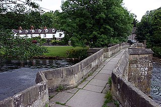
Grindleford Bridge is a grade II listed [1] stone bridge spanning the River Derwent in Grindleford, Derbyshire. The bridge is also a scheduled monument. [2]

Grindleford Bridge is a grade II listed [1] stone bridge spanning the River Derwent in Grindleford, Derbyshire. The bridge is also a scheduled monument. [2]
The bridge, which was built using sandstone ashlar, dates back to c1758, with later adjustments made in the 18th Century. [3] [4] The current bridge replaced an earlier wooden structure which was first referenced in 1577. [5]
The River Dane is a tributary of the River Weaver that originates in the Peak District area of England. The name of the river is probably from the Old Welsh dafn, meaning a "drop or trickle", implying a slow-moving river.

Derbyshire Dales is a local government district in Derbyshire, England. The population at the 2011 Census was 71,116. Much of it is in the Peak District, although most of its population lies along the River Derwent.

The Hope Valley is a rural area centred on the village of Hope, Derbyshire, in the Peak District in the northern Midlands of England.

Grindleford is a village and civil parish in the county of Derbyshire, in the East Midlands of England. The population of the civil parish as taken at the 2011 Census was 909. It lies at an altitude of 492 feet (150 m) in the valley of the River Derwent in the Peak District National Park. The 17th-century Grindleford Bridge crosses the river on the western side of the village. On the west side of the valley is the 1,407 feet (429 m) high Sir William Hill, and to the south-east lies the gritstone escarpment of Froggatt Edge. Grindleford became a parish in 1987, merging the parishes of Eyam Woodlands, Stoke, Nether Padley and Upper Padley.

Froggatt Edge is a gritstone escarpment in the Dark Peak area of the Peak District National Park, in Derbyshire, England, close to the villages of Froggatt, Calver, Curbar, Baslow and Grindleford. The name Froggatt Edge applies only to the northernmost section of the escarpment; the middle and southernmost sections are called Curbar Edge and Baslow Edge respectively. The escarpment, like many in this area, is easily accessible from Sheffield.

Grindleford railway station serves the village of Grindleford in the Derbyshire Peak District, in England, although the station is about a mile way, the nearest village being Nether Padley.

Barlow is a village and civil parish in the North East Derbyshire district of Derbyshire, England. According to the 2001 census the parish had a population of 884, increasing to 920 at the 2011 Census. The village is about 4 miles north-west of Chesterfield.

Padley Gorge is a deep but narrow valley in the Peak District, Derbyshire between the village of Grindleford and the A6187 road.

Burbage Brook is an upper tributary stream of the River Derwent in the Peak District of England.

Matlock Bridge also known as Derwent Bridge, is a stone bridge spanning the River Derwent in Matlock town centre, Derbyshire, England. The bridge dates back to the 15th century, and is a Grade II* listed structure.
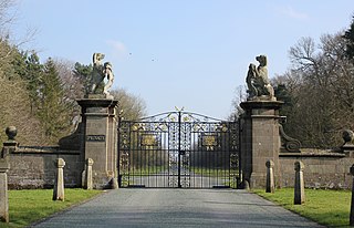
Belgrave is a historic village in Cheshire, England. The area is part of the estates owned the Dukes of Westminster who have their seat at Eaton Hall. The village has a few houses and the Grosvenor Garden Centre. Belgrave Lodge is located at the western end of the 1.7 mi (2.7 km) main approach to Eaton Hall, which is known as the Belgrave Avenue.

Darley Bridge is a grade II* listed stone bridge spanning the River Derwent in Darley Dale, Derbyshire. The bridge links the village with South Darley and Wensley.

Eyam Moor is a plateau-topped hill between the villages of Eyam and Hathersage in Derbyshire, in the Peak District. The summit of Sir William Hill is 429 metres (1,407 ft) above sea level.

Totley Moor is an open moorland hill to the west of the Sheffield suburb of Totley, in the Derbyshire Peak District. The summit is 395 metres (1,296 ft) above sea level.
Holme Bridge is a grade I listed packhorse bridge spanning the River Wye in Bakewell, Derbyshire. The bridge is a Scheduled monument.
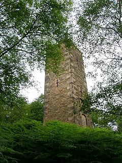
Reform Tower also known as Earl Grey Tower is a Grade-II listed gritstone tower located on Stanton Moor, Derbyshire, England. The tower overlooks the Nine Ladies stone circle.

Baslow Bridge is a grade I listed stone bridge spanning the River Derwent in Baslow, Derbyshire. The bridge is also a scheduled monument.

Conksbury Bridge is a grade II listed stone bridge spanning the River Lathkill south of Over Haddon in the Peak District, Derbyshire. The bridge is named after Conksbury, the nearby deserted medieval settlement that stands to the west.

Mill Bridge is a grade II listed stone bridge crossing the River Lathkill in the hamlet of Alport in the Peak District, Derbyshire. The bridge is located close to an 18th-century corn mill.

Derwent Bridge also known as the Slippery Stones Bridge, is a packhorse bridge spanning the River Derwent, to the north of the Howden Reservoir, Derbyshire, England. The bridge is a Scheduled monument.
Coordinates: 53°17′48″N1°38′02″W / 53.2967°N 1.6340°W
| | This article about a bridge in the United Kingdom is a stub. You can help Wikipedia by expanding it. |