
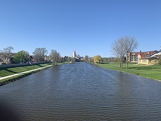
The Feather River is the principal tributary of the Sacramento River, in the Sacramento Valley of Northern California. The river's main stem is about 73 miles (117 km) long. Its length to its most distant headwater tributary is just over 210 miles (340 km). The main stem Feather River begins in Lake Oroville, where its four long tributary forks join—the South Fork, Middle Fork, North Fork, and West Branch Feather Rivers. These and other tributaries drain part of the northern Sierra Nevada, and the extreme southern Cascades, as well as a small portion of the Sacramento Valley. The total drainage basin is about 6,200 square miles (16,000 km2), with approximately 3,604 square miles (9,330 km2) above Lake Oroville.

The Etowah River is a 164-mile-long (264 km) waterway that rises northwest of Dahlonega, Georgia, north of Atlanta. On Matthew Carey's 1795 map the river was labeled "High Town River". On later maps, such as the 1839 Cass County map, it was referred to as "Hightower River", a name that was used in most early Cherokee records.

Pine River may refer to any of the following rivers in the U.S. state of Michigan:
The Cass River is a 61.5-mile-long (99.0 km) river in the Thumb region of the U.S. state of Michigan. It drains large portions of Sanilac and Tuscola counties and smaller portions of Genesee, Huron, Lapeer, and Saginaw counties.

The Saluda River is a principal tributary of the Congaree River, about 200 mi (320 km) long, in northern and western South Carolina in the United States. Via the Congaree River, it is part of the watershed of the Santee River, which flows to the Atlantic Ocean.

The Licking River is a tributary of the Muskingum River, about 40 mi (65 km) long, in central Ohio in the United States. Via the Muskingum and Ohio Rivers, it is part of the watershed of the Mississippi River.
The Pacolet River is a tributary of the Broad River, about 50 miles (80 km) long, in northwestern South Carolina in the United States. One of its principal headwaters tributaries also drains a small portion of western North Carolina. Via the Broad and Congaree rivers, it is part of the watershed of the Santee River, which flows to the Atlantic Ocean. The stream's name has also been spelled historically as "Pacolate River".
Paint Creek is a tributary of the Scioto River, 94.7 miles (152.4 km) long, in south-central Ohio in the United States. Via the Scioto and Ohio Rivers, it is part of the watershed of the Mississippi River. It drains an area of 1,143 square miles (2,960 km2).

The Dowagiac River is a southwesterly flowing 30.9-mile-long (49.7 km) stream in the Lower Peninsula of the U.S. state of Michigan. It is a tributary to the St. Joseph River which flows, in turn, into eastern Lake Michigan.

The Beaver River is an intermittent river, 280 miles (450 km) long, in western Oklahoma and northern Texas in the United States. It is a tributary of the North Canadian River, draining an area of 11,690 square miles (30,300 km2) in a watershed that extends to northeastern New Mexico and includes most of the Oklahoma Panhandle.

Prairie Dog Town Fork Red River is a sandy-braided stream about 120 mi (193 km) long, formed at the confluence of Palo Duro Creek and Tierra Blanca Creek, about 1.8 mi (2.9 km) northeast of Canyon in Randall County, Texas, and flowing east-southeastward to the Red River about 1 mi (2 km) east of the 100th meridian, 8 mi (13 km) south-southwest of Hollis, Oklahoma.
The Sulphur River is a 175-mile-long (282 km) river in northeast Texas and southwest Arkansas in the United States. It is a tributary of the Red River.
Codorus Creek is a 42.4-mile-long (68.2 km) tributary of the Susquehanna River in York County, Pennsylvania, in the United States.
Muddy Creek is a tributary of the Susquehanna River in York County, Pennsylvania, in the United States.
Sweetwater Creek is a stream in the Texas Panhandle and western Oklahoma. It is a tributary to the North Fork of the Red River.

The North Fork Red River, sometimes called simply the "North Fork", is a tributary of the Red River of the South about 271 mi (436 km) long, heading along the eastern Caprock Escarpment of the Llano Estacado about 11.4 mi (18.3 km) southwest of Pampa, Texas. Rising in Gray County, Texas, it terminates at the confluence with Prairie Dog Town Fork of the Red River at the Texas-Oklahoma border.

The Baker Branch Saint John River is a 48.0-mile-long (77.2 km) river. This river is a tributary of the Saint John River, flowing in the Maine North Woods, in Maine, in the Northeastern United States.

Temescal Creek is an approximately 29-mile-long (47 km) watercourse in Riverside County, in the U.S. state of California. Flowing primarily in a northwestern direction, it connects Lake Elsinore with the Santa Ana River. It drains the eastern slopes of the Santa Ana Mountains on its left and on its right the western slopes of the Temescal Mountains along its length. With a drainage basin of about 1,000 square miles (2,600 km2), it is the largest tributary of the Santa Ana River, hydrologically connecting the 720-square-mile (1,900 km2) San Jacinto River and Lake Elsinore watersheds to the rest of the Santa Ana watershed. However, flowing through an arid rain shadow zone of the Santa Ana Mountains, and with diversion of ground water for human use, the creek today is ephemeral for most of its length, except for runoff from housing developments and agricultural return flows.

The Downie River is an approximately 5.5 mi (8.9 km) tributary of the North Yuba River in Sierra County, California, in the United States. The river originates from the confluence of the West Branch Downie River and Rattlesnake Creek in the Tahoe National Forest, and flows south to its confluence with the North Yuba at Downieville. The river drains a mountainous watershed of about 34 sq mi (88 km2) in the northern Sierra Nevada. Tributaries include Lavezzola Creek and Pauley Creek, which both join the Downie from the left shortly above the mouth.

The Little Red River is an intermittent stream about 30 mi (48 km) long, formed at the confluence of the North Prong and South Prong Little Red River in Briscoe County, Texas, and flowing east-northeastward to join the Prairie Dog Town Fork Red River in Hall County, Texas.

