Gros Cap Cemetery | |
 | |
  | |
| Location | Southeast of Gros Cap on US 2 |
|---|---|
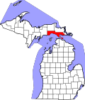
| Nearest city | Gros Cap, Michigan |
| Coordinates | 45°52′13″N84°47′57″W / 45.87028°N 84.79917°W |
| Area | 5.5 acres (2.2 ha) |
| Built | 1889 |
| NRHP reference No. | 71000406 [1] |
| Significant dates | |
| Added to NRHP | April 16, 1971 |
| Designated MSHS | November 6, 1970 [2] |
The Gros Cap Cemetery, once known as the Western Cemetery, [3] is a cemetery located southeast of Gros Cap, Michigan on US 2. It is one of the oldest cemeteries in the United States to be continuously used, [2] and a portion is contained in the Gros Cap Archaeological District. It was designated a Michigan State Historic Site in 1970 [2] and listed on the National Register of Historic Places in 1971. [1]