Lasanen Site | |
Location | Overlooking East Moran Bay, St. Ignace, Michigan [1] |
---|---|
Coordinates | 45°52′0″N84°44′0″W / 45.86667°N 84.73333°W |
Area | less than one acre |
NRHP reference No. | 71000412 [2] |
Added to NRHP | May 6, 1971 |
The Lasanen Site, designated 20MA21, is an archaeological site located in St. Ignace, Michigan. It was listed on the National Register of Historic Places in 1971. [2]
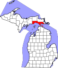
The Lasanen Site is located within the city of St. Ignace, on what was once a beach ridge above the Straits of Mackinac. [3] The site is a burial ground associated with the Iroquois culture. [4] Nineteen small burial pits, located in an area approximately 100 feet (30 m) by 50 feet (15 m), [5] were identified at the site. [3] Five more burial pits were found on adjacent property. [5]
The Lasanen Site was discovered in 1966, when a private landowner, Dr. W. C. Lasanen, unearthed human remains while excavating to construct a foundation. [3] Lasanen notified the Mackinac Island State Park Commission, and urgent salvage excavations were undertaken to recover the exposed human burials. Later in 1966, C. E. Cleland from Michigan State University, along with some students, undertook further excavations at the site. These excavations continued into 1967. [3]
The details unearthed at the burials are consistent with those witnessed and described by Antoine Laumet Cadillac in 1694–97, and may be the same. [3]
Fort Michilimackinac was an 18th-century French, and later British, fort and trading post at the Straits of Mackinac; it was built on the northern tip of the lower peninsula of the present-day state of Michigan in the United States. Built around 1715, and abandoned in 1783, it was located along the Straits, which connect Lake Huron and Lake Michigan of the Great Lakes of North America.
This is a list of properties on the National Register of Historic Places in the U.S. state of Michigan.
This National Park Service list is complete through NPS recent listings posted August 4, 2023.
This is a list of the National Register of Historic Places listings in Mackinac County, Michigan.
The Grand Village of the Illinois, also called Old Kaskaskia Village, is a site significant for being the best documented historic Native American village in the Illinois River valley. It was a large agricultural and trading village of Native Americans of the Illinois confederacy, located on the north bank of the Illinois River near the present town of Utica, Illinois. French explorers Louis Joliet and Father Jacques Marquette came across it in 1673. The Kaskaskia, a tribe of the Illiniwek people lived in the village. It grew rapidly after a French mission and fur trading post were established there in 1675, to a population of about 6,000 people in about 460 houses. Around 1691 the Kaskaskia and other Illiniwek moved further south, abandoning the site due to pressure from an Iroquois invasion from the northeast.
The St. Ignace Mission is located in a municipal park known as Marquette Mission Park. It was the site of a mission established by Jesuit priest, Father Jacques Marquette, and the site of his grave in 1677. A second mission was established at a different site in 1837, and the chapel was moved here in 1954. The second mission chapel is the oldest Catholic church in Michigan and Wisconsin. The St. Ignace Mission was designated a Michigan State Historic Site in 1956, and was declared a U.S. National Historic Landmarks in 1960, one of the earliest sites recognized. The mission chapel serves as the Museum of Ojibwa Culture.
Leary Site, also known as 25-RH-1 or Leary-Kelly Site is an archaeological site near Rulo, Nebraska and the Big Nemaha River. The site now lies entirely on the reservation of the Iowa Tribe of Kansas and Nebraska. The area was once a village and burial site.
The Younge site is an archeological site located in Goodland Township, Lapeer County, Michigan. It is classified as a prehistoric Late Woodland site and was designated as a Michigan State Historic Site on October 29, 1971. It was added to the National Register of Historic Places on October 29, 1976.
The Riverside Site, also known as 20-ME-1, is an archaeological site located near the Riverside Cemetery in Menominee, Michigan. It was listed on the National Register of Historic Places in 1978.
The Summer Island site, designated 20DE4, is an archaeological site located on the northwest side of Summer Island, in Delta County, Michigan. It is classified as a stratified, multi-component site with Middle Woodland, Upper Mississippian and Early Historic/Protohistoric occupations. It was listed on the National Register of Historic Places in 1971.
Spider Cave, also known as Burnt Bluff Cave or 20DE3, is an archaeological site located on the Garden Peninsula near Fayette, Michigan. It was listed on the National Register of Historic Places in 1971.
The Gros Cap Archaeological District is a set of three archaeological sites located in Moran Township, Michigan, USA, designated 20MK6, 20MK7 and 20MK111. It was listed on the National Register of Historic Places in 1982. The three sites cover 13.5 acres (5.5 ha) and include a village site and portions of the Gros Cap Cemetery.
The Gros Cap Cemetery, once known as the Western Cemetery, is a cemetery located southeast of Gros Cap, Michigan on US 2. It is one of the oldest cemeteries in the United States to be continuously used, and a portion is contained in the Gros Cap Archaeological District. It was designated a Michigan State Historic Site in 1970 and listed on the National Register of Historic Places in 1971.
The Juntunen site, also known as 20MK1, is a stratified prehistoric Late Woodland fishing village located on the western tip of Bois Blanc Island. It was listed on the National Register of Historic Places in 1978.
The Scott Point site, also known as 20MK22 or (erroneously) as the Point Patterson site, is an archaeological site located near the shore of Lake Michigan near Scott Point, south of Gould City, Michigan and west of Point Patterson. It was listed on the National Register of Historic Places in 1976.
The Boven Earthworks, also known as the Boven Enclosure, the Mosquito Creek Earthworks, the Falmouth Inclosure, or Missaukee III is a Native American archaeological site designated 20MA19 located near Falmouth and Lake City, Michigan along Mosquito Creek. It was listed on the National Register of Historic Places in 1973.
The Spoonville site, also designated 20OT1, is a historic archeological site, located on the banks of the Grand River in Crockery Township, Ottawa County, Michigan, United States. It was placed on the National Register of Historic Places in 1973.
The Wycamp Creek Site is an archaeological site located near Levering, Michigan. It was placed on the National Register of Historic Places in 1971.
The Moccasin Bluff site is an archaeological site located along the Red Bud Trail and the St. Joseph River north of Buchanan, Michigan. It was listed on the National Register of Historic Places in 1977, and has been classified as a multi-component prehistoric site with the major component dating to the Late Woodland/Upper Mississippian period.
The Fletcher Site, also designated 20BY28, is a Native American cemetery and archaeological site, located on the west bank of the Saginaw River in Bay City, Michigan. It was listed on the National Register of Historic Places in 1971.
The Bugai Site, designated 20SA215, is an archaeological site located near Bridgeport, Michigan. It was listed on the National Register of Historic Places in 1982.