External links
| General | |
|---|---|
| National libraries | |
| Commission overview | |
|---|---|
| Headquarters | Mackinaw City, Michigan |
| Annual budget | $2,950,800 |
| Commission executive |
|
| Parent Commission | Michigan Department of Natural Resources |
| Website | http://www.mackinacparks.com/ |
The Mackinac Island State Park Commission is an appointed board of the State of Michigan that administers state parklands in the Straits of Mackinac area. It performs public activities under the name Mackinac State Historic Parks. Park units include Mackinac Island State Park including Fort Mackinac and certain properties within the historic downtown of Mackinac Island, Michigan; Colonial Michilimackinac including Fort Michilimackinac and Old Mackinac Point Lighthouse; and Historic Mill Creek Discovery Park. It is assigned to the Michigan Department of Natural Resources.
Mackinac State Historic Parks is accredited by the American Alliance of Museums. Over one million artifacts are in the collection. which are overseen by a professional curatorial staff. Archeological digs are conducted, [1] and educational opportunities, including lesson plans, are available. [2] The commission maintains the official Michigan Governor's Summer Residence on Mackinac Island and distributes photographs, media kits, brochures and other promotional material. [3]
On July 15, 2009, the Park celebrated its 20 millionth visitor. [4]
In its present form, the commission was created by Act 451 of 1994 for the purpose of managing these parks. It is composed of seven members—appointed by the governor with the advice and consent of the State Senate—to serve six-year terms. In fiscal year 2003 the gross appropriation for the Mackinac park system was $2,950,800; $1,037,600 of this amount comes from the Mackinac Island state park fund, while $76,400 was generated from user fees. The state general fund made up the remaining $1,836,800. Some public critics have proposed that the Mackinac Island State Park and the Commission be privatized. [5] Management practices have been deemed effective in years past in independent audits. [6]
Budget cuts and ‘belt tightening’ have been on the agency's agenda for several years. [7]
The Mackinac Island State Park Commission was created as the governing body of Mackinac State Historic Parks. In 1875, the government land on Mackinac Island, which encompassed 50 percent of the island, was designated the second national park in the United States. In 1895, it was turned over to the state of Michigan, becoming Michigan's first state park. That year, the state legislature created the Mackinac Island State Park Commission to be stewards of the park and its many historic structures. Due to commission efforts, park land now encompasses 80 percent of Mackinac Island, which includes 1,800 acres (7.3 km2). The commission now also manages parks on the mainland. In total, the commission is responsible for a combined 2,500 acres (10 km2) of parkland within Mackinac State Historic Parks, more than 110 buildings and about 1.7 million artifacts. [8]
The chairman of the commission is the former Michigan House of Representatives Republican Leader Dennis O. Cawthorne. Other commission members include (youngest, oldest and longest serving) Michigan Attorney General Frank J. Kelley; Barry J. Goodman; Karen Karam; Richard A. Manoogian; Chuck Yob and William K. Marvin. [9]

Lake Michigan is one of the five Great Lakes of North America. It is the second-largest of the Great Lakes by volume and the third-largest by surface area, after Lake Superior and Lake Huron. To the east, its basin is conjoined with that of Lake Huron through the narrow Straits of Mackinac, giving it the same surface elevation as its easterly counterpart; the two are technically a single lake.

The Mackinac Bridge is a suspension bridge spanning the Straits of Mackinac, connecting the Upper and Lower peninsulas of the U.S. state of Michigan. Opened in 1957, the 26,372-foot-long bridge is the world's 26th-longest main span and the longest suspension bridge between anchorages in the Western Hemisphere. The Mackinac Bridge is part of Interstate 75 (I-75) and the Lake Michigan and Huron components of the Great Lakes Circle Tour across the straits; it is also a segment of the U.S. North Country National Scenic Trail. The bridge connects the city of St. Ignace on the north end with the village of Mackinaw City on the south.

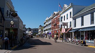
Mackinac Island is an island and resort area, covering 4.35 square miles (11.3 km2) in land area, in the U.S. state of Michigan. The name of the island in Odawa is Michilimackinac and "Mitchimakinak" in Ojibwe meaning "Big Turtle". It is located in Lake Huron, at the eastern end of the Straits of Mackinac, between the state's Upper and Lower Peninsulas. The island was long home to an Odawa settlement and previous indigenous cultures before European colonization began in the 17th century. It was a strategic center of the fur trade around the Great Lakes. Based on a former trading post, Fort Mackinac was constructed on the island by the British during the American Revolutionary War. It was the site of two battles during the War of 1812 before the northern border was settled and the US gained this island in its territory.

Mackinac County is a county in the Upper Peninsula of the U.S. state of Michigan. As of the 2020 Census, the population was 10,834. The county seat is St. Ignace. Formerly known as Michilimackinac County, in 1818 it was one of the first counties of the Michigan Territory, as it had long been a center of French and British colonial fur trading, a Catholic church and Protestant mission, and associated settlement.

Mackinac Island is a city in Mackinac County in the U.S. state of Michigan. As of the 2020 census, the city had a permanent population of 470. The summer population numbers in the thousands due to an influx of summer visitors and hundreds of seasonal workers.

Mackinaw City is a village in Emmet and Cheboygan counties in the U.S. state of Michigan. The population was 806 at the 2010 census; the population surges during the summer tourist season, including an influx of tourists and seasonal workers who serve in the shops, hotels and other recreational facilities there and in the surrounding region. Mackinaw City is at the northern tip (headland) of Michigan's Lower Peninsula along the southern shore of the Straits of Mackinac. Across the straits lies the state's Upper Peninsula. These two land masses are physically connected by the Mackinac Bridge, which runs from Mackinaw City north to St. Ignace. Mackinaw City is also the primary base for ferry service to Mackinac Island, located to the northeast in the straits.
Mackinac or Mackinaw may refer to:

Fort Mackinac is a former British and American military outpost garrisoned from the late 18th century to the late 19th century in the city of Mackinac Island, Michigan, on Mackinac Island. The British built the fort during the American Revolutionary War to control the strategic Straits of Mackinac between Lake Michigan and Lake Huron, and by extension the fur trade on the Great Lakes. The British did not relinquish the fort until thirteen years after the end of the American Revolutionary War. Fort Mackinac later became the scene of two strategic battles for control of the Great Lakes during the War of 1812. During most of the 19th century, it served as an outpost of the United States Army. Closed in 1895, the fort has been adapted as a museum on the grounds of Mackinac Island State Park.

Mackinac National Park was a United States national park that existed from 1875 to 1895 on Mackinac Island in northern Michigan, making it the second U.S. national park after Yellowstone National Park. The 1,044-acre (422 ha) park was created in response to the growing popularity of the island as a summer resort. Its creation was largely the result of efforts by United States Senator Thomas W. Ferry, a native of the island. Senate Bill 28 "to set aside a certain portion of the island of Mackinaw and the straits of Mackinaw, within the State of Michigan as a national park" was introduced December 2, 1874, and signed by President Ulysses S. Grant on March 3, 1875. The national park covered 821 acres while the fort retained 103 acres and the remainder of the island was privately owned.

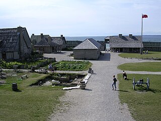
Fort Michilimackinac was an 18th-century French, and later British, fort and trading post at the Straits of Mackinac; it was built on the northern tip of the lower peninsula of the present-day state of Michigan in the United States. Built around 1715, and abandoned in 1783, it was located along the Straits, which connect Lake Huron and Lake Michigan of the Great Lakes of North America. Present-day Mackinaw City developed around the site of the fort, which has been designated as a National Historic Landmark. It is preserved as an open-air historical museum, with several reconstructed wooden buildings and palisade.
M-185 is a state trunkline highway in the U.S. state of Michigan that circles Mackinac Island, a popular tourist destination on the Lake Huron side of the Straits of Mackinac, along the island's shoreline. A narrow paved road of 8.004 miles (12.881 km), it offers scenic views of the straits that divide the Upper and the Lower peninsulas of Michigan and Lakes Huron and Michigan. It has no connection to any other Michigan state trunkline highways—as it is on an island—and is accessible only by passenger ferry. The City of Mackinac Island, which shares jurisdiction over the island with the Mackinac Island State Park Commission (MISPC), calls the highway Main Street within the built-up area on the island's southeast quadrant, and Lake Shore Road elsewhere. M-185 passes by several important sites within Mackinac Island State Park, including Fort Mackinac, Arch Rock, British Landing, and Devil's Kitchen. Lake Shore Road carries the highway next to the Lake Huron shoreline, running between the water's edge and woodlands outside the downtown area.

Mackinac Island State Park is a state park located on Mackinac Island in the U.S. state of Michigan. A Lake Huron island, it is near the Straits of Mackinac. The island park encompasses 1,800 acres (7.3 km2), which is approximately 80% of the island's total area. The park is also within the boundaries of the city of Mackinac Island and has permanent residents within its boundaries. M-185 circles the perimeter of the park as the only motorless highway in the state due to the island's ban of automobiles. The park is governed by the Michigan Department of Natural Resources and the Mackinac Island State Park Commission. On July 15, 2009, the park celebrated its 20 millionth visitor.

Fort Michilimackinac State Park is a state park in the U.S. state of Michigan. It is located in Mackinaw City along the Straits of Mackinac. The park contains Fort Michilimackinac, which itself is dedicated a National Historic Landmark and Old Mackinac Point Lighthouse as well as the Old Mackinac Point Lighthouse Signal Tower which contains a foghorn.

The Michigan Department of Natural Resources (DNR) is the agency of the state of Michigan charged with maintaining natural resources such as state parks, state forests, and recreation areas. It is governed by a director appointed by the Governor and accepted by the Natural Resources Commission. Currently the Director is Daniel Eichinger. The DNR has about 1,400 permanent employees, and over 1,600 seasonal employees.

Mackinaw Point marks the junction of Lake Michigan and Lake Huron. Founded in 1889, the Old Mackinac Point Light Station was in operation from 1890 until 1957.
The Michigan Department of History, Arts and Libraries (MHAL) was an agency of the U.S. state of Michigan. Its official name was Michigan History, Arts and Libraries. It was created in 2001 and was eliminated in 2009.

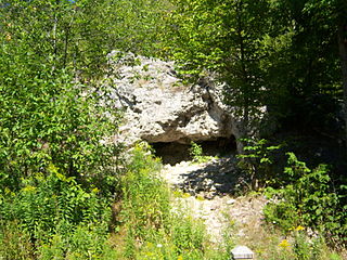
Skull Cave is a small and shallow cave on the central heights of Mackinac Island in Michigan, United States. The cave was carved during the Algonquin post-glacial period by the waters of Lake Algonquin, a swollen meltwater ancestor of today's Lake Huron.

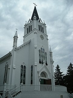
Sainte Anne Church, commonly called 'Ste. Anne Church' or 'Ste. Anne's Church', is a Roman Catholic church that serves the parish of Sainte Anne de Michilimackinac in Mackinac Island, Michigan. The Jesuit missionary Claude Dablon inaugurated the rites of the Catholic faith on Mackinac Island in 1670, but the earliest surviving parish records list sacraments performed starting in April 1695. After moving from Fort de Buade to Fort Michilimackinac about 1708 and from Fort Michilimackinac to Mackinac Island in 1781, the parish used a historic log church for decades. It constructed the current church complex starting in 1874 on a site donated by the former fur trader, Magdelaine Laframboise.