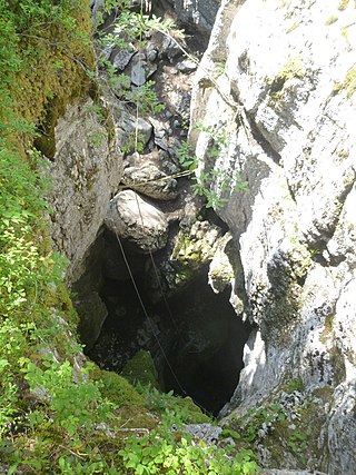
Monte Perdido is the third highest mountain in the Pyrenees. The summit of Monte Perdido (3355 m), located in Spain, lies hidden from France by the seemingly impenetrable peaks of the Cirques of Gavarnie and Estaubé. It stands in the north of Huesca province. The mountain forms part of the Monte Perdido Range and is located in the Ordesa y Monte Perdido National Park, in the western part of the Pyrenees, in the community of Aragon, Spain.

Gouffre Jean-Bernard or Réseau Jean Bernard, sometimes known simply as Jean Bernard, is the seventh deepest cave in the world, and the third deepest one in Europe. It is in the Alps in Samoëns, France. The first entrance to the cave was found by the French caving group Groupe Vulcain in 1963. More entrances have been found over the years since, and currently at least thirteen are known. The highest entrance, known as C37, is at 2,333 m (7,654 ft) above sea level. The cave is named after Jean Dupont and Bernard Raffy, two Groupe Vulcain members who died in 1963 in an unrelated expedition in Goule de Foussoubie Cave.

Norbert Casteret was a famous French caver, adventurer and writer, and is one of the most recognisable names in caving worldwide. Following Édouard-Alfred Martel, Casteret, along with Robert de Joly, became a leading figure of French speleology between the world wars and into the middle of the 20th century.

An ice cave is any type of natural cave that contains significant amounts of perennial (year-round) ice. At least a portion of the cave must have a temperature below 0 °C (32 °F) all year round, and water must have traveled into the cave’s cold zone.

Ordesa y Monte Perdido National Park is an IUCN Category II National Park situated in the Pyrenees. There has been a National Park in the Ordesa Valley since 1918. Its protected area was enlarged in 1982 to cover the whole region, amounting to 156.08 square kilometres.

Plumelec is a commune in the Morbihan department of the Brittany region, in north-western France.

The Gouffre Berger is a cave in the French alps within the commune of Engins high on the Vercors Plateau. It was discovered on 24 May 1953 by Joseph Berger, Georges Bouvet, Ruiz de Arcaute and Marc Jouffrey. From 1953 to 1963, it was regarded as the deepest cave in the world at −1,122 metres (−3,681 ft), relinquishing this title to the previous contender, Pierre Saint Martin, in 1964, after further exploration. The Gouffre Berger is now ranked 39th deepest cave in the world, and the 4th in France.

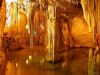
Neptune's Grotto is a stalactite cave near the town of Alghero on the island of Sardinia, Italy. The cave was discovered by local fishermen in the 18th century and has since developed into a popular tourist attraction. The grotto gets its name from the Roman god of the sea, Neptune.

The Dent de Crolles is a karstic mountain of the Chartreuse Mountains range, 17 kilometres north east of Grenoble, Isère, France. The mountain has a characteristic "tooth-like" profile; the French word dent means "tooth". de Crolles is derived from the town of Crolles, located next to the peak. The Dent de Crolles is easily recognizable from the Isère Valley (Grésivaudan) near Grenoble.

The Villars Cave, in French Grotte de Villars or Grotte du Cluzeau, was occupied during the Lower Magdalenian by Cro-Magnon hunter-gatherers. The cave is part of the French commune of Villars in the northern Dordogne département. Besides its enormous wealth in beautiful stalactites, stalagmites and similar calcite deposits it contains cave paintings and some engravings. The Villars Cave and the Rouffignac Cave are the biggest known cave systems in the Dordogne.

Grotte de Lombrives or Lombrives Cave is a large natural cavern located in Ornolac-Ussat-les-Bains, at the eastern edge of the Pyrénées Ariégeoises Natural Regional Park, in the Ariège department of Occitanie, in southwestern France.

La Verna is a show cave in the commune of Sainte-Engrâce in the department of Pyrénées-Atlantiques in France. 660 metres (2,170 ft) of mined tunnel leads into the Salle de la Verna, the largest chamber in a show cave in the world. It has a diameter of 250 metres (820 ft), a height of 194 metres (636 ft), a surface area of 5 hectares and a volume of 3.6 million cubic metres (130,000,000 cu ft). A river cascades into the chamber from halfway up the east wall, and sinks into boulders near the base of the chamber.
The Monte Alegre State Park is a state park in the state of Pará, Brazil. The park covers a hilly region to the north of the Amazon River. It is known for its caves and prehistoric rock paintings, among the oldest archaeological remains in the Amazon region. Efforts have been made to get the local people involved in supporting sustainable tourism.

The Noisetier Cave, owing its popular name to the hazel trees that grow in front of its entrance, is located in a mountainside 145 m (476 ft) atop the Vallée d'Aure in the Ardengost commune, Hautes-Pyrénées department in the region Occitania, Southern France. During systematic excavations since 1992 Middle Paleolithic stone tools and artifacts attributed to the Neanderthal Mousterian culture were discovered among numerous faunal remains.

Grotta del Gelo is a volcanic cave of Mount Etna which is known for the presence of a large amount of ice. The cave formed in 1614–1624 during a large eruption of the volcano, inside one of the lava flows produced during that eruption. Within the two subsequent decades, ice grew and accumulated in the cave. Today it is a tourist destination.

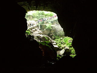
The Bournillon cave is located in the commune of Châtelus in the Isère Department of France, in the Vercors Massif. Its entrance is 105 metres (344 ft) high, and 60 metres (200 ft) wide, and is the largest in Europe. It is one of the main karst springs of Vercors, with a maximum flow rate of 80 cubic metres (2,800 cu ft) per second, which feeds a hydroelectric plant.

The Réseau du Clot d'Aspres is a cave system located mainly under the valley of Clot d'Aspres, which lies within the commune of Villard-de-Lans in the north of the Vercors Massif, in Isère, France. This extensive karst system contains 42 kilometres (26 mi) of passages over a height range of 1,066 meters. The highest point is upstream of the Oréade cave +74 metres (243 ft), and the lowest point is the siphon of the Nuits-Blanches scialet which has been dived to a depth of 34 metres (112 ft).

The Gouffre de la Pierre Saint-Martin, also called Gouffre Lépineux, is the original entrance to a major cave system located in the massif of La Pierre Saint-Martin, in the immediate vicinity of the Franco-Spanish border and the French commune of Arette, in the Pyrénées-Atlantiques in the Nouvelle-Aquitaine region, under which lies part of the cave network.

The Gournier Cave is located near Choranche in the Vercors Massif in south-eastern France. The entrance is at an altitude of 572 m (1,877 ft) at the base of a cliff on the Presles plateau. It is one of the exsurgences of the Coulmes massif, and the cave is considered by many speleologists to be the most beautiful underground river in the Alps.


