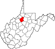
Cherry Grove is an unincorporated community located in Pendleton County, West Virginia, United States. Cherry Grove lies within the Monongahela National Forest at the confluence of Big Run with the North Fork South Branch Potomac River.
Silver Grove is an unincorporated community in Jefferson County, West Virginia, United States. Silver Grove lies between the Harpers Ferry National Historical Park along the Shenandoah River and the Loudoun Heights of the Blue Ridge.
Apple Grove is an unincorporated community located in McDowell County, West Virginia, United States. Apple Grove is located along West Virginia Route 80 on the Dry Fork, south of Iaeger.
Oak Grove is an unincorporated community in Pendleton County, West Virginia, United States. Oak Grove lies on Smith Creek near its confluence with the South Branch Potomac River.

Wheeling Creek is a tributary of the Ohio River, 25 miles (40 km) long, in the Northern Panhandle of West Virginia in the United States, with a watershed extending into southwestern Pennsylvania. Via the Ohio River, it is part of the watershed of the Mississippi River, draining an area of approximately 300 square miles (780 km2) on the unglaciated portion of the Allegheny Plateau. It flows into the Ohio River in downtown Wheeling, just downstream of Ohio's Wheeling Creek on the opposite bank. A variant name is Big Wheeling Creek. According to the French explorer Pierre Joseph Céloron de Blainville, the native name of the stream is the Kanououara River, as was inscribed on the lead plate buried at the mouth by the Ohio River in 1749.
Elm Grove is within Wheeling city limits in Ohio County, West Virginia, United States. It lies at an elevation of 774 feet (236 m).
Apple Grove is a census-designated place (CDP) in Mason County, West Virginia, United States, on the Ohio River located along West Virginia Route 2. Apple Grove lies just south of Gallipolis Ferry. As of the 2010 census, its population was 204. It is part of the Point Pleasant, WV–OH Micropolitan Statistical Area.

Lilly Grove is an unincorporated community in Mercer County, West Virginia, United States. Lilly Grove is located along West Virginia Route 20, 2 miles (3.2 km) east of Princeton.
Pleasant Grove is an unincorporated community in Henry County, Virginia, in the U.S. state of Virginia. Located at the crossroads of Stones Dairy, Hodges Farm, Preston, and Wingfield Orchard Roads. It is about 7 miles west of Martinsville, between Horse Pasture and Bassett, Virginia.
Topins Grove is an unincorporated community in Jackson County, West Virginia, United States. Topins Grove is located on Little Pond Creek and County Highway 6, 7.7 miles (12.4 km) north-northeast of Ravenswood. Topins Grove once had a post office, which is now closed.
Willow Grove was an unincorporated community in Jackson County, West Virginia.
Beech Grove is an unincorporated community in Ritchie County, West Virginia, United States.
Cedar Grove is an unincorporated community in Wood County, West Virginia, United States.
Harmony Grove is an unincorporated community in Monongalia County, West Virginia, United States.
Heavener Grove is an unincorporated community in Upshur County, West Virginia, United States.
Holly Grove is an unincorporated community in Upshur County, West Virginia, United States.
Alley Grove is an unincorporated community in Marshall County, West Virginia, United States.
Ward is an unincorporated community and coal town in Kanawha County, West Virginia, United States. Its post office is closed. Ward is approximately 3 miles (4.8 km) northeast of Cedar Grove, along Kellys Creek.
Sugar Grove is a community located in Pendleton County, West Virginia, United States. Its ZIP Code is 26815. It is located within the United States National Radio Quiet Zone.
Walgrove is an unincorporated community in Kanawha County, in the U.S. state of West Virginia.


