Grove Colliery

Last updated
Grove Colliery, North Lanes, Staffordshire.jpg

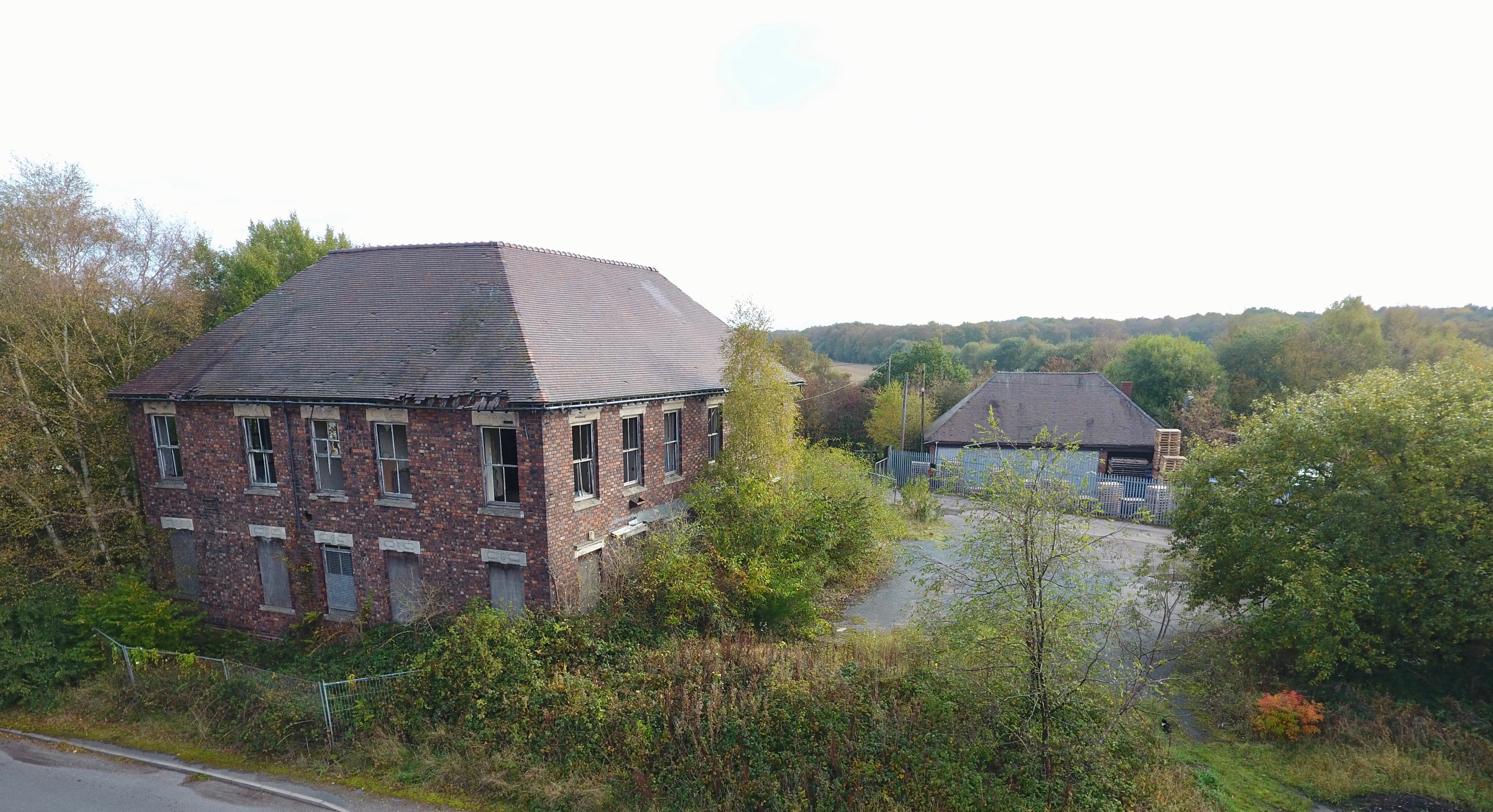
Grove Colliery was a colliery in North Lanes, Staffordshire. Located between the villages of Pelsall and Norton Canes. It opened in 1852 as Wyrley Grove Colliery. It was served by barges on the Cannock Extension Canal until the arrival of a mineral line from Norton Junction. In 1930, a mining explosion occurred which killed 14 miners. [1]

The colliery was closed in 1952 and all traces were swept away by 1964. Today, an industrial estate stands on the site of the former trackbed and the canal is popular with residential barges. [2]

Related Research Articles

<span class="mw-page-title-main">Erie Canal</span> Waterway in New York, U.S.

The Erie Canal is a historic canal in upstate New York that runs east–west between the Hudson River and Lake Erie. Completed in 1825, the canal was the first navigable waterway connecting the Atlantic Ocean to the Great Lakes, vastly reducing the costs of transporting people and goods across the Appalachians. In effect, the canal accelerated the settlement of the Great Lakes region, the westward expansion of the United States, and the economic ascendancy of New York State. It has been called "The Nation's First Superhighway."

<span class="mw-page-title-main">Wyrley and Essington Canal</span> Narrow canal in the Midlands, England

The Wyrley and Essington Canal, known locally as "the Curly Wyrley", is a canal in the English Midlands. As built it ran from Wolverhampton to Huddlesford Junction near Lichfield, with a number of branches: some parts are currently derelict. Pending planned restoration to Huddlesford, the navigable mainline now terminates at Ogley Junction near Brownhills. In 2008 it was designated a Local Nature Reserve.

<span class="mw-page-title-main">Knottingley</span> Town in the City of Wakefield, West Yorkshire, England

Knottingley is a town in the City of Wakefield in West Yorkshire, England on the River Aire and the old A1 road before it was bypassed as the A1(M). Historically part of the West Riding of Yorkshire, it has a population of 13,503, increasing to 13,710 for the City of Wakefield ward at the 2011 Census. It makes up the majority of the Knottingley ward represented on Wakefield Council.

<span class="mw-page-title-main">Regent's Canal</span> Canal in England

Regent's Canal is a canal across an area just north of central London, England. It provides a link from the Paddington Arm of the Grand Union Canal, 550 yards (500 m) north-west of Paddington Basin in the west, to the Limehouse Basin and the River Thames in east London. The canal is 8.6 miles (13.8 km) long.

<span class="mw-page-title-main">Chasewater</span> A lake in Staffordshire, England

Chasewater is a reservoir located in the parish of Burntwood and the district of Lichfield in Staffordshire, England. Originally known as Norton Pool and Cannock Chase Reservoir, it was created as a canal feeder reservoir in 1797. The reservoir was created to directly supply the Wyrley and Essington Canal and maintain levels in the 160-mile (260 km) Birmingham Canal Network. During a period of great industrial growth in the Black Country region the maintenance of water levels in canal infrastructure was essential and Chasewater was in great demand. As canals became less essential for transport of goods during the mid-20th century, the reservoir diversified and became a popular public amenity with activities such as water-skiing, sailing, wakeboarding and cycling. Chasewater is the third largest reservoir by volume in the county of Staffordshire and the largest canal feeder reservoir in the West Midlands.

<span class="mw-page-title-main">Radstock</span> Human settlement in England

Radstock is a town and civil parish on the northern slope of the Mendip Hills in Somerset, England, about 9 miles (14 km) south-west of Bath and 8 miles (13 km) north-west of Frome. It is within the area of the unitary authority of Bath and North East Somerset. The Radstock built-up area had a population of 9,419 at the 2011 Census.

<span class="mw-page-title-main">Wigan Pier</span> Area around the Leeds and Liverpool Canal in Wigan, Greater Manchester, England

Wigan Pier is an area around the Leeds and Liverpool Canal in Wigan, Greater Manchester, England, south-west of the town centre. The name has humorous or ironic connotations since it conjures an image of a seaside pleasure pier, whereas Wigan is inland and a traditionally industrial town.

<span class="mw-page-title-main">Leominster Canal</span> Canal in England, now defunct

The Leominster Canal was an English canal which ran for just over 18 miles from Mamble to Leominster through 16 locks and a number of tunnels, some of which suffered engineering problems even before the canal opened. Originally, the canal was part of a much more ambitious plan to run 46 miles from Stourport to Kington.

<span class="mw-page-title-main">Somerset Coal Canal</span> Canal in Somerset, England

The Somerset Coal Canal was a narrow canal in England, built around 1800. Its route began in basins at Paulton and Timsbury, ran to nearby Camerton, over two aqueducts at Dunkerton, through a tunnel at Combe Hay, then via Midford and Monkton Combe to Limpley Stoke where it joined the Kennet and Avon Canal. This link gave the Somerset coalfield access east toward London. The longest arm was 10.6 miles (17.1 km) long with 23 locks. From Midford an arm also ran via Writhlington to Radstock, with a tunnel at Wellow.

<span class="mw-page-title-main">Okeechobee Waterway</span> Canal in Florida, United States of America

The Okeechobee Waterway or Okeechobee Canal is a relatively shallow artificial waterway in the United States, stretching across Florida from Fort Myers on the west coast to Stuart on Florida's east coast. The waterway can support tows such as barges or private vessels up to 50 feet wide x 250 feet long which draw less than 10 feet, as parts of the system, especially the locks may have low water depths of just ten feet. The system of channels runs through Lake Okeechobee and consists of the Caloosahatchee River to the west of the lake and the St. Lucie Canal east of the lake.

Smallthorne is an area in the city of Stoke-on-Trent in Staffordshire, England. It is in the north-east of the city, near Burslem. Smallthorne borders Bradeley and Chell in the north, Norton-in-the-Moors in the east, Sneyd Green in the south, and Burslem in the west.

The Lebanon and Tremont Branch of the Philadelphia & Reading Railroad was a railroad line in Lebanon and Schuylkill County, Pennsylvania, built to tap the coal fields in the West End of Schuylkill County and send coal southward to Lebanon.

<span class="mw-page-title-main">Greasbrough Canal</span>

The Greasbrough Canal was a private canal built by the Marquess of Rockingham to serve his coal mining interests in and around the village of Greasbrough, near Rotherham, South Yorkshire, England. It opened in 1780, and the Newbiggin branch was built some time later. The main line to Greasbrough closed in 1840 with the coming of the Sheffield and Rotherham Railway, and the canal ceased to carry commercial traffic during the First World War. Most of it has been filled in, but a small section near the River Don Navigation remains in water.

<span class="mw-page-title-main">Somerset Coalfield</span> Coalfield in northern Somerset, England

The Somerset Coalfield in northern Somerset, England is an area where coal was mined from the 15th century until 1973. It is part of a larger coalfield which stretched into southern Gloucestershire. The Somerset coalfield stretched from Cromhall in the north to the Mendip Hills in the south, and from Bath in the east to Nailsea in the west, a total area of about 240 square miles (622 km2). Most of the pits on the coalfield were concentrated in the Cam Brook, Wellow Brook and Nettlebridge Valleys and around Radstock and Farrington Gurney. The pits were grouped geographically, with clusters of pits close together working the same coal seams often under the same ownership. Many pits shared the trackways and tramways which connected them to the Somerset Coal Canal or railways for distribution.

<span class="mw-page-title-main">Norton Canes</span> Human settlement in England

Norton Canes is an industrial village, civil parish and ward of Cannock Chase District, in Staffordshire, England.

<span class="mw-page-title-main">Cannock Extension Canal</span>

The current Cannock Extension Canal is a 1.8-mile (2.9 km) canal in England. It runs from Pelsall Junction on the Wyrley and Essington Canal, north to Norton Canes Docks and forms part of the Birmingham Canal Navigations. Historically, it ran to Hednesford, and served a number of collieries, which provided the main traffic. It opened in 1863, and the northern section closed in 1963, as a result of mining subsidence.

<span class="mw-page-title-main">Tub boat</span> Canal cargo boat

A tub boat was a type of unpowered cargo boat used on a number of the early English and German canals. The English boats were typically 6 m (19.7 ft) long and 2 m (6.6 ft) wide and generally carried 3 long tons to 5 long tons of cargo, though some extra deep ones could carry up to 8 long tons. They are also called compartment boats or container boats.

<span class="mw-page-title-main">Kidwelly and Llanelly Canal</span> Former canal and tramroad system in southwest Wales

The Kidwelly and Llanelly Canal was a canal and tramroad system in Carmarthenshire, Wales, built to carry anthracite coal to the coast for onward transportation by coastal ships. It began life as Kymer's Canal in 1766, which linked pits at Pwll y Llygod to a dock near Kidwelly. Access to the dock gradually became more difficult as the estuary silted up, and an extension to Llanelli was authorised in 1812. Progress was slow, and the new canal was linked to a harbour at Pembrey built by Thomas Gaunt in the 1820s, until the company's own harbour at Burry Port was completed in 1832. Tramways served a number of collieries to the east of Burry Port.

The Llancaiach Branch railway line was a mineral branch line in Glamorganshire, South Wales. It was authorised in 1836 as part of the Taff Vale Railway, and its purpose was to connect collieries at Llancaiach and bring their output to Cardiff for onward shipment. It was designed by Isambard Kingdom Brunel and built on the standard gauge. It opened in 1841 from a junction with the Merthyr line immediately south of Abercynon. It was intended to be horse worked, and included a self-acting rope-worked inclined plane near the junction. The collieries were slow to use the line, preferring their customary use of a tramroad and the Glamorganshire Canal, and the value of the line was diminished when the Taff Vale Extension line, an east-west connecting line belonging to the Newport, Abergavenny and Hereford Railway, intersected it and cut off the colliery connections, and the line became dormant.

<span class="mw-page-title-main">North Lanes, Staffordshire</span>

North Lanes (Lime Lane) is an area of Norton Canes, in the Cannock Chase District of Staffordshire. The area is rural, and forms a large part of Norton Canes's greenbelt. It is the location of the former colliery from where a canal basin of the Cannock Extension Canal is located, and sits above multiple mineshafts. The name is historically Lime Lane but appears as North Lanes on modern maps. The area is mostly made up of winding roads, farmland and common land. The Cannock Extension Canal here is a Cannock Extension Canal due to the presence of Floating Water Plantain. As well as its proximity to Little Wyrley, Brownhills West and Norton Canes. There are two lots of service stations as well as a social club and industrial estates.

References

[3] [4] [5]

  1. "Images courtesy Norton Canes History Members". 28 April 2016.
  2. https://i0.wp.com/brownhillsbob.com/wp-content/uploads/2016/10/gr6-1.jpg?ssl=1.{{cite web}}: Missing or empty |title= (help)
  3. "TH E NORTON CANES HISTORICAL SOCIETY" (PDF).
  4. "Grove Colliery - Chasewater Railway".
  5. "The Grove Colliery – remembering a lost pit".