
The High Tauern are a mountain range on the main chain of the Central Eastern Alps, comprising the highest peaks east of the Brenner Pass. The crest forms the southern border of the Austrian states of Salzburg, Carinthia and East Tyrol, with a small part in the southwest belongs to the Italian province of South Tyrol. The range includes Austria's highest mountain, the Grossglockner at 3,798 metres (12,461 ft) above the Adriatic.

The Zuckerhütl is a mountain in Tyrol, Austria. At 3,505 metres, it is the highest peak of the Stubai Alps and lies at the southern end of the Stubaital Valley.

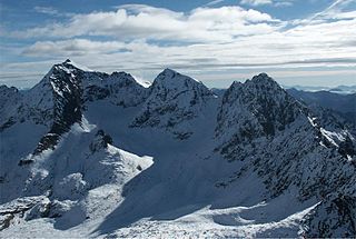
Mallnitz is a municipality in the Spittal an der Drau District in Carinthia, Austria.

The Latemar is a mountain in the Dolomites on the border between South Tyrol and Trentino, Italy. It is the westernmost mountain of the Dolomites and is a popular hiking destination. It is best known for its view from the Karersee lake.

Bratschen are weathering products that occur as a result of frost and aeolian corrasion almost exclusively on the calc-schists of the Upper Slate Mantle in the High Tauern mountains of Austria. The term is German but is used untranslated in English sources. It may be the equivalent of the New Zealand climbers' term 'weet-bix' for a rock that disintegrates easily and so is difficult to climb on.

The Ankogel Group is a sub-group of the Central Eastern Alps. Together with the Goldberg Group, the Glockner Group, the Schober Group, the Kreuzeck Group, the Granatspitze Group, the Venediger Group, the Villgraten Mountains and the Rieserferner Group it forms the mountain range of the Hohe Tauern.

The Hochgolling is a mountain of the Eastern Alps, located on the border of Steiermark and Salzburg, Austria, near the ski resort of Schladming. It is the highest peak of the Lower Tauern range.

The Gurktal Alps are a mountain range of the Central Eastern Alps in Austria, named after the valley of the Gurk River.

The Schladming Tauern are a subrange of the Austrian Central Alps within the Eastern Alps. Together with the Radstadt Tauern, the Rottenmann and Wölz Tauern and the Seckau Tauern the Schladming Tauern form the major range known as the Low Tauern. The mountains are located in Austria in the federal states of Salzburg and Styria. Its highest peak, at 2,862 m is the Hochgolling.

The Rottenmann and Wölz Tauern are a subrange of the Austrian Central Alps within the Eastern Alps. Together with the Radstadt Tauern, the Schladming Tauern and the Seckau Tauern the Rottenmann and Wölz Tauern form the major range known as the Low Tauern. The mountains are located in Austria in the federal state of Styria.

The Hochalmspitze is, at 3,360 metres above the Adriatic (11,020 ft), the highest mountain of the Ankogel Group in the High Tauern range, located east of Mallnitz in the Austrian state of Carinthia. It is sometimes called "Tauern Queen" as a counterpart to the "Tauern King", the Grossglockner.
Petzeck (3,283m) is the highest mountain of the Schober Group in the High Tauern range, Austria. The mountain has a 1,000m high north face but its southern slope is more gentle, with lakes such as Kreuzsee and Wangenitzsee on its slopes. Its south western slope is glaciated.

The Großer Muntanitz (3,232m) is the highest mountain in the Granatspitze Group, located between the Venediger Group and the Glockner Group in the High Tauern, Austria.

Hocharn (3,254m) is the highest mountain of the Goldberg Group in the High Tauern range of the eastern Alps. It is located near the town of Bad Hofgastein and is situated in the Austrian state of Salzburg.

Großer Hafner is a 3,076 m (10,092 ft) high partly-glaciated mountain of the Ankogel Group in the High Tauern range, located at the border between the Austrian states of Carinthia and Salzburg. It is the easternmost three-thousander peak of the range, and also in the entire Alps.

Trogkofel is a mountain of the Carnic Alps lying on the border of Friuli, Italy and Carinthia, Austria. It is located on the main ridge of the Carnics between the Aip Valley to the south and the Gail Valley in the north, and is the second highest mountain on the eastern ridge after Gailtaler Polinik. The mountain is known as Crete Rosse, meaning Red Rocky Mountain in Friuli.

Geierhaupt is a mountain of the Lower Tauern in Styria, Austria. It is the highest mountain of the Seckau Tauern sub group.

Latschur, at 2,236 m (7,336 ft), is the highest mountain of the Latschur Group in the Gailtal Alps range, in the Austrian state of Carinthia.

The Großer Rosennock is, at 2,440 m AA (8,010 ft), the second highest of the Gurktal Alps in Carinthia, Austria, after the Eisenhut, which is just one meter higher.

The Reißeck, also Großes Reißeck is, at 2,965 metres above the Adriatic, the highest peak of the Reißeck Group in the High Tauern of Carinthia, Austria. The range forms the southern part of the larger Ankogel Group with its highest summit, the Hochalmspitze, separated by the col of Mallnitzer Scharte at 2,673 m (8,770 ft). The mountain also gives its name to the Reißeck municipality, located to the south in the Möll valley.


